Property Record
2716 South St, Philadelphia, PA 19146


NEARBY LISTINGS FOR SALE OR LEASE
Property Detail
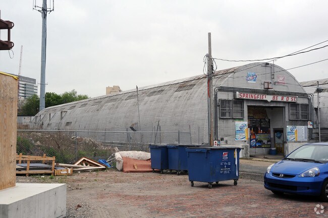
2716 South St
772607100
SWC OF SCHUYLKILL AVE
Scientificpharmaceuticalmedicalresearchfacility
Philadelphia
AE
Pennsylvania
42045C0150F
8.52 AC
2024
South Philadelphia
2026
Philadelphia
001302
Philadelphia-Camden-Wilmington, PA-NJ-DE-MD
1,000,000 SF
DEMOGRAPHICS near 2716 South St
1 Mile
3 Mile
5 Mile
2024 Total Population
82,285
523,952
950,508
2029 Population
80,705
511,213
932,959
Pop Growth 2024-2029
(1.92%)
(2.43%)
(1.85%)
Average Age
35
37
37
2024 Total Households
38,148
233,043
398,524
HH Growth 2024-2029
(2.44%)
(2.73%)
(2.14%)
Median Household Inc
$86,081
$62,501
$53,145
Avg Household Size
1.80
2.10
2.20
2024 Avg HH Vehicles
1.00
1.00
1.00
Median Home Value
$448,774
$316,685
$234,097
Median Year Built
1956
1949
1948
Nearby Places
Map Layers
Map Styles
 Street
 Aerial
- Restaurants
- Banks
- Shops
- Fitness
- Groceries
PUBLIC TRANSPORTATION
TRANSIT/SUBWAY
33Rd Street (Route 10 - SEPTA, Route 11 - SEPTA, Route 13 - SEPTA, Route 34 - SEPTA, Route 36 - SEPTA)
DRIVE
WALK
Distance
33Rd Street (Route 10 - SEPTA, Route 11 - SEPTA, Route 13 - SEPTA, Route 34 - SEPTA, Route 36 - SEPTA)
3 min
16 min
0.8 mi
36Th And Sansom (Route 11 - SEPTA, Route 13 - SEPTA, Route 34 - SEPTA, Route 36 - SEPTA)
DRIVE
WALK
Distance
36Th And Sansom (Route 11 - SEPTA, Route 13 - SEPTA, Route 34 - SEPTA, Route 36 - SEPTA)
3 min
16 min
0.8 mi
22Nd Street (Route 10 - Southeastern Pennsylvania Transportation Authority Rapid Transit (SEPTA Subway & Trolley), Route 11 - Southeastern Pennsylvania Transportation Authority Rapid Transit (SEPTA Subway & Trolley), Route 13 - Southeastern Pennsylvania Transportation Authority Rapid Transit (SEPTA Subway & Trolley), Route 34 - Southeastern Pennsylvania Transportation Authority Rapid Transit (SEPTA Subway & Trolley), Route 36 - Southeastern Pennsylvania Transportation Authority Rapid Transit (SEPTA Subway & Trolley))
DRIVE
WALK
Distance
22Nd Street (Route 10 - Southeastern Pennsylvania Transportation Authority Rapid Transit (SEPTA Subway & Trolley), Route 11 - Southeastern Pennsylvania Transportation Authority Rapid Transit (SEPTA Subway & Trolley), Route 13 - Southeastern Pennsylvania Transportation Authority Rapid Transit (SEPTA Subway & Trolley), Route 34 - Southeastern Pennsylvania Transportation Authority Rapid Transit (SEPTA Subway & Trolley), Route 36 - Southeastern Pennsylvania Transportation Authority Rapid Transit (SEPTA Subway & Trolley))
3 min
17 min
0.9 mi
Drexel Station At 30Th St (Route 10 - SEPTA, Route 11 - SEPTA, Route 13 - SEPTA, Route 34 - SEPTA, Route 36 - SEPTA)
DRIVE
WALK
Distance
Drexel Station At 30Th St (Route 10 - SEPTA, Route 11 - SEPTA, Route 13 - SEPTA, Route 34 - SEPTA, Route 36 - SEPTA)
4 min
17 min
0.9 mi
30Th Street (Market-Frankford Line - Southeastern Pennsylvania Transportation Authority Rapid Transit (SEPTA Subway & Trolley), Route 10 - Southeastern Pennsylvania Transportation Authority Rapid Transit (SEPTA Subway & Trolley), Route 11 - Southeastern Pennsylvania Transportation Authority Rapid Transit (SEPTA Subway & Trolley), Route 13 - Southeastern Pennsylvania Transportation Authority Rapid Transit (SEPTA Subway & Trolley), Route 34 - Southeastern Pennsylvania Transportation Authority Rapid Transit (SEPTA Subway & Trolley), Route 36 - Southeastern Pennsylvania Transportation Authority Rapid Transit (SEPTA Subway & Trolley))
DRIVE
WALK
Distance
30Th Street (Market-Frankford Line - Southeastern Pennsylvania Transportation Authority Rapid Transit (SEPTA Subway & Trolley), Route 10 - Southeastern Pennsylvania Transportation Authority Rapid Transit (SEPTA Subway & Trolley), Route 11 - Southeastern Pennsylvania Transportation Authority Rapid Transit (SEPTA Subway & Trolley), Route 13 - Southeastern Pennsylvania Transportation Authority Rapid Transit (SEPTA Subway & Trolley), Route 34 - Southeastern Pennsylvania Transportation Authority Rapid Transit (SEPTA Subway & Trolley), Route 36 - Southeastern Pennsylvania Transportation Authority Rapid Transit (SEPTA Subway & Trolley))
3 min
18 min
0.9 mi
COMMUTER RAIL
Penn Medicine Station (Airport Line - SEPTA, Lansdale/Doylestown Line - SEPTA, Media/Wawa Line - SEPTA, Wilmington/Newark Line - SEPTA)
DRIVE
WALK
Distance
Penn Medicine Station (Airport Line - SEPTA, Lansdale/Doylestown Line - SEPTA, Media/Wawa Line - SEPTA, Wilmington/Newark Line - SEPTA)
2 min
7 min
0.4 mi
Philadelphia 30Th Street (Atlantic City Line - NJ Transit Commuter Rail (NJ Transit), R1 - NJ Transit Commuter Rail (NJ Transit), R2 - NJ Transit Commuter Rail (NJ Transit), R3 - NJ Transit Commuter Rail (NJ Transit), R5 - NJ Transit Commuter Rail (NJ Transit), R6 - NJ Transit Commuter Rail (NJ Transit), R7 - NJ Transit Commuter Rail (NJ Transit), R8 - NJ Transit Commuter Rail (NJ Transit))
DRIVE
WALK
Distance
Philadelphia 30Th Street (Atlantic City Line - NJ Transit Commuter Rail (NJ Transit), R1 - NJ Transit Commuter Rail (NJ Transit), R2 - NJ Transit Commuter Rail (NJ Transit), R3 - NJ Transit Commuter Rail (NJ Transit), R5 - NJ Transit Commuter Rail (NJ Transit), R6 - NJ Transit Commuter Rail (NJ Transit), R7 - NJ Transit Commuter Rail (NJ Transit), R8 - NJ Transit Commuter Rail (NJ Transit))
3 min
17 min
0.9 mi
AIRPORT
Philadelphia International
DRIVE
WALK
Distance
Philadelphia International
18 min
8.9 mi
Freight Ports
South Jersey Port
DRIVE
WALK
Distance
South Jersey Port
12 min
6.2 mi
Nearby Properties
Address
Land Use
TOTAL SIZE
Lot Size
Zoning
Address
Land Use
TOTAL SIZE
Lot Size
Zoning
11,513 SF
19.92 AC
SPSTA
Address
Land Use
TOTAL SIZE
Lot Size
Zoning
159,630 SF
9.15 AC
SPENT
Address
Land Use
TOTAL SIZE
Lot Size
Zoning
1,449,928 SF
1.22 AC
CMX5
Address
Land Use
TOTAL SIZE
Lot Size
Zoning
1,076,400 SF
5 AC
CMX4
Address
Land Use
TOTAL SIZE
Lot Size
Zoning
1,200,021 SF
0.69 AC
CMX5
Address
Land Use
TOTAL SIZE
Lot Size
Zoning
26,690 SF
500 AC
SPINS
Address
Land Use
TOTAL SIZE
Lot Size
Zoning
1,103,300 SF
1.18 AC
CMX5
Address
Land Use
TOTAL SIZE
Lot Size
Zoning
1,464,000 SF
0.76 AC
CMX5
Address
Land Use
TOTAL SIZE
Lot Size
Zoning
319,590 SF
0.87 AC
I2
Address
Land Use
TOTAL SIZE
Lot Size
Zoning
760,635 SF
0.77 AC
CMX5
Address
Land Use
TOTAL SIZE
Lot Size
Zoning
1,179,072 SF
8.90 AC
RM4
Address
Land Use
TOTAL SIZE
Lot Size
Zoning
1,296,804 SF
2.71 AC
I2
Address
Land Use
TOTAL SIZE
Lot Size
Zoning
782,208 SF
0.68 AC
CMX5
Address
Land Use
TOTAL SIZE
Lot Size
Zoning
2,215,276 SF
2.46 AC
CMX5
Address
Land Use
TOTAL SIZE
Lot Size
Zoning
624,696 SF
5.79 AC
CMX4
Address
Land Use
TOTAL SIZE
Lot Size
Zoning
1,200,000 SF
1.78 AC
CMX5
Address
Land Use
TOTAL SIZE
Lot Size
Zoning
1,075,580 SF
2.65 AC
CMX5
Address
Land Use
TOTAL SIZE
Lot Size
Zoning
468,307 SF
2.45 AC
CMX4
Address
Land Use
TOTAL SIZE
Lot Size
Zoning
500,165 SF
2.16 AC
SPPOA
Address
Land Use
TOTAL SIZE
Lot Size
Zoning
1,152,520 SF
1.49 AC
CMX5
Address
Land Use
TOTAL SIZE
Lot Size
Zoning
696,920 SF
10.55 AC
SPINS
Address
Land Use
TOTAL SIZE
Lot Size
Zoning
1,143,040 SF
0.81 AC
CMX5
Address
Land Use
TOTAL SIZE
Lot Size
Zoning
738,750 SF
1.19 AC
CMX5
Address
Land Use
TOTAL SIZE
Lot Size
Zoning
700,000 SF
7.88 AC
CMX5
Address
Land Use
TOTAL SIZE
Lot Size
Zoning
1,102,992 SF
2.14 AC
CMX5
Address
Land Use
TOTAL SIZE
Lot Size
Zoning
1.88 AC
SPINS
Address
Land Use
TOTAL SIZE
Lot Size
Zoning
738,207 SF
0.89 AC
CMX5
Address
Land Use
TOTAL SIZE
Lot Size
Zoning
665,742 SF
0.98 AC
CMX4
Address
Land Use
TOTAL SIZE
Lot Size
Zoning
1,152,480 SF
1.48 AC
CMX5
Address
Land Use
TOTAL SIZE
Lot Size
Zoning
1,011,079 SF
5.82 AC
CMX5
The World's #1 Commercial Real Estate Marketplace
Connect with us
© 2026 CoStar Group
The information above has been obtained from sources believed reliable. While we do not doubt its accuracy we have not verified it and make no guarantee, warranty or representation about it. It is your responsibility to independently confirm its accuracy and completeness. Any projections, opinions, assumptions, or estimates used are for example only and do not represent the current or future performance of the property. The value of this transaction to you depends on tax and other factors which should be evaluated by your tax, financial, and legal advisors. You and your advisors should conduct a careful, independent investigation of the property to determine to your satisfaction the suitability of the property for your needs.