Property Record
2717 E Highway 199, Springtown, TX 76082


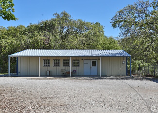
Property Detail
2717 E Highway 199
R000055698
ACRES: 0.250 ABST: 1433, TR:, BLK:, SURV: T & P R R CO LABEL: NTA1585881 MAKE: REPUBLIC MODEL: 31HMK14462AH13 MODEL: 46X14 YR: 2012,
Commercialnec
Parker
B and X Area of moderate flood hazard, usually the area between the limits of the 100-year and 500-year floods.
Texas
2024
0.25 AC
2025
Parker County
140412
Dallas/Ft Worth
1,500 SF
Dallas-Fort Worth-Arlington, TX
NEARBY LISTINGS FOR SALE OR LEASE
DEMOGRAPHICS near 2717 E Highway 199
1 mile
3 mile
5 mile
2024 Total Population
2,237
11,867
29,933
2029 Population
2,598
13,837
34,999
Pop Growth 2024-2029
+ 16.14%
+ 16.60%
+ 16.92%
Average Age
39
39
40
2024 Total Households
778
4,088
10,635
HH Growth 2024-2029
+ 15.30%
+ 15.83%
+ 16.14%
Median Household Inc
$85,221
$90,145
$90,006
Avg Household Size
2.80
2.80
2.70
2024 Avg HH Vehicles
2.00
2.00
2.00
Median Home Value
$169,952
$266,227
$333,865
Median Year Built
1998
2002
2001
Nearby Places
Map Layers
Map Styles
 Street
 Aerial
Transit
 Traffic
 Biking
Places
Listings with unknown addresses are not visible on the map
- Restaurants
- Banks
- Shops
- Fitness
- Groceries
Nearby Properties
Address
Land Use
TOTAL SIZE
Lot Size
Zoning
Address
Land Use
TOTAL SIZE
Lot Size
Zoning
41,629 SF
4.66 AC
Address
Land Use
TOTAL SIZE
Lot Size
Zoning
49,110 SF
6.13 AC
Address
Land Use
TOTAL SIZE
Lot Size
Zoning
585 SF
7.25 AC
Address
Land Use
TOTAL SIZE
Lot Size
Zoning
19,632 SF
10.05 AC
Address
Land Use
TOTAL SIZE
Lot Size
Zoning
16,200 SF
9.28 AC
Address
Land Use
TOTAL SIZE
Lot Size
Zoning
28,300 SF
2.10 AC
Address
Land Use
TOTAL SIZE
Lot Size
Zoning
17,748 SF
5.55 AC
Address
Land Use
TOTAL SIZE
Lot Size
Zoning
5,000 SF
7.73 AC
Address
Land Use
TOTAL SIZE
Lot Size
Zoning
900 SF
11.21 AC
Address
Land Use
TOTAL SIZE
Lot Size
Zoning
5,600 SF
1.98 AC
Address
Land Use
TOTAL SIZE
Lot Size
Zoning
15,354 SF
3 AC
Address
Land Use
TOTAL SIZE
Lot Size
Zoning
4,000 SF
5.03 AC
Address
Land Use
TOTAL SIZE
Lot Size
Zoning
6,378 SF
9.16 AC
Address
Land Use
TOTAL SIZE
Lot Size
Zoning
9,000 SF
9.99 AC
Address
Land Use
TOTAL SIZE
Lot Size
Zoning
15,000 SF
2.28 AC
Address
Land Use
TOTAL SIZE
Lot Size
Zoning
45,000 SF
9.88 AC
Address
Land Use
TOTAL SIZE
Lot Size
Zoning
10,857 SF
1.49 AC
Address
Land Use
TOTAL SIZE
Lot Size
Zoning
7,360 SF
1.28 AC
Address
Land Use
TOTAL SIZE
Lot Size
Zoning
20,500 SF
2 AC
Address
Land Use
TOTAL SIZE
Lot Size
Zoning
3,268 SF
1.53 AC
Address
Land Use
TOTAL SIZE
Lot Size
Zoning
42,245 SF
6.68 AC
Address
Land Use
TOTAL SIZE
Lot Size
Zoning
9,100 SF
1.32 AC
Address
Land Use
TOTAL SIZE
Lot Size
Zoning
5,415 SF
1.25 AC
Address
Land Use
TOTAL SIZE
Lot Size
Zoning
Address
Land Use
TOTAL SIZE
Lot Size
Zoning
1,708 SF
4 AC
Address
Land Use
TOTAL SIZE
Lot Size
Zoning
25,936 SF
4.05 AC
Address
Land Use
TOTAL SIZE
Lot Size
Zoning
4,040 SF
2.97 AC
Address
Land Use
TOTAL SIZE
Lot Size
Zoning
9,992 SF
0.96 AC
Address
Land Use
TOTAL SIZE
Lot Size
Zoning
16,575 SF
1.38 AC
The World's #1 Commercial Real Estate Marketplace
Connect with us
© 2026 CoStar Group
The information above has been obtained from sources believed reliable. While we do not doubt its accuracy we have not verified it and make no guarantee, warranty or representation about it. It is your responsibility to independently confirm its accuracy and completeness. Any projections, opinions, assumptions, or estimates used are for example only and do not represent the current or future performance of the property. The value of this transaction to you depends on tax and other factors which should be evaluated by your tax, financial, and legal advisors. You and your advisors should conduct a careful, independent investigation of the property to determine to your satisfaction the suitability of the property for your needs.