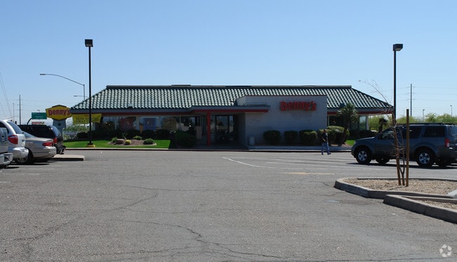
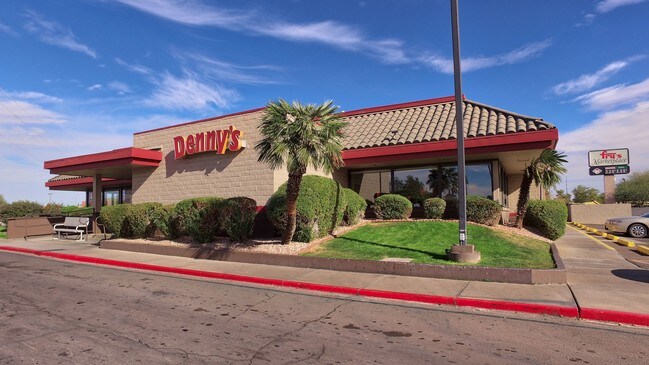
Property Record
2717 W Bell Rd, Phoenix, AZ 85053


Property Detail
2717 W Bell Rd
207-39-003P
PT NE4 DAF COM AT N4 COR SEC TH E ALG N LN SD SEC 2129.97F TO A PT ON WLY R/W LN BLACK CNYN H/W TH S 65F TO POB TH CONT S 85F TH S 74D 43M E 50F TH S 15D 16M W 105.21F TH W 169.52F TH N 200F TH E 151F TO POB
Restaurantbuilding
Maricopa
C-R
Arizona
C and X Area of minimal flood hazard, usually depicted on FIRMs as above the 500-year flood level.
0.78 AC
2025
N Phoenix/I-17 Corr
2025
Phoenix
104207
Phoenix-Mesa-Chandler, AZ
6,092 SF
NEARBY LISTINGS FOR SALE OR LEASE
DEMOGRAPHICS near 2717 W Bell Rd
1 mile
3 mile
5 mile
2025 Total Population
14,897
149,330
337,186
2030 Population
15,230
154,827
349,087
Pop Growth 2025-2030
+ 2.24%
+ 3.68%
+ 3.53%
Average Age
39
39
39
2025 Total Households
5,660
58,795
132,474
HH Growth 2025-2030
+ 2.24%
+ 3.94%
+ 3.72%
Median Household Inc
$74,371
$74,363
$75,886
Avg Household Size
2.50
2.50
2.40
2025 Avg HH Vehicles
2.00
2.00
2.00
Median Home Value
$370,444
$392,376
$403,097
Median Year Built
1979
1983
1984
Nearby Places
Map Layers
Map Styles
 Street
 Aerial
Layers
 Traffic
 Biking
Places
Listings with unknown addresses are not visible on the map
- Restaurants
- Banks
- Shops
- Fitness
- Groceries
PUBLIC TRANSPORTATION
AIRPORT
Phoenix Sky Harbor International
Drive
Walk
Distance
Phoenix Sky Harbor International
29 min
20.7 mi
Freight Ports
Port of San Diego
Drive
Walk
Distance
Port of San Diego
407 min
364.9 mi
SALE & LEASE HISTORY
LISTING DATE
SALE/LEASE

Sep 10, 2025
For Lease
Jan 24, 2018
For Sale
Nearby Properties
Address
Land Use
TOTAL SIZE
Lot Size
Zoning
Address
Land Use
TOTAL SIZE
Lot Size
Zoning
249,119 SF
15.40 AC
PUD
Address
Land Use
TOTAL SIZE
Lot Size
Zoning
10.70 AC
I-P
Address
Land Use
TOTAL SIZE
Lot Size
Zoning
159,642 SF
11.85 AC
C-C
Address
Land Use
TOTAL SIZE
Lot Size
Zoning
Address
Land Use
TOTAL SIZE
Lot Size
Zoning
526,912 SF
55.64 AC
Address
Land Use
TOTAL SIZE
Lot Size
Zoning
704,521 SF
15.12 AC
C-C
Address
Land Use
TOTAL SIZE
Lot Size
Zoning
625,318 SF
15.79 AC
Address
Land Use
TOTAL SIZE
Lot Size
Zoning
16.84 AC
Address
Land Use
TOTAL SIZE
Lot Size
Zoning
434,799 SF
69.70 AC
R-8
Address
Land Use
TOTAL SIZE
Lot Size
Zoning
1,089,213 SF
53.03 AC
R-3
Address
Land Use
TOTAL SIZE
Lot Size
Zoning
17,365 SF
1.50 AC
C-G
Address
Land Use
TOTAL SIZE
Lot Size
Zoning
968,899 SF
76.37 AC
I-1
Address
Land Use
TOTAL SIZE
Lot Size
Zoning
2.62 AC
IND.PK.
Address
Land Use
TOTAL SIZE
Lot Size
Zoning
361,228 SF
24.60 AC
I-P
Address
Land Use
TOTAL SIZE
Lot Size
Zoning
296,753 SF
9.53 AC
CPBP
Address
Land Use
TOTAL SIZE
Lot Size
Zoning
314,839 SF
39 AC
R-18
Address
Land Use
TOTAL SIZE
Lot Size
Zoning
290,321 SF
37.97 AC
R-8
Address
Land Use
TOTAL SIZE
Lot Size
Zoning
28.71 AC
Address
Land Use
TOTAL SIZE
Lot Size
Zoning
469,322 SF
22.40 AC
M-H
Address
Land Use
TOTAL SIZE
Lot Size
Zoning
228,085 SF
7.84 AC
I-P
Address
Land Use
TOTAL SIZE
Lot Size
Zoning
189,524 SF
13.80 AC
I-P
Address
Land Use
TOTAL SIZE
Lot Size
Zoning
483,381 SF
27.83 AC
C-C
Address
Land Use
TOTAL SIZE
Lot Size
Zoning
229,000 SF
18.99 AC
I-P
Address
Land Use
TOTAL SIZE
Lot Size
Zoning
268,353 SF
20.45 AC
I-P
Address
Land Use
TOTAL SIZE
Lot Size
Zoning
430,038 SF
26.71 AC
M-H
Address
Land Use
TOTAL SIZE
Lot Size
Zoning
145,956 SF
10.30 AC
CP/GCP
Address
Land Use
TOTAL SIZE
Lot Size
Zoning
358,005 SF
8.54 AC
M-H
Address
Land Use
TOTAL SIZE
Lot Size
Zoning
221,641 SF
21.60 AC
C-2
Address
Land Use
TOTAL SIZE
Lot Size
Zoning
171,751 SF
8.61 AC
C-2
Address
Land Use
TOTAL SIZE
Lot Size
Zoning
3.08 AC
The World's #1 Commercial Real Estate Marketplace
Connect with us
© 2026 CoStar Group
The information above has been obtained from sources believed reliable. While we do not doubt its accuracy we have not verified it and make no guarantee, warranty or representation about it. It is your responsibility to independently confirm its accuracy and completeness. Any projections, opinions, assumptions, or estimates used are for example only and do not represent the current or future performance of the property. The value of this transaction to you depends on tax and other factors which should be evaluated by your tax, financial, and legal advisors. You and your advisors should conduct a careful, independent investigation of the property to determine to your satisfaction the suitability of the property for your needs.