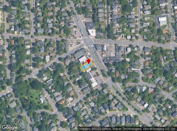
Property Record
2718 Washington Blvd, Arlington, VA 22201

Current Lease Availabilities
NEARBY LISTINGS FOR SALE OR LEASE
Property Detail
2718 Washington Blvd
Washington-Arlington-Alexandria, DC-VA-MD-WV
Clarendon
18-054-012
LTS 357 358 MOORES NO 3 CLARENDON 6841 SQ FT
Storebuilding
Arlington
X
Virginia
51013C0039D
357
2025
0.16 AC
2025
Virginia Square
101803
Washington, DC
3,525 SF
DEMOGRAPHICS near 2718 Washington Blvd
1 Mile
3 Mile
5 Mile
2024 Total Population
44,684
270,573
701,497
2029 Population
44,013
264,247
670,361
Pop Growth 2024-2029
(1.50%)
(2.34%)
(4.44%)
Average Age
36
37
38
2024 Total Households
22,265
125,262
332,120
HH Growth 2024-2029
(1.62%)
(2.57%)
(5.15%)
Median Household Inc
$132,209
$118,157
$118,576
Avg Household Size
1.90
2.00
2.00
2024 Avg HH Vehicles
1.00
1.00
1.00
Median Home Value
$781,610
$764,607
$774,647
Median Year Built
1993
1975
1969
Nearby Places
- Restaurants
- Banks
- Shops
- Fitness
- Groceries
PUBLIC TRANSPORTATION
TRANSIT/SUBWAY
Clarendon (Orange Line - Washington Metropolitan Area Transit Authority Metrorail (Metrorail), Silver Line - Washington Metropolitan Area Transit Authority Metrorail (Metrorail))
DRIVE
WALK
Distance
Clarendon (Orange Line - Washington Metropolitan Area Transit Authority Metrorail (Metrorail), Silver Line - Washington Metropolitan Area Transit Authority Metrorail (Metrorail))
2 min
11 min
0.6 mi
Virginia Square-GMU (Orange Line - Washington Metropolitan Area Transit Authority Metrorail (Metrorail), Silver Line - Washington Metropolitan Area Transit Authority Metrorail (Metrorail))
DRIVE
WALK
Distance
Virginia Square-GMU (Orange Line - Washington Metropolitan Area Transit Authority Metrorail (Metrorail), Silver Line - Washington Metropolitan Area Transit Authority Metrorail (Metrorail))
3 min
18 min
1.0 mi
COMMUTER RAIL
Crystal City (Fredericksburg Line - Virginia Railway Express, Manassas Line - Virginia Railway Express)
DRIVE
WALK
Distance
Crystal City (Fredericksburg Line - Virginia Railway Express, Manassas Line - Virginia Railway Express)
8 min
3.2 mi
DRIVE
WALK
Distance
10 min
5.0 mi
AIRPORT
Ronald Reagan Washington Ntl
DRIVE
WALK
Distance
Ronald Reagan Washington Ntl
11 min
4.5 mi
Washington Dulles International
DRIVE
WALK
Distance
Washington Dulles International
40 min
23.4 mi
Baltimore/Washington International Thurgood Marshall
DRIVE
WALK
Distance
Baltimore/Washington International Thurgood Marshall
55 min
35.9 mi
Freight Ports
Port of Baltimore
DRIVE
WALK
Distance
Port of Baltimore
64 min
43.5 mi
Nearby Properties
Address
Land Use
TOTAL SIZE
Lot Size
Zoning
Address
Land Use
TOTAL SIZE
Lot Size
Zoning
900,000 SF
11.10 AC
S-3A
Address
Land Use
TOTAL SIZE
Lot Size
Zoning
6,500,000 SF
92.03 AC
S-3A
Address
Land Use
TOTAL SIZE
Lot Size
Zoning
2,455,000 SF
11.08 AC
MU-2
Address
Land Use
TOTAL SIZE
Lot Size
Zoning
52.44 AC
UNZONED
Address
Land Use
TOTAL SIZE
Lot Size
Zoning
1,310,661 SF
3.38 AC
D-6
Address
Land Use
TOTAL SIZE
Lot Size
Zoning
1.57 AC
D-5
Address
Land Use
TOTAL SIZE
Lot Size
Zoning
1,185,122 SF
2.43 AC
D-6
Address
Land Use
TOTAL SIZE
Lot Size
Zoning
469,183 SF
1.20 AC
D-5
Address
Land Use
TOTAL SIZE
Lot Size
Zoning
900,000 SF
260 AC
S-3A
Address
Land Use
TOTAL SIZE
Lot Size
Zoning
77.26 AC
R-3/GT
Address
Land Use
TOTAL SIZE
Lot Size
Zoning
636,768 SF
1.91 AC
C-O-ROSSLY
Address
Land Use
TOTAL SIZE
Lot Size
Zoning
508,547 SF
4.58 AC
C-O-2.5
Address
Land Use
TOTAL SIZE
Lot Size
Zoning
293,674 SF
13.45 AC
C-O-2.5
Address
Land Use
TOTAL SIZE
Lot Size
Zoning
40,891 SF
2.39 AC
C-O-2.5/C-
Address
Land Use
TOTAL SIZE
Lot Size
Zoning
776,520 SF
1.49 AC
MU-9B
Address
Land Use
TOTAL SIZE
Lot Size
Zoning
1,365,427 SF
2.62 AC
MU-9B;RA-4
Address
Land Use
TOTAL SIZE
Lot Size
Zoning
499,000 SF
1.49 AC
RA-4
Address
Land Use
TOTAL SIZE
Lot Size
Zoning
400,000 SF
1.30 AC
RA-4
Address
Land Use
TOTAL SIZE
Lot Size
Zoning
20.19 AC
S-3A/S-D
Address
Land Use
TOTAL SIZE
Lot Size
Zoning
482,000 SF
1.17 AC
MU-9B;RA-4
Address
Land Use
TOTAL SIZE
Lot Size
Zoning
45,523 SF
0.24 AC
C-O-ROSSLY
Address
Land Use
TOTAL SIZE
Lot Size
Zoning
62,298 SF
2.58 AC
R-5
Address
Land Use
TOTAL SIZE
Lot Size
Zoning
486,121 SF
1.37 AC
MU9
Address
Land Use
TOTAL SIZE
Lot Size
Zoning
1,882 SF
0.97 AC
C-O-A
Address
Land Use
TOTAL SIZE
Lot Size
Zoning
4.67 AC
MU-13;MU-1
Address
Land Use
TOTAL SIZE
Lot Size
Zoning
580,759 SF
0.69 AC
C-O/C-O-RO
Address
Land Use
TOTAL SIZE
Lot Size
Zoning
633,810 SF
3.45 AC
RA-H-3.2
Address
Land Use
TOTAL SIZE
Lot Size
Zoning
591,243 SF
1.90 AC
RA-H-3.2
Address
Land Use
TOTAL SIZE
Lot Size
Zoning
986,000 SF
2.30 AC
C-O-A
Address
Land Use
TOTAL SIZE
Lot Size
Zoning
440,000 SF
0.62 AC
D-5
The World's #1 Commercial Real Estate Marketplace
Connect with us
© 2025 CoStar Group
The information above has been obtained from sources believed reliable. While we do not doubt its accuracy we have not verified it and make no guarantee, warranty or representation about it. It is your responsibility to independently confirm its accuracy and completeness. Any projections, opinions, assumptions, or estimates used are for example only and do not represent the current or future performance of the property. The value of this transaction to you depends on tax and other factors which should be evaluated by your tax, financial, and legal advisors. You and your advisors should conduct a careful, independent investigation of the property to determine to your satisfaction the suitability of the property for your needs.