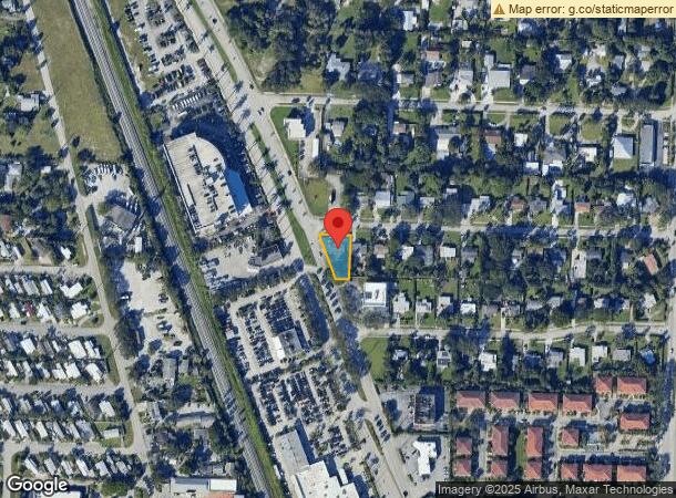
Property Record
2718 Conroy Dr, West Palm Beach, FL 33403

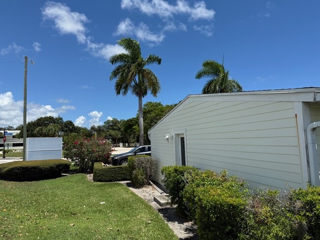
This Property Is For Sale
NEARBY LISTINGS FOR SALE OR LEASE
Property Detail
2718 Conroy Dr
South Florida
Lake Park Manor
West Palm Beach-Boca Raton-Delray Beach, FL
LAKE PARK MANOR LT 42 (LESS RD R/W AS IN OR3642P0557
68-43-42-17-05-000-0420
Palm Beach
Officebuilding
Florida
2024
42
2025
0.20 AC
000805
North Palm Beach
1,714 SF
DEMOGRAPHICS near 2718 Conroy Dr
1 Mile
3 Mile
5 Mile
2024 Total Population
9,648
97,628
180,397
2029 Population
9,819
102,890
189,678
Pop Growth 2024-2029
+ 1.77%
+ 5.39%
+ 5.14%
Average Age
40
44
44
2024 Total Households
3,895
41,178
75,319
HH Growth 2024-2029
+ 1.08%
+ 5.31%
+ 4.91%
Median Household Inc
$67,806
$71,171
$73,912
Avg Household Size
2.40
2.30
2.30
2024 Avg HH Vehicles
2.00
2.00
2.00
Median Home Value
$361,172
$369,244
$396,412
Median Year Built
1970
1983
1985
Nearby Places
- Restaurants
- Banks
- Shops
- Fitness
- Groceries
PUBLIC TRANSPORTATION
COMMUTER RAIL
Mangonia Park (Tri-County Commuter - South Florida Regional Transportation Authority (Tri-Rail))
DRIVE
WALK
Distance
Mangonia Park (Tri-County Commuter - South Florida Regional Transportation Authority (Tri-Rail))
10 min
4.5 mi
West Palm Beach (Tri-County Commuter - South Florida Regional Transportation Authority (Tri-Rail))
DRIVE
WALK
Distance
West Palm Beach (Tri-County Commuter - South Florida Regional Transportation Authority (Tri-Rail))
15 min
7.8 mi
AIRPORT
Palm Beach International
DRIVE
WALK
Distance
Palm Beach International
22 min
14.4 mi
Freight Ports
Port of Palm Beach
DRIVE
WALK
Distance
Port of Palm Beach
9 min
3.9 mi
Nearby Properties
Address
Land Use
TOTAL SIZE
Lot Size
Zoning
Address
Land Use
TOTAL SIZE
Lot Size
Zoning
738,470 SF
43.51 AC
CG1
Address
Land Use
TOTAL SIZE
Lot Size
Zoning
1,778,741 SF
69.19 AC
CF
Address
Land Use
TOTAL SIZE
Lot Size
Zoning
557,199 SF
46.91 AC
PCD
Address
Land Use
TOTAL SIZE
Lot Size
Zoning
626,464 SF
2.91 AC
MXD
Address
Land Use
TOTAL SIZE
Lot Size
Zoning
566,998 SF
43.11 AC
PCD
Address
Land Use
TOTAL SIZE
Lot Size
Zoning
390,319 SF
44.34 AC
PCD
Address
Land Use
TOTAL SIZE
Lot Size
Zoning
308,087 SF
68.94 AC
P/I
Address
Land Use
TOTAL SIZE
Lot Size
Zoning
416,171 SF
19.24 AC
R-PUD
Address
Land Use
TOTAL SIZE
Lot Size
Zoning
399,171 SF
6.60 AC
PCD
Address
Land Use
TOTAL SIZE
Lot Size
Zoning
195,263 SF
2.73 AC
PCD
Address
Land Use
TOTAL SIZE
Lot Size
Zoning
368,320 SF
23.07 AC
CLIC
Address
Land Use
TOTAL SIZE
Lot Size
Zoning
270,888 SF
8.93 AC
RH
Address
Land Use
TOTAL SIZE
Lot Size
Zoning
406,434 SF
40.60 AC
P/I
Address
Land Use
TOTAL SIZE
Lot Size
Zoning
248,945 SF
10.87 AC
PO
Address
Land Use
TOTAL SIZE
Lot Size
Zoning
59,520 SF
19.04 AC
C-S
Address
Land Use
TOTAL SIZE
Lot Size
Zoning
347,834 SF
8.92 AC
PCD
Address
Land Use
TOTAL SIZE
Lot Size
Zoning
433,243 SF
40.26 AC
RM-15
Address
Land Use
TOTAL SIZE
Lot Size
Zoning
680,979 SF
44.87 AC
PCD
Address
Land Use
TOTAL SIZE
Lot Size
Zoning
252,544 SF
9.95 AC
R1AA
Address
Land Use
TOTAL SIZE
Lot Size
Zoning
266,196 SF
17.61 AC
R-3
Address
Land Use
TOTAL SIZE
Lot Size
Zoning
381,665 SF
26.01 AC
PCD
Address
Land Use
TOTAL SIZE
Lot Size
Zoning
291,437 SF
22.02 AC
PO
Address
Land Use
TOTAL SIZE
Lot Size
Zoning
155,141 SF
25.97 AC
PCD
Address
Land Use
TOTAL SIZE
Lot Size
Zoning
109,243 SF
9.14 AC
CG1
Address
Land Use
TOTAL SIZE
Lot Size
Zoning
180,563 SF
54.46 AC
P/I
Address
Land Use
TOTAL SIZE
Lot Size
Zoning
150,114 SF
3.20 AC
MXD
Address
Land Use
TOTAL SIZE
Lot Size
Zoning
286,353 SF
22.12 AC
RH
Address
Land Use
TOTAL SIZE
Lot Size
Zoning
314,993 SF
38.46 AC
CF
Address
Land Use
TOTAL SIZE
Lot Size
Zoning
215,592 SF
38.87 AC
RL3
Address
Land Use
TOTAL SIZE
Lot Size
Zoning
The World's #1 Commercial Real Estate Marketplace
Connect with us
© 2025 CoStar Group
The information above has been obtained from sources believed reliable. While we do not doubt its accuracy we have not verified it and make no guarantee, warranty or representation about it. It is your responsibility to independently confirm its accuracy and completeness. Any projections, opinions, assumptions, or estimates used are for example only and do not represent the current or future performance of the property. The value of this transaction to you depends on tax and other factors which should be evaluated by your tax, financial, and legal advisors. You and your advisors should conduct a careful, independent investigation of the property to determine to your satisfaction the suitability of the property for your needs.