Property Record
27180 State Highway 189, Blue Jay, CA 92317
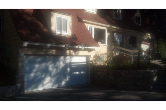
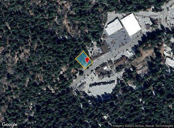
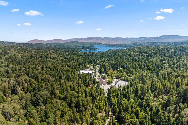

This Property Is For Sale
NEARBY LISTINGS FOR SALE OR LEASE
Property Detail
27180 State Highway 189
0335-321-12
TRACT 8839 LOT 14 TRACT 8839 LOT NO 14 (OD PER 7-8-88 #88-220487 AND #88-220488)
Officebuilding
San Bernardino
X
California
06071C7955H
14
2024
0.51 AC
2025
San Bernardino
010903
Inland Empire (California)
2,139 SF
Riverside-San Bernardino-Ontario, CA
DEMOGRAPHICS near 27180 State Highway 189
1 Mile
3 Mile
5 Mile
2024 Total Population
2,452
11,568
17,128
2029 Population
2,436
11,398
16,685
Pop Growth 2024-2029
(0.65%)
(1.47%)
(2.59%)
Average Age
45
45
44
2024 Total Households
972
4,723
7,080
HH Growth 2024-2029
(0.62%)
(1.48%)
(2.67%)
Median Household Inc
$92,137
$90,378
$86,763
Avg Household Size
2.30
2.40
2.30
2024 Avg HH Vehicles
2.00
2.00
2.00
Median Home Value
$647,159
$575,461
$497,893
Median Year Built
1976
1974
1971
Nearby Places
- Restaurants
- Banks
- Shops
- Fitness
- Groceries
PUBLIC TRANSPORTATION
AIRPORT
Ontario International
DRIVE
WALK
Distance
Ontario International
57 min
40.7 mi
Freight Ports
Port of Long Beach
DRIVE
WALK
Distance
Port of Long Beach
115 min
88.7 mi
Nearby Properties
Address
Land Use
TOTAL SIZE
Lot Size
Zoning
Address
Land Use
TOTAL SIZE
Lot Size
Zoning
185,773 SF
15.42 AC
LACG
Address
Land Use
TOTAL SIZE
Lot Size
Zoning
73,307 SF
32.90 AC
CFSDRES
Address
Land Use
TOTAL SIZE
Lot Size
Zoning
160,928 SF
8.77 AC
LACG
Address
Land Use
TOTAL SIZE
Lot Size
Zoning
25.95 AC
CFSDRES
Address
Land Use
TOTAL SIZE
Lot Size
Zoning
79,205 SF
17.72 AC
Address
Land Use
TOTAL SIZE
Lot Size
Zoning
78,044 SF
3.18 AC
LACS
Address
Land Use
TOTAL SIZE
Lot Size
Zoning
32,675 SF
91.96 AC
LARC
Address
Land Use
TOTAL SIZE
Lot Size
Zoning
34,726 SF
1.02 AC
LACG
Address
Land Use
TOTAL SIZE
Lot Size
Zoning
13,816 SF
28.10 AC
Address
Land Use
TOTAL SIZE
Lot Size
Zoning
32,648 SF
1.44 AC
LACGSCP
Address
Land Use
TOTAL SIZE
Lot Size
Zoning
Address
Land Use
TOTAL SIZE
Lot Size
Zoning
172.99 AC
Address
Land Use
TOTAL SIZE
Lot Size
Zoning
24,570 SF
2.24 AC
LACG
Address
Land Use
TOTAL SIZE
Lot Size
Zoning
46,398 SF
1.88 AC
CFCGSCP
Address
Land Use
TOTAL SIZE
Lot Size
Zoning
11,772 SF
0.22 AC
LACG
Address
Land Use
TOTAL SIZE
Lot Size
Zoning
Address
Land Use
TOTAL SIZE
Lot Size
Zoning
143.31 AC
Address
Land Use
TOTAL SIZE
Lot Size
Zoning
22,887 SF
19.30 AC
LARS14M
Address
Land Use
TOTAL SIZE
Lot Size
Zoning
56.70 AC
LARS14M
Address
Land Use
TOTAL SIZE
Lot Size
Zoning
22,542 SF
7.03 AC
LARS14M
Address
Land Use
TOTAL SIZE
Lot Size
Zoning
20,868 SF
68.79 AC
LASDRES
Address
Land Use
TOTAL SIZE
Lot Size
Zoning
25,759 SF
0.98 AC
LACGSCP
Address
Land Use
TOTAL SIZE
Lot Size
Zoning
3,570 SF
0.86 AC
LACS
Address
Land Use
TOTAL SIZE
Lot Size
Zoning
31,164 SF
0.82 AC
LACGSCP
Address
Land Use
TOTAL SIZE
Lot Size
Zoning
15,462 SF
0.52 AC
LACGSCP
Address
Land Use
TOTAL SIZE
Lot Size
Zoning
Address
Land Use
TOTAL SIZE
Lot Size
Zoning
20,228 SF
2.55 AC
LARS14M
Address
Land Use
TOTAL SIZE
Lot Size
Zoning
61,908 SF
0.19 AC
LACG
Address
Land Use
TOTAL SIZE
Lot Size
Zoning
2,650 SF
1.33 AC
LACG
Address
Land Use
TOTAL SIZE
Lot Size
Zoning
3.45 AC
LACGSCP
The World's #1 Commercial Real Estate Marketplace
Connect with us
© 2025 CoStar Group
The information above has been obtained from sources believed reliable. While we do not doubt its accuracy we have not verified it and make no guarantee, warranty or representation about it. It is your responsibility to independently confirm its accuracy and completeness. Any projections, opinions, assumptions, or estimates used are for example only and do not represent the current or future performance of the property. The value of this transaction to you depends on tax and other factors which should be evaluated by your tax, financial, and legal advisors. You and your advisors should conduct a careful, independent investigation of the property to determine to your satisfaction the suitability of the property for your needs.