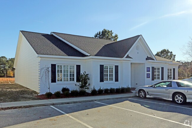
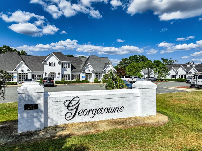
Property Record
2719 Graves Dr, Goldsboro, NC 27534
NEARBY LISTINGS FOR SALE OR LEASE
Property Detail
2719 Graves Dr
Goldsboro, NC
Wayne
3519411262
North Carolina
Officebuilding
0.04 AC
X
North Carolina Southeast Area
3720351900K
Other Market Areas
1,840 SF
DEMOGRAPHICS near 2719 Graves Dr
1 Mile
3 Mile
5 Mile
2024 Total Population
5,201
31,377
45,892
2029 Population
5,229
31,714
46,341
Pop Growth 2024-2029
+ 0.54%
+ 1.07%
+ 0.98%
Average Age
32
39
39
2024 Total Households
2,057
13,332
19,181
HH Growth 2024-2029
+ 0.49%
+ 1.04%
+ 0.97%
Median Household Inc
$42,916
$41,148
$40,353
Avg Household Size
2.40
2.20
2.30
2024 Avg HH Vehicles
2.00
2.00
2.00
Median Home Value
$190,137
$161,190
$155,270
Median Year Built
1987
1975
1976
Nearby Places
- Restaurants
- Banks
- Shops
- Fitness
- Groceries
SALE & LEASE HISTORY
LISTING DATE
SALE/LEASE

Jun 24, 2024
For Sale
Dec 29, 2017
For Lease
Dec 29, 2017
For Sale
Apr 28, 2024
For Sale
Nearby Properties
Address
Land Use
TOTAL SIZE
Lot Size
Zoning
Address
Land Use
TOTAL SIZE
Lot Size
Zoning
114.96 AC
Address
Land Use
TOTAL SIZE
Lot Size
Zoning
200,000 SF
95.24 AC
O&I
Address
Land Use
TOTAL SIZE
Lot Size
Zoning
5,784 SF
18.48 AC
Address
Land Use
TOTAL SIZE
Lot Size
Zoning
1,980 SF
14.96 AC
Address
Land Use
TOTAL SIZE
Lot Size
Zoning
232,432 SF
46.60 AC
SC
Address
Land Use
TOTAL SIZE
Lot Size
Zoning
88,715 SF
12.87 AC
Address
Land Use
TOTAL SIZE
Lot Size
Zoning
32,568 SF
2.90 AC
CBDH
Address
Land Use
TOTAL SIZE
Lot Size
Zoning
8,960 SF
13.22 AC
O&I
Address
Land Use
TOTAL SIZE
Lot Size
Zoning
69,124 SF
18.82 AC
Address
Land Use
TOTAL SIZE
Lot Size
Zoning
58,832 SF
13.82 AC
SC
Address
Land Use
TOTAL SIZE
Lot Size
Zoning
21,152 SF
3.97 AC
Address
Land Use
TOTAL SIZE
Lot Size
Zoning
226,334 SF
21.28 AC
Address
Land Use
TOTAL SIZE
Lot Size
Zoning
57,824 SF
2.44 AC
Address
Land Use
TOTAL SIZE
Lot Size
Zoning
135,320 SF
16.03 AC
Address
Land Use
TOTAL SIZE
Lot Size
Zoning
56,616 SF
2.38 AC
Address
Land Use
TOTAL SIZE
Lot Size
Zoning
135,710 SF
18.38 AC
Address
Land Use
TOTAL SIZE
Lot Size
Zoning
95,539 SF
13.03 AC
SC
Address
Land Use
TOTAL SIZE
Lot Size
Zoning
96,434 SF
7 AC
Address
Land Use
TOTAL SIZE
Lot Size
Zoning
13,180 SF
15.59 AC
R-6
Address
Land Use
TOTAL SIZE
Lot Size
Zoning
59,680 SF
2.26 AC
Address
Land Use
TOTAL SIZE
Lot Size
Zoning
120,754 SF
8.32 AC
Address
Land Use
TOTAL SIZE
Lot Size
Zoning
15,552 SF
7.63 AC
R-7
Address
Land Use
TOTAL SIZE
Lot Size
Zoning
118,116 SF
16.12 AC
Address
Land Use
TOTAL SIZE
Lot Size
Zoning
107,334 SF
11.92 AC
GB
Address
Land Use
TOTAL SIZE
Lot Size
Zoning
8,100 SF
8.60 AC
Address
Land Use
TOTAL SIZE
Lot Size
Zoning
7,978 SF
2.24 AC
Address
Land Use
TOTAL SIZE
Lot Size
Zoning
3,972 SF
19.62 AC
RM-8
Address
Land Use
TOTAL SIZE
Lot Size
Zoning
50,993 SF
10 AC
Address
Land Use
TOTAL SIZE
Lot Size
Zoning
104,883 SF
12.59 AC
Address
Land Use
TOTAL SIZE
Lot Size
Zoning
94,776 SF
13.59 AC
O&I2
The World's #1 Commercial Real Estate Marketplace
Connect with us
© 2025 CoStar Group
The information above has been obtained from sources believed reliable. While we do not doubt its accuracy we have not verified it and make no guarantee, warranty or representation about it. It is your responsibility to independently confirm its accuracy and completeness. Any projections, opinions, assumptions, or estimates used are for example only and do not represent the current or future performance of the property. The value of this transaction to you depends on tax and other factors which should be evaluated by your tax, financial, and legal advisors. You and your advisors should conduct a careful, independent investigation of the property to determine to your satisfaction the suitability of the property for your needs.