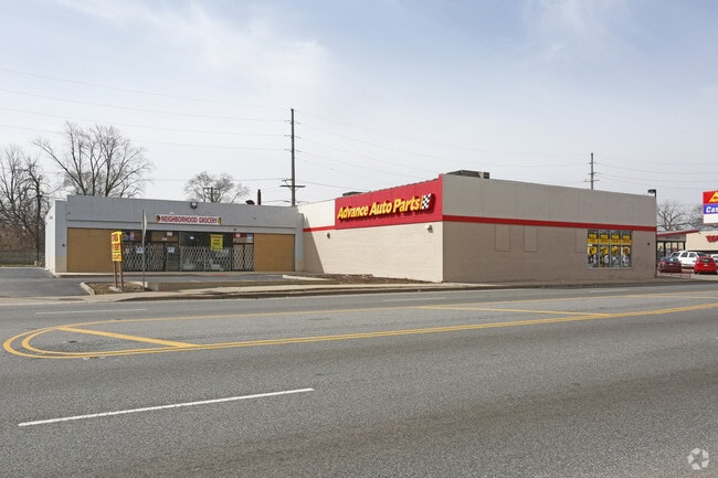
Property Record
272 E 147Th St, Harvey, IL 60426

Current Lease Availabilities
NEARBY LISTINGS FOR SALE OR LEASE
Property Detail
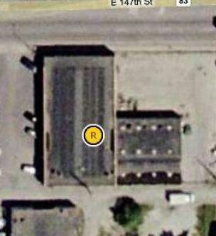
272 E 147Th St
29-08-403-053-0000
Chaxel & Mechams Subdivision
Commercialbuilding
Cook
X
Illinois
17031C0732J
0.32 AC
2023
Near South Cook
2025
Chicago
827100
Chicago-Naperville-Elgin, IL-IN
7,670 SF
DEMOGRAPHICS near 272 E 147Th St
1 Mile
3 Mile
5 Mile
2024 Total Population
13,996
105,652
268,571
2029 Population
13,978
104,822
263,646
Pop Growth 2024-2029
(0.13%)
(0.79%)
(1.83%)
Average Age
40
39
40
2024 Total Households
5,165
37,545
98,610
HH Growth 2024-2029
(0.50%)
(1.03%)
(2.17%)
Median Household Inc
$39,468
$44,193
$49,871
Avg Household Size
2.60
2.70
2.60
2024 Avg HH Vehicles
1.00
2.00
2.00
Median Home Value
$88,332
$112,902
$137,923
Median Year Built
1957
1962
1962
Nearby Places
Map Layers
Map Styles
 Street
 Aerial
- Restaurants
- Banks
- Shops
- Fitness
- Groceries
PUBLIC TRANSPORTATION
TRANSIT/SUBWAY
147th Street Station (Metra Electric Line - Northeast Illinois Regional Commuter Railroad (Metra))
DRIVE
WALK
Distance
147th Street Station (Metra Electric Line - Northeast Illinois Regional Commuter Railroad (Metra))
3 min
8 min
0.5 mi
Harvey Station (Metra Electric Line - Northeast Illinois Regional Commuter Railroad (Metra))
DRIVE
WALK
Distance
Harvey Station (Metra Electric Line - Northeast Illinois Regional Commuter Railroad (Metra))
4 min
18 min
0.9 mi
COMMUTER RAIL
Robbins Station (Rock Island District Line - Northeast Illinois Regional Commuter Railroad (Metra))
DRIVE
WALK
Distance
Robbins Station (Rock Island District Line - Northeast Illinois Regional Commuter Railroad (Metra))
9 min
3.5 mi
Blue Island - Vermont Street Station (Metra Electric Line - Northeast Illinois Regional Commuter Railroad (Metra), Rock Island District Line - Northeast Illinois Regional Commuter Railroad (Metra))
DRIVE
WALK
Distance
Blue Island - Vermont Street Station (Metra Electric Line - Northeast Illinois Regional Commuter Railroad (Metra), Rock Island District Line - Northeast Illinois Regional Commuter Railroad (Metra))
10 min
4.0 mi
AIRPORT
Chicago Midway International
DRIVE
WALK
Distance
Chicago Midway International
39 min
16.3 mi
Chicago O'Hare International
DRIVE
WALK
Distance
Chicago O'Hare International
49 min
38.1 mi
Freight Ports
Port of Baltimore
DRIVE
WALK
Distance
Port of Baltimore
1 min
602.7 mi
Nearby Properties
Address
Land Use
TOTAL SIZE
Lot Size
Zoning
Address
Land Use
TOTAL SIZE
Lot Size
Zoning
1.45 AC
Address
Land Use
TOTAL SIZE
Lot Size
Zoning
88,008 SF
3.96 AC
Address
Land Use
TOTAL SIZE
Lot Size
Zoning
83,005 SF
3.11 AC
Address
Land Use
TOTAL SIZE
Lot Size
Zoning
4.85 AC
Address
Land Use
TOTAL SIZE
Lot Size
Zoning
380,924 SF
19.13 AC
Address
Land Use
TOTAL SIZE
Lot Size
Zoning
44,184 SF
5 AC
Address
Land Use
TOTAL SIZE
Lot Size
Zoning
60,864 SF
5.55 AC
Address
Land Use
TOTAL SIZE
Lot Size
Zoning
2.86 AC
Address
Land Use
TOTAL SIZE
Lot Size
Zoning
Address
Land Use
TOTAL SIZE
Lot Size
Zoning
Address
Land Use
TOTAL SIZE
Lot Size
Zoning
67,314 SF
1.19 AC
Address
Land Use
TOTAL SIZE
Lot Size
Zoning
44,189 SF
3.09 AC
Address
Land Use
TOTAL SIZE
Lot Size
Zoning
49,229 SF
1.31 AC
Address
Land Use
TOTAL SIZE
Lot Size
Zoning
Address
Land Use
TOTAL SIZE
Lot Size
Zoning
216,386 SF
16.84 AC
PD 42
Address
Land Use
TOTAL SIZE
Lot Size
Zoning
38,111 SF
6.70 AC
Address
Land Use
TOTAL SIZE
Lot Size
Zoning
25,290 SF
1.05 AC
Address
Land Use
TOTAL SIZE
Lot Size
Zoning
233,490 SF
10.19 AC
Address
Land Use
TOTAL SIZE
Lot Size
Zoning
9,992 SF
1.40 AC
Address
Land Use
TOTAL SIZE
Lot Size
Zoning
6.34 AC
Address
Land Use
TOTAL SIZE
Lot Size
Zoning
170,680 SF
15.28 AC
M3-3
Address
Land Use
TOTAL SIZE
Lot Size
Zoning
2,888 SF
16.72 AC
PD 1091
Address
Land Use
TOTAL SIZE
Lot Size
Zoning
180,139 SF
18.78 AC
Address
Land Use
TOTAL SIZE
Lot Size
Zoning
225,800 SF
22.52 AC
M3-2,M1-2
Address
Land Use
TOTAL SIZE
Lot Size
Zoning
49,896 SF
0.87 AC
Address
Land Use
TOTAL SIZE
Lot Size
Zoning
Address
Land Use
TOTAL SIZE
Lot Size
Zoning
Address
Land Use
TOTAL SIZE
Lot Size
Zoning
36,228 SF
1.01 AC
Address
Land Use
TOTAL SIZE
Lot Size
Zoning
68,208 SF
1.28 AC
The World's #1 Commercial Real Estate Marketplace
Connect with us
© 2026 CoStar Group
The information above has been obtained from sources believed reliable. While we do not doubt its accuracy we have not verified it and make no guarantee, warranty or representation about it. It is your responsibility to independently confirm its accuracy and completeness. Any projections, opinions, assumptions, or estimates used are for example only and do not represent the current or future performance of the property. The value of this transaction to you depends on tax and other factors which should be evaluated by your tax, financial, and legal advisors. You and your advisors should conduct a careful, independent investigation of the property to determine to your satisfaction the suitability of the property for your needs.