Property Record
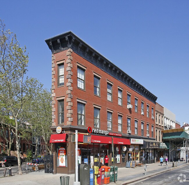
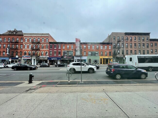
272 Flatbush Ave, Brooklyn, NY 11217


NEARBY LISTINGS FOR SALE OR LEASE
Property Detail
272 Flatbush Ave
00936-0022
DOCID-2017090501214002
Commercialofficeresidentialmixeduse
Kings
X
New York
3604970211F
22
2024
0.05 AC
2025
Park Slope
016100
Long Island (New York)
6,451 SF
New York-Jersey City-White Plains, NY-NJ
DEMOGRAPHICS near 272 Flatbush Ave
1 mile
3 mile
5 mile
2024 Total Population
165,066
1,250,376
2,726,097
2029 Population
157,836
1,183,379
2,554,855
Pop Growth 2024-2029
(4.38%)
(5.36%)
(6.28%)
Average Age
38
38
38
2024 Total Households
75,333
498,276
1,084,505
HH Growth 2024-2029
(4.80%)
(5.77%)
(6.54%)
Median Household Inc
$127,632
$79,849
$81,686
Avg Household Size
2.10
2.40
2.40
2024 Avg HH Vehicles
.00
.00
.00
Median Home Value
$1,058,002
$992,833
$893,494
Median Year Built
1947
1948
1948
Nearby Places
Map Layers
Map Styles
 Street
 Aerial
Transit
 Traffic
 Biking
Places
Listings with unknown addresses are not visible on the map
- Restaurants
- Banks
- Shops
- Fitness
- Groceries
PUBLIC TRANSPORTATION
TRANSIT/SUBWAY
Lafayette Avenue (A - New York MTA Subway (The Subway), C - New York MTA Subway (The Subway))
Drive
Walk
Distance
Lafayette Avenue (A - New York MTA Subway (The Subway), C - New York MTA Subway (The Subway))
2 min
9 min
0.5 mi
Pacific Street (D - New York MTA Subway (The Subway), M - New York MTA Subway (The Subway), N - New York MTA Subway (The Subway), R - New York MTA Subway (The Subway))
Drive
Walk
Distance
Pacific Street (D - New York MTA Subway (The Subway), M - New York MTA Subway (The Subway), N - New York MTA Subway (The Subway), R - New York MTA Subway (The Subway))
4 min
11 min
0.6 mi
COMMUTER RAIL
Nostrand Avenue Station (Far Rockaway Branch - Long Island Rail Road, Hempstead Branch - Long Island Rail Road, Long Beach Branch - Long Island Rail Road, West Hempstead Branch - Long Island Rail Road)
Drive
Walk
Distance
Nostrand Avenue Station (Far Rockaway Branch - Long Island Rail Road, Hempstead Branch - Long Island Rail Road, Long Beach Branch - Long Island Rail Road, West Hempstead Branch - Long Island Rail Road)
6 min
1.8 mi
East New York Station (Far Rockaway Branch - Long Island Rail Road, Long Beach Branch - Long Island Rail Road, West Hempstead Branch - Long Island Rail Road)
Drive
Walk
Distance
East New York Station (Far Rockaway Branch - Long Island Rail Road, Long Beach Branch - Long Island Rail Road, West Hempstead Branch - Long Island Rail Road)
17 min
5.3 mi
AIRPORT
LaGuardia
Drive
Walk
Distance
LaGuardia
17 min
10.1 mi
Newark Liberty International
Drive
Walk
Distance
Newark Liberty International
29 min
15.6 mi
John F Kennedy International
Drive
Walk
Distance
John F Kennedy International
25 min
17.8 mi
SALE & LEASE HISTORY
LISTING DATE
SALE/LEASE

Sep 24, 2016
For Lease
May 03, 2018
For Lease
Jun 30, 2022
For Lease
Jul 19, 2017
For Lease
Nearby Properties
Address
Land Use
TOTAL SIZE
Lot Size
Zoning
Address
Land Use
TOTAL SIZE
Lot Size
Zoning
2,812,739 SF
2.10 AC
C5-3
Address
Land Use
TOTAL SIZE
Lot Size
Zoning
8.22 AC
R8
Address
Land Use
TOTAL SIZE
Lot Size
Zoning
8.22 AC
R8
Address
Land Use
TOTAL SIZE
Lot Size
Zoning
5.12 AC
C6-1G
Address
Land Use
TOTAL SIZE
Lot Size
Zoning
5.12 AC
C6-1G
Address
Land Use
TOTAL SIZE
Lot Size
Zoning
5.12 AC
C6-1G
Address
Land Use
TOTAL SIZE
Lot Size
Zoning
5.12 AC
C6-1G
Address
Land Use
TOTAL SIZE
Lot Size
Zoning
5.12 AC
C6-1G
Address
Land Use
TOTAL SIZE
Lot Size
Zoning
5.12 AC
C6-1G
Address
Land Use
TOTAL SIZE
Lot Size
Zoning
5.12 AC
C6-1G
Address
Land Use
TOTAL SIZE
Lot Size
Zoning
5.12 AC
C6-1G
Address
Land Use
TOTAL SIZE
Lot Size
Zoning
5.12 AC
C6-1G
Address
Land Use
TOTAL SIZE
Lot Size
Zoning
5.12 AC
C6-1G
Address
Land Use
TOTAL SIZE
Lot Size
Zoning
5.12 AC
C6-1G
Address
Land Use
TOTAL SIZE
Lot Size
Zoning
5.12 AC
C6-1G
Address
Land Use
TOTAL SIZE
Lot Size
Zoning
5.12 AC
C6-1G
Address
Land Use
TOTAL SIZE
Lot Size
Zoning
5.12 AC
C6-1G
Address
Land Use
TOTAL SIZE
Lot Size
Zoning
5.12 AC
C6-1G
Address
Land Use
TOTAL SIZE
Lot Size
Zoning
5.12 AC
C6-1G
Address
Land Use
TOTAL SIZE
Lot Size
Zoning
5.12 AC
C6-1G
Address
Land Use
TOTAL SIZE
Lot Size
Zoning
5.12 AC
C6-1G
Address
Land Use
TOTAL SIZE
Lot Size
Zoning
5.12 AC
C6-1G
Address
Land Use
TOTAL SIZE
Lot Size
Zoning
5.12 AC
C6-1G
Address
Land Use
TOTAL SIZE
Lot Size
Zoning
5.12 AC
C6-1G
Address
Land Use
TOTAL SIZE
Lot Size
Zoning
5.12 AC
C6-1G
Address
Land Use
TOTAL SIZE
Lot Size
Zoning
5.12 AC
C6-1G
Address
Land Use
TOTAL SIZE
Lot Size
Zoning
5.12 AC
C6-1G
Address
Land Use
TOTAL SIZE
Lot Size
Zoning
5.12 AC
C6-1G
Address
Land Use
TOTAL SIZE
Lot Size
Zoning
5.12 AC
C6-1G
Address
Land Use
TOTAL SIZE
Lot Size
Zoning
5.12 AC
C6-1G
The World's #1 Commercial Real Estate Marketplace
Connect with us
© 2026 CoStar Group
The information above has been obtained from sources believed reliable. While we do not doubt its accuracy we have not verified it and make no guarantee, warranty or representation about it. It is your responsibility to independently confirm its accuracy and completeness. Any projections, opinions, assumptions, or estimates used are for example only and do not represent the current or future performance of the property. The value of this transaction to you depends on tax and other factors which should be evaluated by your tax, financial, and legal advisors. You and your advisors should conduct a careful, independent investigation of the property to determine to your satisfaction the suitability of the property for your needs.