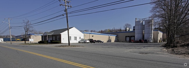
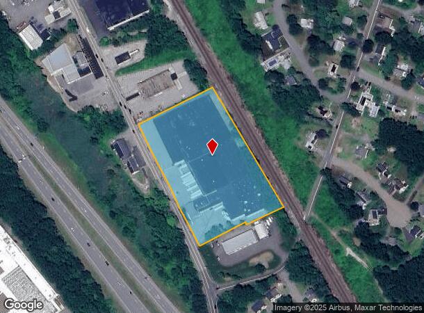
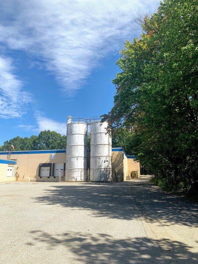
Property Record
272 Nashua St, Leominster, MA 01453
NEARBY LISTINGS FOR SALE OR LEASE
Property Detail
272 Nashua St
Manufacturinglight
Worcester
X
Massachusetts
25027C0286F
4.76 AC
2025
Fitchburg/Leominster
2025
Boston
709501
Worcester, MA-CT
121,987 SF
LEOM-000324-000002
DEMOGRAPHICS near 272 Nashua St
1 Mile
3 Mile
5 Mile
2024 Total Population
6,465
45,950
83,927
2029 Population
6,382
45,731
83,587
Pop Growth 2024-2029
(1.28%)
(0.48%)
(0.41%)
Average Age
40
41
41
2024 Total Households
2,555
18,578
32,519
HH Growth 2024-2029
(1.41%)
(0.51%)
(0.41%)
Median Household Inc
$63,125
$73,315
$76,071
Avg Household Size
2.50
2.40
2.40
2024 Avg HH Vehicles
2.00
2.00
2.00
Median Home Value
$319,328
$331,667
$332,946
Median Year Built
1949
1965
1962
Nearby Places
Map Layers
Map Styles
 Street
 Aerial
- Restaurants
- Banks
- Shops
- Fitness
- Groceries
PUBLIC TRANSPORTATION
COMMUTER RAIL
North Leominster (Fitchburg/South Acton Line - Massachusetts Bay Transportation Authority Commuter Rail (Purple Line))
DRIVE
WALK
Distance
North Leominster (Fitchburg/South Acton Line - Massachusetts Bay Transportation Authority Commuter Rail (Purple Line))
1 min
12 min
0.6 mi
Shirley (Fitchburg/South Acton Line - Massachusetts Bay Transportation Authority Commuter Rail (Purple Line))
DRIVE
WALK
Distance
Shirley (Fitchburg/South Acton Line - Massachusetts Bay Transportation Authority Commuter Rail (Purple Line))
11 min
5.1 mi
AIRPORT
Worcester Regional
DRIVE
WALK
Distance
Worcester Regional
38 min
26.2 mi
Manchester Boston Regional
DRIVE
WALK
Distance
Manchester Boston Regional
69 min
38.7 mi
Freight Ports
Port of Boston
DRIVE
WALK
Distance
Port of Boston
67 min
43.9 mi
SALE & LEASE HISTORY
LISTING DATE
SALE/LEASE

Oct 18, 2016
For Lease
Jan 02, 2020
For Lease
Nearby Properties
Address
Land Use
TOTAL SIZE
Lot Size
Zoning
Address
Land Use
TOTAL SIZE
Lot Size
Zoning
39.94 AC
Address
Land Use
TOTAL SIZE
Lot Size
Zoning
20.19 AC
Address
Land Use
TOTAL SIZE
Lot Size
Zoning
65.15 AC
Address
Land Use
TOTAL SIZE
Lot Size
Zoning
20,188 SF
18.86 AC
Address
Land Use
TOTAL SIZE
Lot Size
Zoning
24.35 AC
Address
Land Use
TOTAL SIZE
Lot Size
Zoning
45,066 SF
18.52 AC
Address
Land Use
TOTAL SIZE
Lot Size
Zoning
41,182 SF
339 AC
AI
Address
Land Use
TOTAL SIZE
Lot Size
Zoning
35.43 AC
RA
Address
Land Use
TOTAL SIZE
Lot Size
Zoning
372,000 SF
30.33 AC
Address
Land Use
TOTAL SIZE
Lot Size
Zoning
552,952 SF
27.44 AC
Address
Land Use
TOTAL SIZE
Lot Size
Zoning
20.30 AC
Address
Land Use
TOTAL SIZE
Lot Size
Zoning
30,078 SF
19.66 AC
Address
Land Use
TOTAL SIZE
Lot Size
Zoning
47,173 SF
0.76 AC
Address
Land Use
TOTAL SIZE
Lot Size
Zoning
77,758 SF
7.78 AC
Address
Land Use
TOTAL SIZE
Lot Size
Zoning
9.30 AC
Address
Land Use
TOTAL SIZE
Lot Size
Zoning
68,822 SF
9.83 AC
Address
Land Use
TOTAL SIZE
Lot Size
Zoning
171,063 SF
14.62 AC
Address
Land Use
TOTAL SIZE
Lot Size
Zoning
51,492 SF
9.34 AC
Address
Land Use
TOTAL SIZE
Lot Size
Zoning
Address
Land Use
TOTAL SIZE
Lot Size
Zoning
56.75 AC
Address
Land Use
TOTAL SIZE
Lot Size
Zoning
11.14 AC
Address
Land Use
TOTAL SIZE
Lot Size
Zoning
Address
Land Use
TOTAL SIZE
Lot Size
Zoning
125,461 SF
11.27 AC
Address
Land Use
TOTAL SIZE
Lot Size
Zoning
66.70 AC
Address
Land Use
TOTAL SIZE
Lot Size
Zoning
135,070 SF
6 AC
Address
Land Use
TOTAL SIZE
Lot Size
Zoning
74,060 SF
7.98 AC
Address
Land Use
TOTAL SIZE
Lot Size
Zoning
102,628 SF
10.50 AC
Address
Land Use
TOTAL SIZE
Lot Size
Zoning
Address
Land Use
TOTAL SIZE
Lot Size
Zoning
118,587 SF
22.30 AC
Address
Land Use
TOTAL SIZE
Lot Size
Zoning
81,594 SF
1.59 AC
The World's #1 Commercial Real Estate Marketplace
Connect with us
© 2025 CoStar Group
The information above has been obtained from sources believed reliable. While we do not doubt its accuracy we have not verified it and make no guarantee, warranty or representation about it. It is your responsibility to independently confirm its accuracy and completeness. Any projections, opinions, assumptions, or estimates used are for example only and do not represent the current or future performance of the property. The value of this transaction to you depends on tax and other factors which should be evaluated by your tax, financial, and legal advisors. You and your advisors should conduct a careful, independent investigation of the property to determine to your satisfaction the suitability of the property for your needs.