Property Record
2720 E Farmer Ave, Springfield, MO 65803
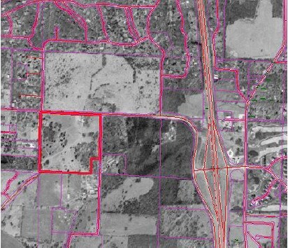

Property Detail
2720 E Farmer Ave
19-28-202-001
SW1/4 NW1/4 (EX 1 1/2A SE COR) 28/28/21
Agriculturalland
GREENE
INC
Missouri
B and X Area of moderate flood hazard, usually the area between the limits of the 100-year and 500-year floods.
38.50 AC
2025
Southeast
2025
Springfield
004402
Springfield, MO
NEARBY LISTINGS FOR SALE OR LEASE
DEMOGRAPHICS near 2720 E Farmer Ave
1 mile
3 mile
5 mile
2024 Total Population
1,519
24,691
90,262
2029 Population
1,593
25,523
93,580
Pop Growth 2024-2029
+ 4.87%
+ 3.37%
+ 3.68%
Average Age
45
43
41
2024 Total Households
605
10,430
38,353
HH Growth 2024-2029
+ 4.96%
+ 3.26%
+ 3.56%
Median Household Inc
$133,615
$88,550
$73,286
Avg Household Size
2.50
2.30
2.30
2024 Avg HH Vehicles
2.00
2.00
2.00
Median Home Value
$488,946
$358,683
$302,237
Median Year Built
1998
1993
1991
Nearby Places
Map Layers
Map Styles
 Street
 Aerial
Transit
 Traffic
 Biking
Places
Listings with unknown addresses are not visible on the map
- Restaurants
- Banks
- Shops
- Fitness
- Groceries
PUBLIC TRANSPORTATION
AIRPORT
Springfield-Branson Ntl
Drive
Walk
Distance
Springfield-Branson Ntl
36 min
24.6 mi
Freight Ports
Tulsa Port of Inola
Drive
Walk
Distance
Tulsa Port of Inola
200 min
177.3 mi
Nearby Properties
Address
Land Use
TOTAL SIZE
Lot Size
Zoning
Address
Land Use
TOTAL SIZE
Lot Size
Zoning
2,400 SF
41.33 AC
Address
Land Use
TOTAL SIZE
Lot Size
Zoning
15.46 AC
Address
Land Use
TOTAL SIZE
Lot Size
Zoning
1,632 SF
12 AC
Address
Land Use
TOTAL SIZE
Lot Size
Zoning
15.46 AC
INC.
Address
Land Use
TOTAL SIZE
Lot Size
Zoning
1.98 AC
INC.
Address
Land Use
TOTAL SIZE
Lot Size
Zoning
8.08 AC
INC
Address
Land Use
TOTAL SIZE
Lot Size
Zoning
11.56 AC
INC
Address
Land Use
TOTAL SIZE
Lot Size
Zoning
3.43 AC
INC
Address
Land Use
TOTAL SIZE
Lot Size
Zoning
42,540 SF
3.63 AC
INC
Address
Land Use
TOTAL SIZE
Lot Size
Zoning
13.11 AC
INC
Address
Land Use
TOTAL SIZE
Lot Size
Zoning
47,214 SF
4.25 AC
INC
Address
Land Use
TOTAL SIZE
Lot Size
Zoning
Address
Land Use
TOTAL SIZE
Lot Size
Zoning
114,021 SF
12.83 AC
INC
Address
Land Use
TOTAL SIZE
Lot Size
Zoning
5.72 AC
INC
Address
Land Use
TOTAL SIZE
Lot Size
Zoning
1,836 SF
35.65 AC
Address
Land Use
TOTAL SIZE
Lot Size
Zoning
9,474 SF
8.90 AC
Address
Land Use
TOTAL SIZE
Lot Size
Zoning
2.84 AC
INC
Address
Land Use
TOTAL SIZE
Lot Size
Zoning
3,025 SF
2.20 AC
Address
Land Use
TOTAL SIZE
Lot Size
Zoning
4.16 AC
INC
Address
Land Use
TOTAL SIZE
Lot Size
Zoning
116,136 SF
5.88 AC
INC
Address
Land Use
TOTAL SIZE
Lot Size
Zoning
54.39 AC
INC
Address
Land Use
TOTAL SIZE
Lot Size
Zoning
49,544 SF
4.96 AC
INC
Address
Land Use
TOTAL SIZE
Lot Size
Zoning
11,421 SF
163.10 AC
Address
Land Use
TOTAL SIZE
Lot Size
Zoning
43,010 SF
3.71 AC
INC
Address
Land Use
TOTAL SIZE
Lot Size
Zoning
167.92 AC
PAD
Address
Land Use
TOTAL SIZE
Lot Size
Zoning
9,841 SF
7.17 AC
Address
Land Use
TOTAL SIZE
Lot Size
Zoning
14,700 SF
2.42 AC
INC
Address
Land Use
TOTAL SIZE
Lot Size
Zoning
7.63 AC
INC
Address
Land Use
TOTAL SIZE
Lot Size
Zoning
3,910 SF
6.33 AC
Address
Land Use
TOTAL SIZE
Lot Size
Zoning
63,149 SF
6.01 AC
INC
The World's #1 Commercial Real Estate Marketplace
Connect with us
© 2026 CoStar Group
The information above has been obtained from sources believed reliable. While we do not doubt its accuracy we have not verified it and make no guarantee, warranty or representation about it. It is your responsibility to independently confirm its accuracy and completeness. Any projections, opinions, assumptions, or estimates used are for example only and do not represent the current or future performance of the property. The value of this transaction to you depends on tax and other factors which should be evaluated by your tax, financial, and legal advisors. You and your advisors should conduct a careful, independent investigation of the property to determine to your satisfaction the suitability of the property for your needs.