Property Record
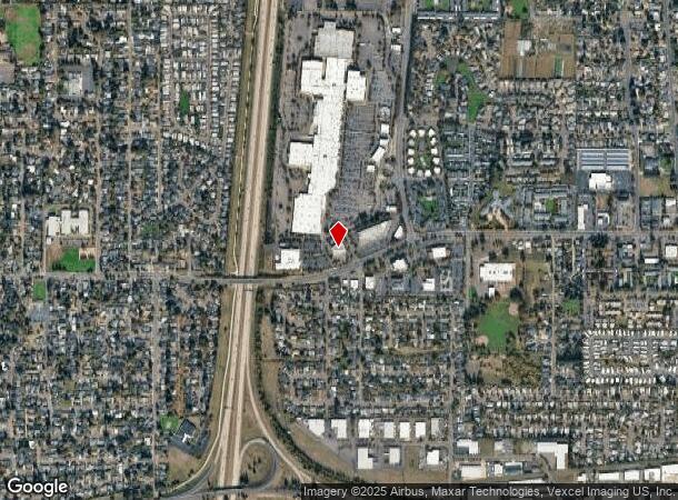
2720 Gateway St, Springfield, OR 97477
NEARBY LISTINGS FOR SALE OR LEASE
Property Detail
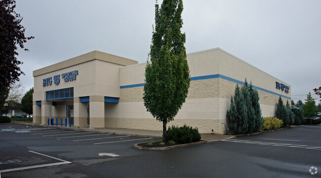
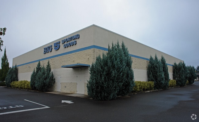
2720 Gateway St
Eugene-Springfield, OR
Shoppes At Gateway
1004538
TL 02305
Commercialacreage
Lane
X
Oregon
41039C1133F
2305
2023
5.96 AC
2023
Lane County
002103
Portland
DEMOGRAPHICS near 2720 Gateway St
1 Mile
3 Mile
5 Mile
2024 Total Population
16,172
99,918
182,197
2029 Population
16,124
100,379
182,716
Pop Growth 2024-2029
(0.30%)
+ 0.46%
+ 0.28%
Average Age
39
38
39
2024 Total Households
6,836
42,082
77,491
HH Growth 2024-2029
(0.29%)
+ 0.48%
+ 0.26%
Median Household Inc
$53,239
$53,184
$57,073
Avg Household Size
2.30
2.20
2.20
2024 Avg HH Vehicles
2.00
2.00
2.00
Median Home Value
$338,536
$383,034
$381,431
Median Year Built
1977
1977
1974
Nearby Places
Map Layers
Map Styles
 Street
 Aerial
- Restaurants
- Banks
- Shops
- Fitness
- Groceries
PUBLIC TRANSPORTATION
COMMUTER RAIL
DRIVE
WALK
Distance
8 min
3.2 mi
AIRPORT
Mahlon Sweet Field
DRIVE
WALK
Distance
Mahlon Sweet Field
21 min
11.5 mi
Nearby Properties
Address
Land Use
TOTAL SIZE
Lot Size
Zoning
Address
Land Use
TOTAL SIZE
Lot Size
Zoning
110.25 AC
PL
Address
Land Use
TOTAL SIZE
Lot Size
Zoning
15.37 AC
PL
Address
Land Use
TOTAL SIZE
Lot Size
Zoning
71.87 AC
PL
Address
Land Use
TOTAL SIZE
Lot Size
Zoning
1.56 AC
C-2
Address
Land Use
TOTAL SIZE
Lot Size
Zoning
1.86 AC
C-2
Address
Land Use
TOTAL SIZE
Lot Size
Zoning
9.57 AC
LD
Address
Land Use
TOTAL SIZE
Lot Size
Zoning
24 AC
C-2
Address
Land Use
TOTAL SIZE
Lot Size
Zoning
13.82 AC
PL
Address
Land Use
TOTAL SIZE
Lot Size
Zoning
9.81 AC
C-2
Address
Land Use
TOTAL SIZE
Lot Size
Zoning
3.99 AC
I-3
Address
Land Use
TOTAL SIZE
Lot Size
Zoning
5.87 AC
C-2
Address
Land Use
TOTAL SIZE
Lot Size
Zoning
2.76 AC
C-3
Address
Land Use
TOTAL SIZE
Lot Size
Zoning
3.10 AC
S-WS
Address
Land Use
TOTAL SIZE
Lot Size
Zoning
2.56 AC
C-2
Address
Land Use
TOTAL SIZE
Lot Size
Zoning
33.20 AC
HI
Address
Land Use
TOTAL SIZE
Lot Size
Zoning
1.23 AC
C-3
Address
Land Use
TOTAL SIZE
Lot Size
Zoning
16.80 AC
PL
Address
Land Use
TOTAL SIZE
Lot Size
Zoning
2.77 AC
C-2
Address
Land Use
TOTAL SIZE
Lot Size
Zoning
14.39 AC
E-1
Address
Land Use
TOTAL SIZE
Lot Size
Zoning
3.29 AC
S-RP
Address
Land Use
TOTAL SIZE
Lot Size
Zoning
1.21 AC
C-2
Address
Land Use
TOTAL SIZE
Lot Size
Zoning
9.59 AC
R-1
Address
Land Use
TOTAL SIZE
Lot Size
Zoning
14.54 AC
C-2
Address
Land Use
TOTAL SIZE
Lot Size
Zoning
2.15 AC
PL
Address
Land Use
TOTAL SIZE
Lot Size
Zoning
Address
Land Use
TOTAL SIZE
Lot Size
Zoning
17.37 AC
AG
Address
Land Use
TOTAL SIZE
Lot Size
Zoning
13.55 AC
CI
Address
Land Use
TOTAL SIZE
Lot Size
Zoning
11.23 AC
Address
Land Use
TOTAL SIZE
Lot Size
Zoning
4.31 AC
C-2
Address
Land Use
TOTAL SIZE
Lot Size
Zoning
The World's #1 Commercial Real Estate Marketplace
Connect with us
© 2026 CoStar Group
The information above has been obtained from sources believed reliable. While we do not doubt its accuracy we have not verified it and make no guarantee, warranty or representation about it. It is your responsibility to independently confirm its accuracy and completeness. Any projections, opinions, assumptions, or estimates used are for example only and do not represent the current or future performance of the property. The value of this transaction to you depends on tax and other factors which should be evaluated by your tax, financial, and legal advisors. You and your advisors should conduct a careful, independent investigation of the property to determine to your satisfaction the suitability of the property for your needs.