Property Record
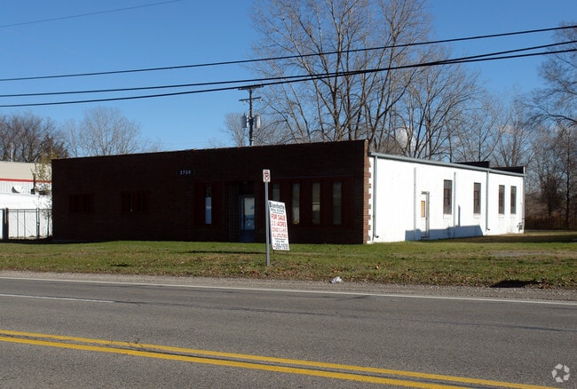
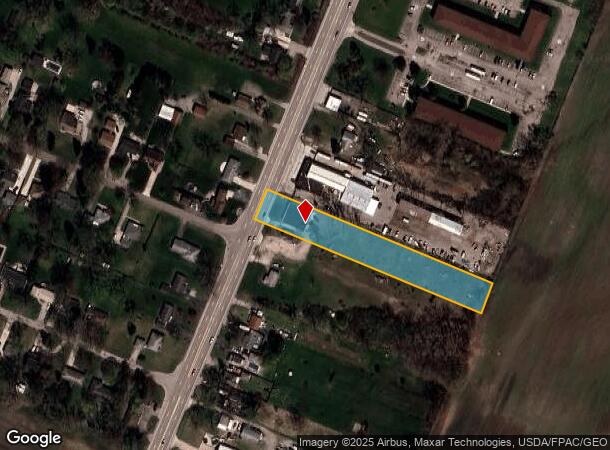
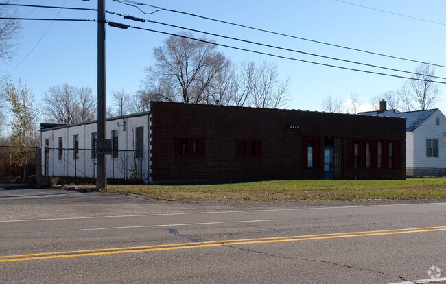
2720 N Monroe St, Monroe, MI 48162
NEARBY LISTINGS FOR SALE OR LEASE
Property Detail
2720 N Monroe St
07-353-018-00
North River Raisin
Publicstorage
F-953 SEC 20 T6S R9E & PC 353 1.50 AMOL COM 1525.90 FT N 24 DEG 52'E FR INT E LI PC 353 W/CL SANTURE RD, TH N 24 DEG 52'E 92
X
Monroe
26115C0234E
Michigan
2024
1.50 AC
2025
Monroe County
831300
Detroit
4,200 SF
Monroe, MI
DEMOGRAPHICS near 2720 N Monroe St
1 Mile
3 Mile
5 Mile
2024 Total Population
2,113
25,438
58,041
2029 Population
2,182
25,817
58,999
Pop Growth 2024-2029
+ 3.27%
+ 1.49%
+ 1.65%
Average Age
45
42
41
2024 Total Households
849
10,610
23,522
HH Growth 2024-2029
+ 3.06%
+ 1.39%
+ 1.58%
Median Household Inc
$85,577
$59,744
$61,203
Avg Household Size
2.40
2.30
2.40
2024 Avg HH Vehicles
2.00
2.00
2.00
Median Home Value
$245,833
$168,904
$162,977
Median Year Built
1975
1968
1971
Nearby Places
Map Layers
Map Styles
 Street
 Aerial
- Restaurants
- Banks
- Shops
- Fitness
- Groceries
PUBLIC TRANSPORTATION
AIRPORT
Detroit Metro Wayne County
DRIVE
WALK
Distance
Detroit Metro Wayne County
31 min
21.8 mi
Windsor International
DRIVE
WALK
Distance
Windsor International
62 min
43.3 mi
Eugene F Kranz Toledo Express
DRIVE
WALK
Distance
Eugene F Kranz Toledo Express
65 min
45.6 mi
Freight Ports
DRIVE
WALK
Distance
41 min
29.8 mi
Nearby Properties
Address
Land Use
TOTAL SIZE
Lot Size
Zoning
Address
Land Use
TOTAL SIZE
Lot Size
Zoning
200,000 SF
94.63 AC
CO
Address
Land Use
TOTAL SIZE
Lot Size
Zoning
409,765 SF
41.46 AC
Address
Land Use
TOTAL SIZE
Lot Size
Zoning
95.60 AC
Address
Land Use
TOTAL SIZE
Lot Size
Zoning
195,744 SF
32.62 AC
C-2-COMMER
Address
Land Use
TOTAL SIZE
Lot Size
Zoning
315,000 SF
24.47 AC
Address
Land Use
TOTAL SIZE
Lot Size
Zoning
3.97 AC
Address
Land Use
TOTAL SIZE
Lot Size
Zoning
134,464 SF
34.35 AC
Address
Land Use
TOTAL SIZE
Lot Size
Zoning
192,917 SF
15.81 AC
R3B-MULTIF
Address
Land Use
TOTAL SIZE
Lot Size
Zoning
69,590 SF
11.55 AC
C-2-COMMER
Address
Land Use
TOTAL SIZE
Lot Size
Zoning
291,322 SF
55.05 AC
Address
Land Use
TOTAL SIZE
Lot Size
Zoning
148,343 SF
15.15 AC
Address
Land Use
TOTAL SIZE
Lot Size
Zoning
3,822 SF
16.60 AC
R-1A
Address
Land Use
TOTAL SIZE
Lot Size
Zoning
138,119 SF
15.12 AC
Address
Land Use
TOTAL SIZE
Lot Size
Zoning
189,314 SF
28.56 AC
Address
Land Use
TOTAL SIZE
Lot Size
Zoning
94,324 SF
10.11 AC
Address
Land Use
TOTAL SIZE
Lot Size
Zoning
62,459 SF
2.59 AC
Address
Land Use
TOTAL SIZE
Lot Size
Zoning
290,248 SF
52.03 AC
Address
Land Use
TOTAL SIZE
Lot Size
Zoning
142,400 SF
15.20 AC
Address
Land Use
TOTAL SIZE
Lot Size
Zoning
43,127 SF
8.10 AC
Address
Land Use
TOTAL SIZE
Lot Size
Zoning
412,877 SF
22.35 AC
R-1A
Address
Land Use
TOTAL SIZE
Lot Size
Zoning
220,500 SF
31.81 AC
Address
Land Use
TOTAL SIZE
Lot Size
Zoning
200,700 SF
9.95 AC
R-1A
Address
Land Use
TOTAL SIZE
Lot Size
Zoning
31.45 AC
Address
Land Use
TOTAL SIZE
Lot Size
Zoning
149,282 SF
7.57 AC
R-1A
Address
Land Use
TOTAL SIZE
Lot Size
Zoning
75,437 SF
8.74 AC
R-1A
Address
Land Use
TOTAL SIZE
Lot Size
Zoning
109,626 SF
8.89 AC
Address
Land Use
TOTAL SIZE
Lot Size
Zoning
2,100 SF
36.48 AC
MHP
Address
Land Use
TOTAL SIZE
Lot Size
Zoning
85,062 SF
9.32 AC
Address
Land Use
TOTAL SIZE
Lot Size
Zoning
Address
Land Use
TOTAL SIZE
Lot Size
Zoning
150,200 SF
5.68 AC
R-1A
The World's #1 Commercial Real Estate Marketplace
Connect with us
© 2025 CoStar Group
The information above has been obtained from sources believed reliable. While we do not doubt its accuracy we have not verified it and make no guarantee, warranty or representation about it. It is your responsibility to independently confirm its accuracy and completeness. Any projections, opinions, assumptions, or estimates used are for example only and do not represent the current or future performance of the property. The value of this transaction to you depends on tax and other factors which should be evaluated by your tax, financial, and legal advisors. You and your advisors should conduct a careful, independent investigation of the property to determine to your satisfaction the suitability of the property for your needs.