Property Record
2722 Progress Rd, Madison, WI 53716


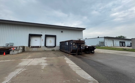
Property Detail
2722 Progress Rd
0710-222-0309-7
FOURTH ADDITION TO GLENDALE INDUSTRIAL PARK, BLK 5, LOTS 5 & 6.
Commercialnec
Dane
IG
Wisconsin
B and X Area of moderate flood hazard, usually the area between the limits of the 100-year and 500-year floods.
5,6
2025
3.07 AC
2025
Southeast Madison
003100
Milwaukee/Madison
44,800 SF
Madison, WI
NEARBY LISTINGS FOR SALE OR LEASE
DEMOGRAPHICS near 2722 Progress Rd
1 mile
3 mile
5 mile
2024 Total Population
3,030
43,051
139,293
2029 Population
3,101
44,546
144,427
Pop Growth 2024-2029
+ 2.34%
+ 3.47%
+ 3.69%
Average Age
43
42
37
2024 Total Households
1,384
18,982
63,431
HH Growth 2024-2029
+ 2.75%
+ 3.81%
+ 4.12%
Median Household Inc
$76,205
$91,225
$69,859
Avg Household Size
2.10
2.20
2.00
2024 Avg HH Vehicles
2.00
2.00
2.00
Median Home Value
$286,444
$342,382
$353,508
Median Year Built
1966
1974
1976
Nearby Places
Map Layers
Map Styles
 Street
 Aerial
Transit
 Traffic
 Biking
Places
Listings with unknown addresses are not visible on the map
- Restaurants
- Banks
- Shops
- Fitness
- Groceries
PUBLIC TRANSPORTATION
AIRPORT
Dane County Regional/Truax Field
Drive
Walk
Distance
Dane County Regional/Truax Field
15 min
7.8 mi
SALE & LEASE HISTORY
LISTING DATE
SALE/LEASE

Sep 08, 2025
For Lease
Nearby Properties
Address
Land Use
TOTAL SIZE
Lot Size
Zoning
Address
Land Use
TOTAL SIZE
Lot Size
Zoning
168,685 SF
14.05 AC
IL
Address
Land Use
TOTAL SIZE
Lot Size
Zoning
20,965 SF
10.98 AC
IL
Address
Land Use
TOTAL SIZE
Lot Size
Zoning
13.40 AC
Address
Land Use
TOTAL SIZE
Lot Size
Zoning
2.03 AC
Address
Land Use
TOTAL SIZE
Lot Size
Zoning
3.59 AC
Address
Land Use
TOTAL SIZE
Lot Size
Zoning
166,108 SF
2 AC
WP-25
Address
Land Use
TOTAL SIZE
Lot Size
Zoning
156,054 SF
9.40 AC
SE
Address
Land Use
TOTAL SIZE
Lot Size
Zoning
2.38 AC
Address
Land Use
TOTAL SIZE
Lot Size
Zoning
21.92 AC
Address
Land Use
TOTAL SIZE
Lot Size
Zoning
5.53 AC
Address
Land Use
TOTAL SIZE
Lot Size
Zoning
272,519 SF
16.40 AC
IL
Address
Land Use
TOTAL SIZE
Lot Size
Zoning
3.49 AC
Address
Land Use
TOTAL SIZE
Lot Size
Zoning
131,000 SF
4.51 AC
WP-25
Address
Land Use
TOTAL SIZE
Lot Size
Zoning
149,897 SF
17.72 AC
IL
Address
Land Use
TOTAL SIZE
Lot Size
Zoning
6,868 SF
18.35 AC
IL
Address
Land Use
TOTAL SIZE
Lot Size
Zoning
131,307 SF
1.21 AC
PD
Address
Land Use
TOTAL SIZE
Lot Size
Zoning
202,800 SF
13.05 AC
WP-31
Address
Land Use
TOTAL SIZE
Lot Size
Zoning
87,541 SF
1.85 AC
TR-U2
Address
Land Use
TOTAL SIZE
Lot Size
Zoning
140,832 SF
3.51 AC
WP-25
Address
Land Use
TOTAL SIZE
Lot Size
Zoning
131,874 SF
8.98 AC
IL
Address
Land Use
TOTAL SIZE
Lot Size
Zoning
116,406 SF
4.01 AC
PD
Address
Land Use
TOTAL SIZE
Lot Size
Zoning
202,323 SF
10.45 AC
IL
Address
Land Use
TOTAL SIZE
Lot Size
Zoning
95,909 SF
1 AC
TE
Address
Land Use
TOTAL SIZE
Lot Size
Zoning
204,296 SF
14.35 AC
CC
Address
Land Use
TOTAL SIZE
Lot Size
Zoning
281,400 SF
15.01 AC
IL
Address
Land Use
TOTAL SIZE
Lot Size
Zoning
86,633 SF
6.25 AC
TR-P
Address
Land Use
TOTAL SIZE
Lot Size
Zoning
82,062 SF
2.38 AC
WP-25
Address
Land Use
TOTAL SIZE
Lot Size
Zoning
94,440 SF
4.42 AC
SE
Address
Land Use
TOTAL SIZE
Lot Size
Zoning
79,554 SF
6.59 AC
TR-P
Address
Land Use
TOTAL SIZE
Lot Size
Zoning
1.99 AC
The World's #1 Commercial Real Estate Marketplace
Connect with us
© 2026 CoStar Group
The information above has been obtained from sources believed reliable. While we do not doubt its accuracy we have not verified it and make no guarantee, warranty or representation about it. It is your responsibility to independently confirm its accuracy and completeness. Any projections, opinions, assumptions, or estimates used are for example only and do not represent the current or future performance of the property. The value of this transaction to you depends on tax and other factors which should be evaluated by your tax, financial, and legal advisors. You and your advisors should conduct a careful, independent investigation of the property to determine to your satisfaction the suitability of the property for your needs.