Property Record
2725 N Kansas Expy, Springfield, MO 65803
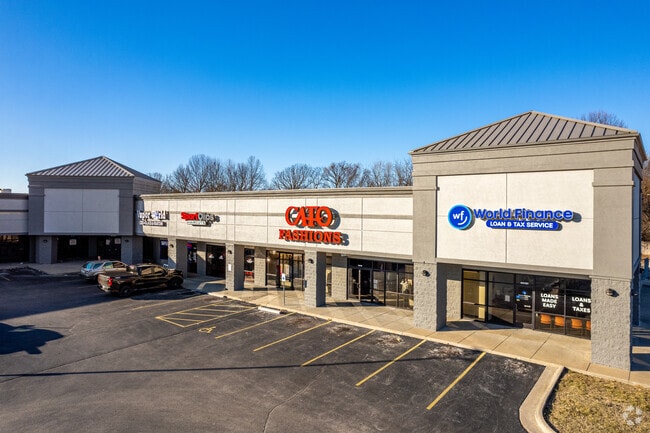

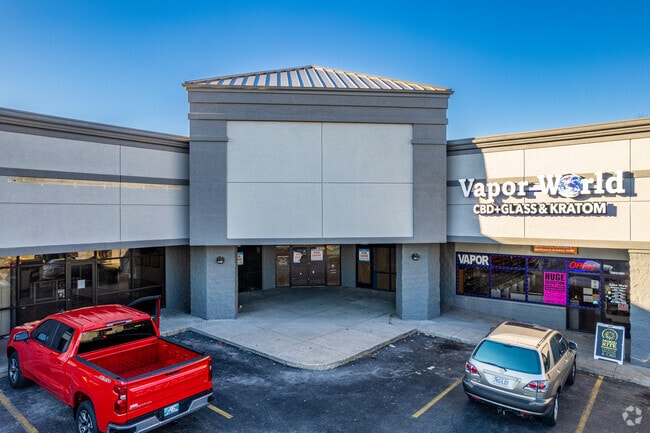
Property Detail
2725 N Kansas Expy
13-03-401-045
2.51A M/L BEG NE COR S1/2 NE1/4 NE1/4 SE1/4 3/29/22 S 1.96 F T W 196.38 FT S186.19 FT E 72.84 FT N 15.5 FT ELY 122.26 FT S 75.38 FT W 606.30 FT N 236.85 FTE TO BEG 3/29/22 (EX NEW
Communitycenter
Greene
INC
Missouri
B and X Area of moderate flood hazard, usually the area between the limits of the 100-year and 500-year floods.
2.51 AC
2025
Northwest
2025
Springfield
005600
Springfield, MO
30,131 SF
NEARBY LISTINGS FOR SALE OR LEASE
DEMOGRAPHICS near 2725 N Kansas Expy
1 mile
3 mile
5 mile
2025 Total Population
6,325
52,587
115,463
2030 Population
6,554
54,351
118,911
Pop Growth 2025-2030
+ 3.62%
+ 3.35%
+ 2.99%
Average Age
39
38
37
2025 Total Households
2,689
21,713
49,329
HH Growth 2025-2030
+ 3.79%
+ 3.62%
+ 3.27%
Median Household Inc
$43,096
$44,158
$45,860
Avg Household Size
2.30
2.20
2.10
2025 Avg HH Vehicles
2.00
2.00
2.00
Median Home Value
$129,887
$144,325
$161,813
Median Year Built
1971
1971
1974
Nearby Places
Map Layers
Map Styles
 Street
 Aerial
Layers
 Traffic
 Biking
Places
Listings with unknown addresses are not visible on the map
- Restaurants
- Banks
- Shops
- Fitness
- Groceries
PUBLIC TRANSPORTATION
AIRPORT
Springfield-Branson Ntl
Drive
Walk
Distance
Springfield-Branson Ntl
18 min
8.8 mi
SALE & LEASE HISTORY
LISTING DATE
SALE/LEASE

Sep 25, 2016
For Lease
Apr 04, 2017
For Lease
Nearby Properties
Address
Land Use
TOTAL SIZE
Lot Size
Zoning
Address
Land Use
TOTAL SIZE
Lot Size
Zoning
23.75 AC
Address
Land Use
TOTAL SIZE
Lot Size
Zoning
5.84 AC
INC
Address
Land Use
TOTAL SIZE
Lot Size
Zoning
5.47 AC
INC
Address
Land Use
TOTAL SIZE
Lot Size
Zoning
143,774 SF
5.85 AC
INC
Address
Land Use
TOTAL SIZE
Lot Size
Zoning
234,926 SF
9.41 AC
INC
Address
Land Use
TOTAL SIZE
Lot Size
Zoning
290,844 SF
20.78 AC
INC
Address
Land Use
TOTAL SIZE
Lot Size
Zoning
186,125 SF
21.09 AC
INC
Address
Land Use
TOTAL SIZE
Lot Size
Zoning
2.92 AC
INC
Address
Land Use
TOTAL SIZE
Lot Size
Zoning
93,916 SF
7.91 AC
INC
Address
Land Use
TOTAL SIZE
Lot Size
Zoning
167,705 SF
1.43 AC
INC
Address
Land Use
TOTAL SIZE
Lot Size
Zoning
29.42 AC
INC
Address
Land Use
TOTAL SIZE
Lot Size
Zoning
1.69 AC
INC
Address
Land Use
TOTAL SIZE
Lot Size
Zoning
136,629 SF
26.79 AC
INC
Address
Land Use
TOTAL SIZE
Lot Size
Zoning
10.76 AC
INC
Address
Land Use
TOTAL SIZE
Lot Size
Zoning
16.08 AC
Address
Land Use
TOTAL SIZE
Lot Size
Zoning
75.07 AC
INC
Address
Land Use
TOTAL SIZE
Lot Size
Zoning
Address
Land Use
TOTAL SIZE
Lot Size
Zoning
154,635 SF
9.16 AC
INC
Address
Land Use
TOTAL SIZE
Lot Size
Zoning
107,429 SF
0.78 AC
INC
Address
Land Use
TOTAL SIZE
Lot Size
Zoning
Address
Land Use
TOTAL SIZE
Lot Size
Zoning
Address
Land Use
TOTAL SIZE
Lot Size
Zoning
12.39 AC
Address
Land Use
TOTAL SIZE
Lot Size
Zoning
78,239 SF
10.01 AC
INC
Address
Land Use
TOTAL SIZE
Lot Size
Zoning
213,437 SF
1.58 AC
INC
Address
Land Use
TOTAL SIZE
Lot Size
Zoning
Address
Land Use
TOTAL SIZE
Lot Size
Zoning
66,075 SF
1.94 AC
INC
Address
Land Use
TOTAL SIZE
Lot Size
Zoning
55,568 SF
2.13 AC
INC
Address
Land Use
TOTAL SIZE
Lot Size
Zoning
55,309 SF
0.69 AC
INC
Address
Land Use
TOTAL SIZE
Lot Size
Zoning
105,920 SF
4.88 AC
INC
Address
Land Use
TOTAL SIZE
Lot Size
Zoning
504,804 SF
34.94 AC
INC
The World's #1 Commercial Real Estate Marketplace
Connect with us
© 2026 CoStar Group
The information above has been obtained from sources believed reliable. While we do not doubt its accuracy we have not verified it and make no guarantee, warranty or representation about it. It is your responsibility to independently confirm its accuracy and completeness. Any projections, opinions, assumptions, or estimates used are for example only and do not represent the current or future performance of the property. The value of this transaction to you depends on tax and other factors which should be evaluated by your tax, financial, and legal advisors. You and your advisors should conduct a careful, independent investigation of the property to determine to your satisfaction the suitability of the property for your needs.