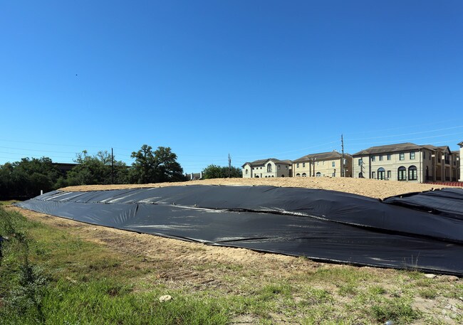
Property Record
2727 Albany St, Houston, TX 77006

NEARBY LISTINGS FOR SALE OR LEASE
Property Detail
2727 Albany St
1362780010001
Pearl On Helena R/P Amend
Apartment
RES A BLK 1 PEARL ON HELENA R/P AMEND
X
Harris
48201C0860L
Texas
2024
1.15 AC
2025
Midtown
410602
Houston
279,915 SF
Houston-The Woodlands-Sugar Land, TX
DEMOGRAPHICS near 2727 Albany St
1 Mile
3 Mile
5 Mile
2024 Total Population
37,441
232,469
503,982
2029 Population
38,997
242,614
524,550
Pop Growth 2024-2029
+ 4.16%
+ 4.36%
+ 4.08%
Average Age
37
37
38
2024 Total Households
22,044
111,067
232,828
HH Growth 2024-2029
+ 4.12%
+ 4.74%
+ 4.32%
Median Household Inc
$89,026
$93,076
$83,131
Avg Household Size
1.60
1.80
2.00
2024 Avg HH Vehicles
1.00
1.00
2.00
Median Home Value
$441,124
$466,950
$444,645
Median Year Built
2004
2002
1995
Nearby Places
Map Layers
Map Styles
 Street
 Aerial
- Restaurants
- Banks
- Shops
- Fitness
- Groceries
PUBLIC TRANSPORTATION
TRANSIT/SUBWAY
Mcgowen (METRORAIL RED LINE - Metropolitan Transit Authority of Harris County, Redline - Metropolitan Transit Authority of Harris County)
DRIVE
WALK
Distance
Mcgowen (METRORAIL RED LINE - Metropolitan Transit Authority of Harris County, Redline - Metropolitan Transit Authority of Harris County)
2 min
12 min
0.6 mi
Ensemble/Hcc (METRORAIL RED LINE - Metropolitan Transit Authority of Harris County, Redline - Metropolitan Transit Authority of Harris County)
DRIVE
WALK
Distance
Ensemble/Hcc (METRORAIL RED LINE - Metropolitan Transit Authority of Harris County, Redline - Metropolitan Transit Authority of Harris County)
2 min
16 min
0.8 mi
Ensemble/Hcc Stn Sb (METRORAIL RED LINE - Metropolitan Transit Authority of Harris County)
DRIVE
WALK
Distance
Ensemble/Hcc Stn Sb (METRORAIL RED LINE - Metropolitan Transit Authority of Harris County)
2 min
16 min
0.8 mi
Downtown Transit Center (METRORAIL RED LINE - Metropolitan Transit Authority of Harris County, Redline - Metropolitan Transit Authority of Harris County)
DRIVE
WALK
Distance
Downtown Transit Center (METRORAIL RED LINE - Metropolitan Transit Authority of Harris County, Redline - Metropolitan Transit Authority of Harris County)
3 min
19 min
1.0 mi
COMMUTER RAIL
Houston (Sunset Limited - Amtrak)
DRIVE
WALK
Distance
Houston (Sunset Limited - Amtrak)
5 min
2.1 mi
AIRPORT
William P Hobby
DRIVE
WALK
Distance
William P Hobby
25 min
12.5 mi
George Bush Intcntl/Houston
DRIVE
WALK
Distance
George Bush Intcntl/Houston
28 min
21.8 mi
Freight Ports
Port of Houston
DRIVE
WALK
Distance
Port of Houston
21 min
12.0 mi
SALE & LEASE HISTORY
LISTING DATE
SALE/LEASE

May 08, 2017
For Sale
Nearby Properties
Address
Land Use
TOTAL SIZE
Lot Size
Zoning
Address
Land Use
TOTAL SIZE
Lot Size
Zoning
1,383,720 SF
1.47 AC
Address
Land Use
TOTAL SIZE
Lot Size
Zoning
1,101,686 SF
1.45 AC
Address
Land Use
TOTAL SIZE
Lot Size
Zoning
973,861 SF
1.18 AC
Address
Land Use
TOTAL SIZE
Lot Size
Zoning
899,279 SF
1.18 AC
Address
Land Use
TOTAL SIZE
Lot Size
Zoning
797,208 SF
1.46 AC
Address
Land Use
TOTAL SIZE
Lot Size
Zoning
1,916,394 SF
1.46 AC
Address
Land Use
TOTAL SIZE
Lot Size
Zoning
1,871,418 SF
1.44 AC
Address
Land Use
TOTAL SIZE
Lot Size
Zoning
1,252,274 SF
2.02 AC
Address
Land Use
TOTAL SIZE
Lot Size
Zoning
1,091,726 SF
2.60 AC
Address
Land Use
TOTAL SIZE
Lot Size
Zoning
1,232,364 SF
1.49 AC
Address
Land Use
TOTAL SIZE
Lot Size
Zoning
1,436,400 SF
1.44 AC
Address
Land Use
TOTAL SIZE
Lot Size
Zoning
1,321,033 SF
1.46 AC
Address
Land Use
TOTAL SIZE
Lot Size
Zoning
4,169,721 SF
31.23 AC
Address
Land Use
TOTAL SIZE
Lot Size
Zoning
2,005,097 SF
1.44 AC
Address
Land Use
TOTAL SIZE
Lot Size
Zoning
1,374,271 SF
1.44 AC
Address
Land Use
TOTAL SIZE
Lot Size
Zoning
1,150,681 SF
1.17 AC
Address
Land Use
TOTAL SIZE
Lot Size
Zoning
515,025 SF
1.50 AC
Address
Land Use
TOTAL SIZE
Lot Size
Zoning
1,657,484 SF
1.44 AC
Address
Land Use
TOTAL SIZE
Lot Size
Zoning
1,282,908 SF
2.74 AC
Address
Land Use
TOTAL SIZE
Lot Size
Zoning
1,311,133 SF
1.44 AC
Address
Land Use
TOTAL SIZE
Lot Size
Zoning
555,351 SF
1.40 AC
Address
Land Use
TOTAL SIZE
Lot Size
Zoning
1,181,384 SF
1.47 AC
Address
Land Use
TOTAL SIZE
Lot Size
Zoning
1,044,305 SF
3.16 AC
Address
Land Use
TOTAL SIZE
Lot Size
Zoning
1,162,204 SF
1.44 AC
Address
Land Use
TOTAL SIZE
Lot Size
Zoning
934,258 SF
1.45 AC
Address
Land Use
TOTAL SIZE
Lot Size
Zoning
1,103,424 SF
1.44 AC
Address
Land Use
TOTAL SIZE
Lot Size
Zoning
1,365,801 SF
1.44 AC
Address
Land Use
TOTAL SIZE
Lot Size
Zoning
565,276 SF
1.35 AC
Address
Land Use
TOTAL SIZE
Lot Size
Zoning
644,352 SF
8.05 AC
Address
Land Use
TOTAL SIZE
Lot Size
Zoning
1,017,783 SF
1.44 AC
The World's #1 Commercial Real Estate Marketplace
Connect with us
© 2025 CoStar Group
The information above has been obtained from sources believed reliable. While we do not doubt its accuracy we have not verified it and make no guarantee, warranty or representation about it. It is your responsibility to independently confirm its accuracy and completeness. Any projections, opinions, assumptions, or estimates used are for example only and do not represent the current or future performance of the property. The value of this transaction to you depends on tax and other factors which should be evaluated by your tax, financial, and legal advisors. You and your advisors should conduct a careful, independent investigation of the property to determine to your satisfaction the suitability of the property for your needs.