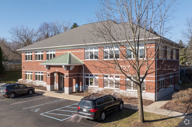
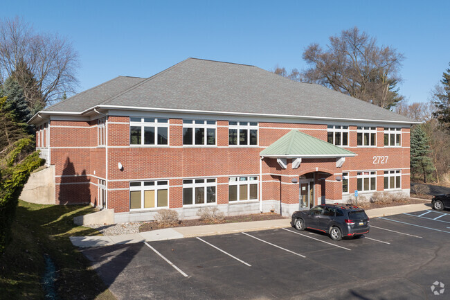
Property Record
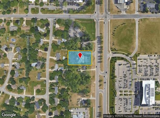
2727 E Beltline Ave Ne, Grand Rapids, MI 49525
Current Lease Availabilities
NEARBY LISTINGS FOR SALE OR LEASE
Property Detail
2727 E Beltline Ave Ne
41-14-10-228-027
S 155 FT OF N 520 FT OF E 1/8 NE 1/4 EX THAT PART LYING E OF A LINE 70.0 FT W FROM /MEAS PERP TO/ & PAR WITH FOL DESC LINE -
Dentalbldg
Kent
X
Michigan
26081C0314D
0.92 AC
2024
Northeast Grand Rapids
2025
West Michigan
011801
Grand Rapids-Wyoming, MI
10,212 SF
DEMOGRAPHICS near 2727 E Beltline Ave Ne
1 Mile
3 Mile
5 Mile
2024 Total Population
4,858
46,410
130,068
2029 Population
4,955
46,830
130,979
Pop Growth 2024-2029
+ 2.00%
+ 0.90%
+ 0.70%
Average Age
38
40
39
2024 Total Households
1,724
19,041
53,446
HH Growth 2024-2029
+ 1.86%
+ 0.85%
+ 0.68%
Median Household Inc
$114,423
$75,630
$74,638
Avg Household Size
2.70
2.40
2.30
2024 Avg HH Vehicles
2.00
2.00
2.00
Median Home Value
$361,985
$262,797
$266,550
Median Year Built
1995
1979
1964
Nearby Places
Map Layers
Map Styles
 Street
 Aerial
- Restaurants
- Banks
- Shops
- Fitness
- Groceries
PUBLIC TRANSPORTATION
COMMUTER RAIL
DRIVE
WALK
Distance
12 min
8.5 mi
AIRPORT
Gerald R Ford International
DRIVE
WALK
Distance
Gerald R Ford International
22 min
13.5 mi
Nearby Properties
Address
Land Use
TOTAL SIZE
Lot Size
Zoning
Address
Land Use
TOTAL SIZE
Lot Size
Zoning
494,398 SF
R-PUD
Address
Land Use
TOTAL SIZE
Lot Size
Zoning
25.41 AC
Address
Land Use
TOTAL SIZE
Lot Size
Zoning
257,381 SF
7.08 AC
SD-PRD
Address
Land Use
TOTAL SIZE
Lot Size
Zoning
112,764 SF
17.29 AC
SD-PRD
Address
Land Use
TOTAL SIZE
Lot Size
Zoning
18.07 AC
MON-LDR
Address
Land Use
TOTAL SIZE
Lot Size
Zoning
21.77 AC
MCN-MDR
Address
Land Use
TOTAL SIZE
Lot Size
Zoning
47,370 SF
8.18 AC
MON-LDR
Address
Land Use
TOTAL SIZE
Lot Size
Zoning
Address
Land Use
TOTAL SIZE
Lot Size
Zoning
Address
Land Use
TOTAL SIZE
Lot Size
Zoning
24.96 AC
MCN-MDR
Address
Land Use
TOTAL SIZE
Lot Size
Zoning
247,954 SF
40.84 AC
SD-PRD
Address
Land Use
TOTAL SIZE
Lot Size
Zoning
158,449 SF
14.33 AC
MCN-MDR
Address
Land Use
TOTAL SIZE
Lot Size
Zoning
21.10 AC
MON-MDR
Address
Land Use
TOTAL SIZE
Lot Size
Zoning
417,625 SF
29.60 AC
SD-IT
Address
Land Use
TOTAL SIZE
Lot Size
Zoning
145,127 SF
18.52 AC
SD-PRD
Address
Land Use
TOTAL SIZE
Lot Size
Zoning
22.63 AC
MCN-MDR
Address
Land Use
TOTAL SIZE
Lot Size
Zoning
34,120 SF
5.81 AC
SD-PRD
Address
Land Use
TOTAL SIZE
Lot Size
Zoning
56,095 SF
3.30 AC
SD-PRD
Address
Land Use
TOTAL SIZE
Lot Size
Zoning
16.34 AC
Address
Land Use
TOTAL SIZE
Lot Size
Zoning
Address
Land Use
TOTAL SIZE
Lot Size
Zoning
13.26 AC
MON-MDR
Address
Land Use
TOTAL SIZE
Lot Size
Zoning
138,864 SF
34.91 AC
R-1
Address
Land Use
TOTAL SIZE
Lot Size
Zoning
16.29 AC
MCN-MDR
Address
Land Use
TOTAL SIZE
Lot Size
Zoning
58,686 SF
3.71 AC
SD-NOS
Address
Land Use
TOTAL SIZE
Lot Size
Zoning
14.36 AC
MON-MDR
Address
Land Use
TOTAL SIZE
Lot Size
Zoning
83,464 SF
3.28 AC
SD-PRD
Address
Land Use
TOTAL SIZE
Lot Size
Zoning
Address
Land Use
TOTAL SIZE
Lot Size
Zoning
126,218 SF
10.10 AC
MON-LDR
Address
Land Use
TOTAL SIZE
Lot Size
Zoning
123,600 SF
10.15 AC
MCN-MDR
Address
Land Use
TOTAL SIZE
Lot Size
Zoning
97,894 SF
5.90 AC
MCN-LDR
The World's #1 Commercial Real Estate Marketplace
Connect with us
© 2025 CoStar Group
The information above has been obtained from sources believed reliable. While we do not doubt its accuracy we have not verified it and make no guarantee, warranty or representation about it. It is your responsibility to independently confirm its accuracy and completeness. Any projections, opinions, assumptions, or estimates used are for example only and do not represent the current or future performance of the property. The value of this transaction to you depends on tax and other factors which should be evaluated by your tax, financial, and legal advisors. You and your advisors should conduct a careful, independent investigation of the property to determine to your satisfaction the suitability of the property for your needs.