Property Record
3669 7Th Ave, Los Angeles, CA 90018


NEARBY LISTINGS FOR SALE OR LEASE
Property Detail
3669 7Th Ave
Los Angeles-Long Beach-Glendale, CA
5210
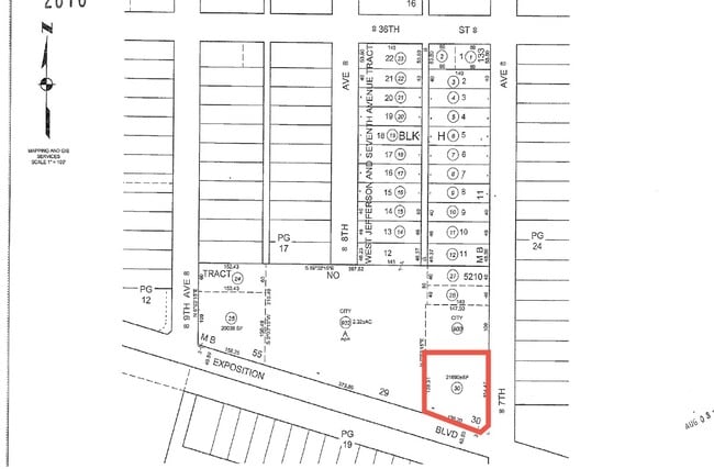
5044-018-030
TR=5210 FOR DESC SEE ASSESSORS MAPS POR OF LOT A
Lightindustrial
Los Angeles
X
California
06037C1614G
a
2025
0.48 AC
2025
Westside
219020
Los Angeles
15,460 SF
DEMOGRAPHICS near 3669 7Th Ave
1 Mile
3 Mile
5 Mile
2024 Total Population
42,093
419,603
1,244,682
2029 Population
40,639
406,917
1,208,587
Pop Growth 2024-2029
(3.45%)
(3.02%)
(2.90%)
Average Age
40
39
38
2024 Total Households
15,027
143,885
464,274
HH Growth 2024-2029
(3.67%)
(3.14%)
(2.81%)
Median Household Inc
$60,538
$52,091
$58,999
Avg Household Size
2.70
2.70
2.50
2024 Avg HH Vehicles
2.00
2.00
1.00
Median Home Value
$768,278
$810,079
$853,991
Median Year Built
1947
1949
1957
Nearby Places
Map Layers
Map Styles
 Street
 Aerial
- Restaurants
- Banks
- Shops
- Fitness
- Groceries
PUBLIC TRANSPORTATION
TRANSIT/SUBWAY
Expo/Crenshaw (Expo Line - Los Angeles County Metropolitan Transportation Authority (Metro))
DRIVE
WALK
Distance
Expo/Crenshaw (Expo Line - Los Angeles County Metropolitan Transportation Authority (Metro))
1 min
12 min
0.6 mi
Expo/Western (Expo Line - Los Angeles County Metropolitan Transportation Authority (Metro))
DRIVE
WALK
Distance
Expo/Western (Expo Line - Los Angeles County Metropolitan Transportation Authority (Metro))
2 min
19 min
1.0 mi
COMMUTER RAIL
Los Angeles (Coast Starlight - Amtrak, Pacific Surfliner - Amtrak, Southwest Chief - Amtrak, Texas Eagle - Amtrak)
DRIVE
WALK
Distance
Los Angeles (Coast Starlight - Amtrak, Pacific Surfliner - Amtrak, Southwest Chief - Amtrak, Texas Eagle - Amtrak)
12 min
7.1 mi
Union Station (91 Line - Southern California Regional Rail Authority (Metrolink), Antelope Valley Line - Southern California Regional Rail Authority (Metrolink), Orange County Line - Southern California Regional Rail Authority (Metrolink), Riverside Line - Southern California Regional Rail Authority (Metrolink), San Bernardino Line - Southern California Regional Rail Authority (Metrolink), Ventura County Line - Southern California Regional Rail Authority (Metrolink))
DRIVE
WALK
Distance
Union Station (91 Line - Southern California Regional Rail Authority (Metrolink), Antelope Valley Line - Southern California Regional Rail Authority (Metrolink), Orange County Line - Southern California Regional Rail Authority (Metrolink), Riverside Line - Southern California Regional Rail Authority (Metrolink), San Bernardino Line - Southern California Regional Rail Authority (Metrolink), Ventura County Line - Southern California Regional Rail Authority (Metrolink))
14 min
7.4 mi
AIRPORT
Los Angeles International
DRIVE
WALK
Distance
Los Angeles International
17 min
8.8 mi
Bob Hope
DRIVE
WALK
Distance
Bob Hope
27 min
15.5 mi
Long Beach (Daugherty Field)
DRIVE
WALK
Distance
Long Beach (Daugherty Field)
31 min
22.5 mi
Freight Ports
Port of Long Beach
DRIVE
WALK
Distance
Port of Long Beach
34 min
24.4 mi
SALE & LEASE HISTORY
LISTING DATE
SALE/LEASE

May 20, 2025
For Sale
Feb 16, 2021
For Sale
Aug 01, 2023
For Lease
Nearby Properties
Address
Land Use
TOTAL SIZE
Lot Size
Zoning
Address
Land Use
TOTAL SIZE
Lot Size
Zoning
969,516 SF
14.75 AC
Address
Land Use
TOTAL SIZE
Lot Size
Zoning
1,178,786 SF
3.89 AC
LAC2
Address
Land Use
TOTAL SIZE
Lot Size
Zoning
420,864 SF
63.07 AC
LAUSC-1A
Address
Land Use
TOTAL SIZE
Lot Size
Zoning
871,235 SF
14.56 AC
LAC2
Address
Land Use
TOTAL SIZE
Lot Size
Zoning
256,059 SF
Address
Land Use
TOTAL SIZE
Lot Size
Zoning
368,411 SF
10.91 AC
C2-2D-CPIO
Address
Land Use
TOTAL SIZE
Lot Size
Zoning
200,689 SF
5.79 AC
LAUSC-1A
Address
Land Use
TOTAL SIZE
Lot Size
Zoning
337,025 SF
14.59 AC
LAUSC-1A
Address
Land Use
TOTAL SIZE
Lot Size
Zoning
666,499 SF
10.63 AC
LAC2
Address
Land Use
TOTAL SIZE
Lot Size
Zoning
298,630 SF
4.64 AC
LAUSC-1B
Address
Land Use
TOTAL SIZE
Lot Size
Zoning
786,423 SF
11.74 AC
LAC2
Address
Land Use
TOTAL SIZE
Lot Size
Zoning
78,793 SF
3.53 AC
LAMR1
Address
Land Use
TOTAL SIZE
Lot Size
Zoning
310,063 SF
2.22 AC
LAC2
Address
Land Use
TOTAL SIZE
Lot Size
Zoning
377,946 SF
5.03 AC
LAUSC-1A
Address
Land Use
TOTAL SIZE
Lot Size
Zoning
106,000 SF
4.26 AC
LAMR 1
Address
Land Use
TOTAL SIZE
Lot Size
Zoning
237,673 SF
3.73 AC
M1-2D-CPIO
Address
Land Use
TOTAL SIZE
Lot Size
Zoning
190,164 SF
1.18 AC
LAR4
Address
Land Use
TOTAL SIZE
Lot Size
Zoning
73,918 SF
3.86 AC
LAM1
Address
Land Use
TOTAL SIZE
Lot Size
Zoning
152,000 SF
1.04 AC
LAC2
Address
Land Use
TOTAL SIZE
Lot Size
Zoning
31,358 SF
5.43 AC
LAMR
Address
Land Use
TOTAL SIZE
Lot Size
Zoning
303,775 SF
2.27 AC
Address
Land Use
TOTAL SIZE
Lot Size
Zoning
102,877 SF
8.69 AC
LAC2
Address
Land Use
TOTAL SIZE
Lot Size
Zoning
1.05 AC
LAC4
Address
Land Use
TOTAL SIZE
Lot Size
Zoning
112,636 SF
24.20 AC
LAUSC-1A
Address
Land Use
TOTAL SIZE
Lot Size
Zoning
343,879 SF
4.26 AC
LAC2
Address
Land Use
TOTAL SIZE
Lot Size
Zoning
168,636 SF
1.44 AC
LARAS4
Address
Land Use
TOTAL SIZE
Lot Size
Zoning
203,272 SF
14.53 AC
LAC2
Address
Land Use
TOTAL SIZE
Lot Size
Zoning
199,495 SF
1.54 AC
LAR4
Address
Land Use
TOTAL SIZE
Lot Size
Zoning
179,989 SF
0.90 AC
LAR4
Address
Land Use
TOTAL SIZE
Lot Size
Zoning
188,130 SF
1.11 AC
LAC2
The World's #1 Commercial Real Estate Marketplace
Connect with us
© 2025 CoStar Group
The information above has been obtained from sources believed reliable. While we do not doubt its accuracy we have not verified it and make no guarantee, warranty or representation about it. It is your responsibility to independently confirm its accuracy and completeness. Any projections, opinions, assumptions, or estimates used are for example only and do not represent the current or future performance of the property. The value of this transaction to you depends on tax and other factors which should be evaluated by your tax, financial, and legal advisors. You and your advisors should conduct a careful, independent investigation of the property to determine to your satisfaction the suitability of the property for your needs.