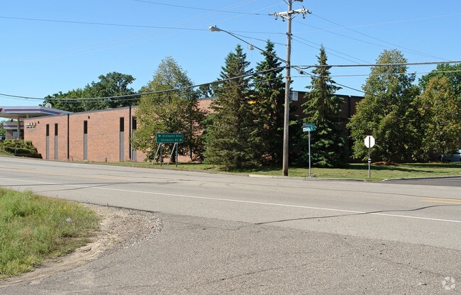
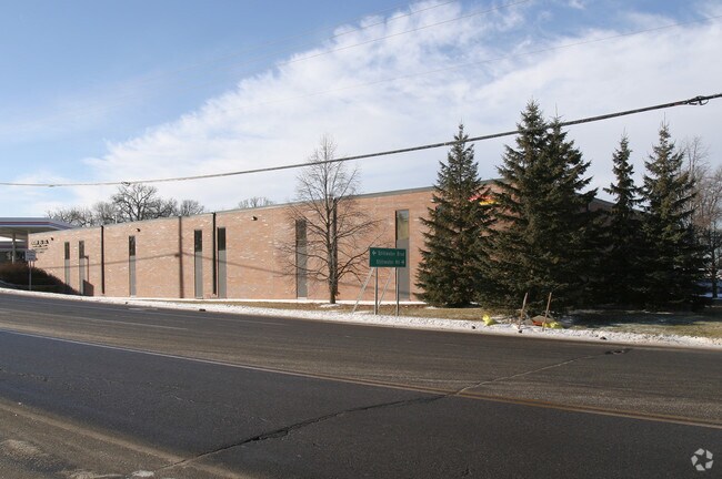
Property Record
2728 Geranium Ave E, Saint Paul, MN 55119

Save to a Folder
{{folder.Name}}
{{folder.ListingIds.length}} Properties
{{folder.ListingIds.length}} Property
Create a New Folder
Property Detail
2728 Geranium Ave E
Minneapolis-St. Paul-Bloomington, MN-WI
MIDVALE ACRES NO. 2 PART OF LOTS 12 THRU LOT 14 BLOCK 5 LYING NLY ...SD LOT 14 & ALL OF LOT 11 BLK 5
25-29-22-11-0057
RAMSEY
Heavyindustrial
Minnesota
B and X Area of moderate flood hazard, usually the area between the limits of the 100-year and 500-year floods.
12,14
2024
1.19 AC
2025
East
042501
Minneapolis/St Paul
19,530 SF
NEARBY LISTINGS FOR SALE OR LEASE
DEMOGRAPHICS near 2728 Geranium Ave E
1 mile
3 mile
5 mile
2025 Total Population
9,393
99,188
219,543
2030 Population
9,514
100,471
221,671
Pop Growth 2025-2030
+ 1.29%
+ 1.29%
+ 0.97%
Average Age
40
37
38
2025 Total Households
3,981
35,985
79,021
HH Growth 2025-2030
+ 1.46%
+ 1.47%
+ 1.17%
Median Household Inc
$74,031
$78,020
$81,870
Avg Household Size
2.30
2.60
2.60
2025 Avg HH Vehicles
2.00
2.00
2.00
Median Home Value
$268,209
$275,102
$295,576
Median Year Built
1984
1974
1975
Nearby Places
Map Layers
Map Styles
 Street
 Aerial
Layers
 Traffic
 Biking
Places
Listings with unknown addresses are not visible on the map
- Restaurants
- Banks
- Shops
- Fitness
- Groceries
PUBLIC TRANSPORTATION
COMMUTER RAIL
St. Paul-Minneapolis (Borealis - Amtrak, Empire Builder - Amtrak)
Drive
Walk
Distance
St. Paul-Minneapolis (Borealis - Amtrak, Empire Builder - Amtrak)
12 min
6.5 mi
AIRPORT
Minneapolis-St Paul International/Wold-Chamberlain
Drive
Walk
Distance
Minneapolis-St Paul International/Wold-Chamberlain
26 min
16.7 mi
Freight Ports
Port Milwaukee
Drive
Walk
Distance
Port Milwaukee
358 min
325.6 mi
SALE & LEASE HISTORY
LISTING DATE
SALE/LEASE

Apr 21, 2021
For Sale
Nearby Properties
Address
Land Use
TOTAL SIZE
Lot Size
Zoning
Address
Land Use
TOTAL SIZE
Lot Size
Zoning
267,948 SF
372.92 AC
Address
Land Use
TOTAL SIZE
Lot Size
Zoning
270,348 SF
35.96 AC
Address
Land Use
TOTAL SIZE
Lot Size
Zoning
236,236 SF
Address
Land Use
TOTAL SIZE
Lot Size
Zoning
272,720 SF
Address
Land Use
TOTAL SIZE
Lot Size
Zoning
460,439 SF
25.26 AC
Address
Land Use
TOTAL SIZE
Lot Size
Zoning
29.55 AC
Address
Land Use
TOTAL SIZE
Lot Size
Zoning
228,036 SF
31.11 AC
Address
Land Use
TOTAL SIZE
Lot Size
Zoning
53,851 SF
22.74 AC
Address
Land Use
TOTAL SIZE
Lot Size
Zoning
201,728 SF
Address
Land Use
TOTAL SIZE
Lot Size
Zoning
311,332 SF
36.34 AC
Address
Land Use
TOTAL SIZE
Lot Size
Zoning
143,922 SF
23.12 AC
Address
Land Use
TOTAL SIZE
Lot Size
Zoning
181.88 AC
Address
Land Use
TOTAL SIZE
Lot Size
Zoning
20.03 AC
Address
Land Use
TOTAL SIZE
Lot Size
Zoning
246,000 SF
31.03 AC
Address
Land Use
TOTAL SIZE
Lot Size
Zoning
170,084 SF
Address
Land Use
TOTAL SIZE
Lot Size
Zoning
160,600 SF
Address
Land Use
TOTAL SIZE
Lot Size
Zoning
96,587 SF
17.42 AC
Address
Land Use
TOTAL SIZE
Lot Size
Zoning
41,201 SF
9.55 AC
Address
Land Use
TOTAL SIZE
Lot Size
Zoning
256,440 SF
27.44 AC
Address
Land Use
TOTAL SIZE
Lot Size
Zoning
371,200 SF
8.99 AC
Address
Land Use
TOTAL SIZE
Lot Size
Zoning
222,374 SF
43.99 AC
Address
Land Use
TOTAL SIZE
Lot Size
Zoning
49,691 SF
10.94 AC
Address
Land Use
TOTAL SIZE
Lot Size
Zoning
Address
Land Use
TOTAL SIZE
Lot Size
Zoning
143,930 SF
Address
Land Use
TOTAL SIZE
Lot Size
Zoning
3.91 AC
Address
Land Use
TOTAL SIZE
Lot Size
Zoning
111,528 SF
20.30 AC
Address
Land Use
TOTAL SIZE
Lot Size
Zoning
190,062 SF
6.99 AC
Address
Land Use
TOTAL SIZE
Lot Size
Zoning
301,658 SF
21.92 AC
Address
Land Use
TOTAL SIZE
Lot Size
Zoning
192,600 SF
11 AC
Address
Land Use
TOTAL SIZE
Lot Size
Zoning
191,844 SF
10.75 AC
The World's #1 Commercial Real Estate Marketplace
Connect with us
© 2026 CoStar Group
The information above has been obtained from sources believed reliable. While we do not doubt its accuracy we have not verified it and make no guarantee, warranty or representation about it. It is your responsibility to independently confirm its accuracy and completeness. Any projections, opinions, assumptions, or estimates used are for example only and do not represent the current or future performance of the property. The value of this transaction to you depends on tax and other factors which should be evaluated by your tax, financial, and legal advisors. You and your advisors should conduct a careful, independent investigation of the property to determine to your satisfaction the suitability of the property for your needs.