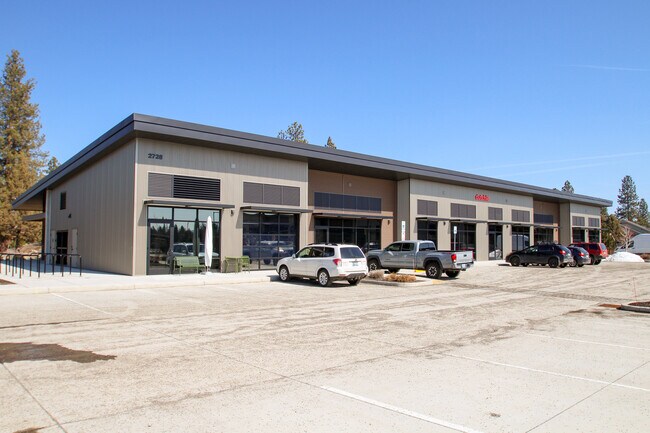
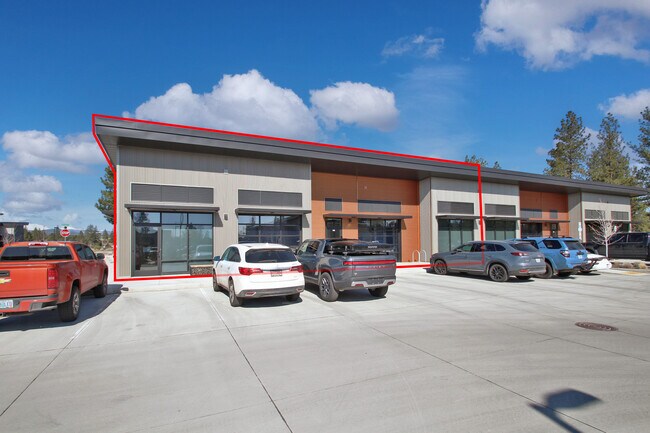
Property Record
2728 Nw Potts Ct, Bend, OR 97703

Property Detail
2728 Nw Potts Ct
276758
DISTRICT 2 EAST LOT 2
Commercialnec
Deschutes
ME
Oregon
B and X Area of moderate flood hazard, usually the area between the limits of the 100-year and 500-year floods.
2
2025
0.93 AC
2025
Deschutes County
001302
Portland
13,054 SF
Bend, OR
NEARBY LISTINGS FOR SALE OR LEASE
DEMOGRAPHICS near 2728 Nw Potts Ct
1 mile
3 mile
5 mile
2025 Total Population
6,961
43,924
101,635
2030 Population
7,203
45,486
104,060
Pop Growth 2025-2030
+ 3.48%
+ 3.56%
+ 2.39%
Average Age
43
42
41
2025 Total Households
2,888
18,254
41,672
HH Growth 2025-2030
+ 3.46%
+ 3.53%
+ 2.37%
Median Household Inc
$146,350
$116,252
$101,440
Avg Household Size
2.40
2.30
2.40
2025 Avg HH Vehicles
2.00
2.00
2.00
Median Home Value
$1,018,016
$897,156
$761,300
Median Year Built
2008
2002
2000
Nearby Places
Map Layers
Map Styles
 Street
 Aerial
Layers
 Traffic
 Biking
Places
Listings with unknown addresses are not visible on the map
- Restaurants
- Banks
- Shops
- Fitness
- Groceries
PUBLIC TRANSPORTATION
AIRPORT
Roberts Field
Drive
Walk
Distance
Roberts Field
32 min
20.2 mi
SALE & LEASE HISTORY
LISTING DATE
SALE/LEASE

Apr 05, 2023
For Lease
Nearby Properties
Address
Land Use
TOTAL SIZE
Lot Size
Zoning
Address
Land Use
TOTAL SIZE
Lot Size
Zoning
3.74 AC
MR
Address
Land Use
TOTAL SIZE
Lot Size
Zoning
25,574 SF
3.74 AC
MR
Address
Land Use
TOTAL SIZE
Lot Size
Zoning
27,863 SF
4.23 AC
MU
Address
Land Use
TOTAL SIZE
Lot Size
Zoning
318,598 SF
9.77 AC
RS
Address
Land Use
TOTAL SIZE
Lot Size
Zoning
166,371 SF
2.52 AC
MU
Address
Land Use
TOTAL SIZE
Lot Size
Zoning
199,892 SF
19.16 AC
CG
Address
Land Use
TOTAL SIZE
Lot Size
Zoning
1.04 AC
CB
Address
Land Use
TOTAL SIZE
Lot Size
Zoning
201,575 SF
1.04 AC
CB
Address
Land Use
TOTAL SIZE
Lot Size
Zoning
129,449 SF
2.91 AC
MR
Address
Land Use
TOTAL SIZE
Lot Size
Zoning
46,317 SF
5.67 AC
RM
Address
Land Use
TOTAL SIZE
Lot Size
Zoning
170,218 SF
13.27 AC
RS
Address
Land Use
TOTAL SIZE
Lot Size
Zoning
132,020 SF
12.11 AC
CG
Address
Land Use
TOTAL SIZE
Lot Size
Zoning
21.41 AC
MU
Address
Land Use
TOTAL SIZE
Lot Size
Zoning
88,619 SF
2.17 AC
ME
Address
Land Use
TOTAL SIZE
Lot Size
Zoning
2.17 AC
Address
Land Use
TOTAL SIZE
Lot Size
Zoning
105,069 SF
4.97 AC
RS
Address
Land Use
TOTAL SIZE
Lot Size
Zoning
164,959 SF
9.30 AC
CG
Address
Land Use
TOTAL SIZE
Lot Size
Zoning
164,959 SF
9.30 AC
CG
Address
Land Use
TOTAL SIZE
Lot Size
Zoning
7.73 AC
MR
Address
Land Use
TOTAL SIZE
Lot Size
Zoning
7.73 AC
MR
Address
Land Use
TOTAL SIZE
Lot Size
Zoning
125,966 SF
8.19 AC
RS
Address
Land Use
TOTAL SIZE
Lot Size
Zoning
89,486 SF
8.32 AC
MR
Address
Land Use
TOTAL SIZE
Lot Size
Zoning
6,321 SF
8.32 AC
MR
Address
Land Use
TOTAL SIZE
Lot Size
Zoning
7,322 SF
8.32 AC
MR
Address
Land Use
TOTAL SIZE
Lot Size
Zoning
86,455 SF
7.55 AC
MU
Address
Land Use
TOTAL SIZE
Lot Size
Zoning
67,972 SF
5.10 AC
MR
Address
Land Use
TOTAL SIZE
Lot Size
Zoning
146.29 AC
Address
Land Use
TOTAL SIZE
Lot Size
Zoning
146.29 AC
PF
Address
Land Use
TOTAL SIZE
Lot Size
Zoning
146.29 AC
PF
Address
Land Use
TOTAL SIZE
Lot Size
Zoning
61,568 SF
1.13 AC
MU
The World's #1 Commercial Real Estate Marketplace
Connect with us
© 2026 CoStar Group
The information above has been obtained from sources believed reliable. While we do not doubt its accuracy we have not verified it and make no guarantee, warranty or representation about it. It is your responsibility to independently confirm its accuracy and completeness. Any projections, opinions, assumptions, or estimates used are for example only and do not represent the current or future performance of the property. The value of this transaction to you depends on tax and other factors which should be evaluated by your tax, financial, and legal advisors. You and your advisors should conduct a careful, independent investigation of the property to determine to your satisfaction the suitability of the property for your needs.