Property Record
27298 Telegraph Rd, Flat Rock, MI 48134
NEARBY LISTINGS FOR SALE OR LEASE
Property Detail
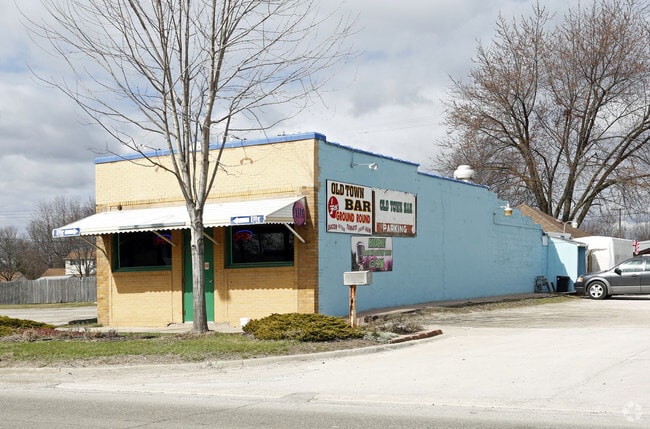
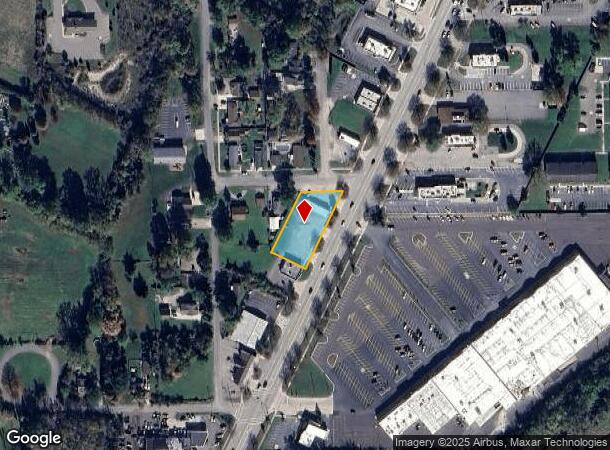
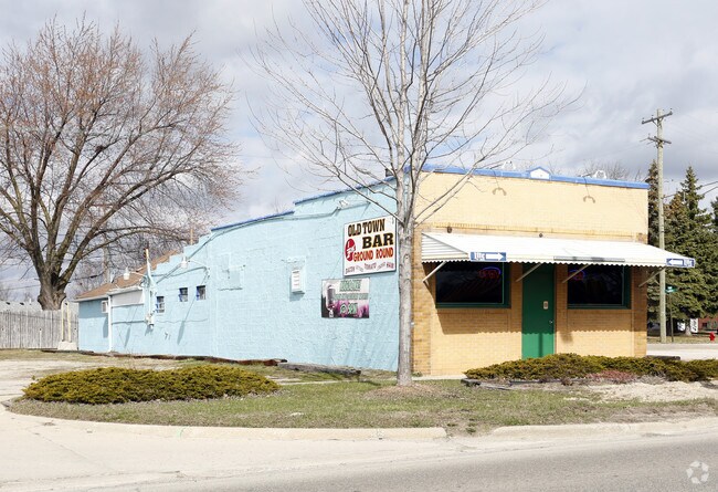
27298 Telegraph Rd
Detroit-Warren-Dearborn, MI
Flat Rock
58-091-02-0013-301
31A 13 TO 23 T4S LOTS 13 TO 23 INCL ALSO SE 1/2 ADJ VAC ALLEY SWASEYS FLAT ROCK SUB T4S R10E L56 P13 WCR
Bartavern
Wayne
AE
Michigan
26115C0110E
13-23
2024
0.56 AC
2025
Downriver South
599001
Detroit
2,134 SF
DEMOGRAPHICS near 27298 Telegraph Rd
1 Mile
3 Mile
5 Mile
2024 Total Population
5,875
37,902
76,163
2029 Population
5,651
36,514
73,456
Pop Growth 2024-2029
(3.81%)
(3.66%)
(3.55%)
Average Age
40
41
42
2024 Total Households
2,296
14,819
30,378
HH Growth 2024-2029
(3.83%)
(3.63%)
(3.55%)
Median Household Inc
$72,903
$80,107
$78,533
Avg Household Size
2.50
2.50
2.50
2024 Avg HH Vehicles
2.00
2.00
2.00
Median Home Value
$209,302
$234,240
$221,996
Median Year Built
1985
1989
1981
Nearby Places
Map Layers
Map Styles
 Street
 Aerial
- Restaurants
- Banks
- Shops
- Fitness
- Groceries
PUBLIC TRANSPORTATION
AIRPORT
Detroit Metro Wayne County
DRIVE
WALK
Distance
Detroit Metro Wayne County
20 min
12.3 mi
Windsor International
DRIVE
WALK
Distance
Windsor International
48 min
30.4 mi
Freight Ports
Port of Toledo
DRIVE
WALK
Distance
Port of Toledo
52 min
39.4 mi
SALE & LEASE HISTORY
LISTING DATE
SALE/LEASE

Apr 13, 2022
For Sale
Nearby Properties
Address
Land Use
TOTAL SIZE
Lot Size
Zoning
Address
Land Use
TOTAL SIZE
Lot Size
Zoning
3,189,689 SF
228.88 AC
Address
Land Use
TOTAL SIZE
Lot Size
Zoning
215,724 SF
Address
Land Use
TOTAL SIZE
Lot Size
Zoning
235,489 SF
23.47 AC
Address
Land Use
TOTAL SIZE
Lot Size
Zoning
177,054 SF
11.88 AC
PUD
Address
Land Use
TOTAL SIZE
Lot Size
Zoning
1,021,918 SF
163.58 AC
Address
Land Use
TOTAL SIZE
Lot Size
Zoning
3,280 SF
99.72 AC
Address
Land Use
TOTAL SIZE
Lot Size
Zoning
4,860 SF
69.40 AC
MHP MOB
Address
Land Use
TOTAL SIZE
Lot Size
Zoning
203,114 SF
14.50 AC
R-M MUL
Address
Land Use
TOTAL SIZE
Lot Size
Zoning
33,600 SF
100.03 AC
Address
Land Use
TOTAL SIZE
Lot Size
Zoning
307,181 SF
22.32 AC
Address
Land Use
TOTAL SIZE
Lot Size
Zoning
61,784 SF
6.78 AC
Address
Land Use
TOTAL SIZE
Lot Size
Zoning
141,861 SF
13 AC
RM-1
Address
Land Use
TOTAL SIZE
Lot Size
Zoning
167,004 SF
19.04 AC
RM-1
Address
Land Use
TOTAL SIZE
Lot Size
Zoning
179,235 SF
25.38 AC
Address
Land Use
TOTAL SIZE
Lot Size
Zoning
59,427 SF
5.50 AC
Address
Land Use
TOTAL SIZE
Lot Size
Zoning
68,409 SF
64.56 AC
Address
Land Use
TOTAL SIZE
Lot Size
Zoning
95,650 SF
73.78 AC
Address
Land Use
TOTAL SIZE
Lot Size
Zoning
52.37 AC
Address
Land Use
TOTAL SIZE
Lot Size
Zoning
3,520 SF
62.97 AC
MHP MOB
Address
Land Use
TOTAL SIZE
Lot Size
Zoning
3,870 SF
38.38 AC
Address
Land Use
TOTAL SIZE
Lot Size
Zoning
146,300 SF
25.84 AC
Address
Land Use
TOTAL SIZE
Lot Size
Zoning
101,861 SF
15.33 AC
B-2
Address
Land Use
TOTAL SIZE
Lot Size
Zoning
69,112 SF
10.34 AC
B-2
Address
Land Use
TOTAL SIZE
Lot Size
Zoning
69,938 SF
1.74 AC
Address
Land Use
TOTAL SIZE
Lot Size
Zoning
114,165 SF
13.07 AC
Address
Land Use
TOTAL SIZE
Lot Size
Zoning
124,102 SF
17.09 AC
Address
Land Use
TOTAL SIZE
Lot Size
Zoning
44.13 AC
MHP MOB
Address
Land Use
TOTAL SIZE
Lot Size
Zoning
30,719 SF
9.93 AC
AG AGRI
Address
Land Use
TOTAL SIZE
Lot Size
Zoning
18,520 SF
326.27 AC
Address
Land Use
TOTAL SIZE
Lot Size
Zoning
130,627 SF
20.42 AC
The World's #1 Commercial Real Estate Marketplace
Connect with us
© 2025 CoStar Group
The information above has been obtained from sources believed reliable. While we do not doubt its accuracy we have not verified it and make no guarantee, warranty or representation about it. It is your responsibility to independently confirm its accuracy and completeness. Any projections, opinions, assumptions, or estimates used are for example only and do not represent the current or future performance of the property. The value of this transaction to you depends on tax and other factors which should be evaluated by your tax, financial, and legal advisors. You and your advisors should conduct a careful, independent investigation of the property to determine to your satisfaction the suitability of the property for your needs.