Property Record
273 Forest Rd, Bessemer, AL 35023
NEARBY LISTINGS FOR SALE OR LEASE
Property Detail
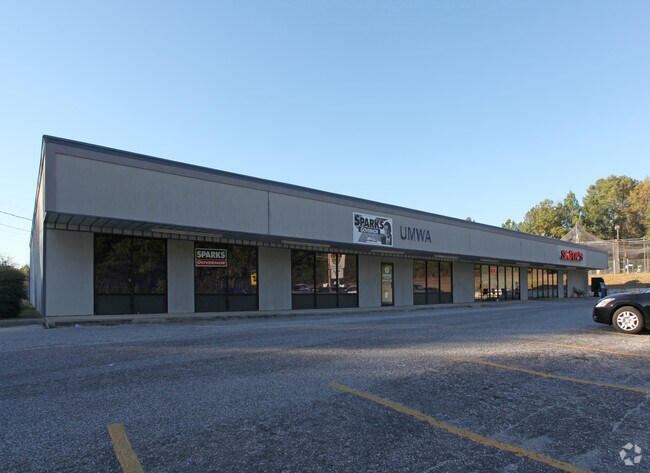
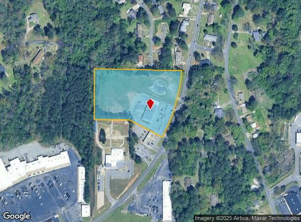
273 Forest Rd
Birmingham-Hoover, AL
Hueytown Bible Church
30-00-20-3-003-081.003
PT OF LOT 1 HUEYTOWN BIBLE CHURCH 16/26 DESC AS FOLS BEG AT NW COR OF SE4 OF SW4 OF SEC 20 TP 18S R 4W TH E 528.6 FT TH S 251.7 FT TO A PT ON WLY R/W OF FOREST RD TH SWLY ALG SD R/W 194 FT TH SW 244.3 FT TH S 5 FT TH W 235 FT TH N 334.2 FT TO POB AND
Commercialnec
Jefferson
X
Alabama
01073C0528G
1
2023
4.20 AC
2024
Bessemer
014001
Birmingham
9,060 SF
DEMOGRAPHICS near 273 Forest Rd
1 Mile
3 Mile
5 Mile
2024 Total Population
4,777
30,025
72,149
2029 Population
4,649
29,520
71,403
Pop Growth 2024-2029
(2.68%)
(1.68%)
(1.03%)
Average Age
42
41
40
2024 Total Households
1,839
11,718
28,418
HH Growth 2024-2029
(2.99%)
(1.77%)
(1.14%)
Median Household Inc
$54,012
$55,759
$45,959
Avg Household Size
2.40
2.50
2.40
2024 Avg HH Vehicles
2.00
2.00
2.00
Median Home Value
$137,047
$141,222
$127,029
Median Year Built
1967
1969
1966
Nearby Places
Map Layers
Map Styles
 Street
 Aerial
- Restaurants
- Banks
- Shops
- Fitness
- Groceries
PUBLIC TRANSPORTATION
AIRPORT
Birmingham-Shuttlesworth International
DRIVE
WALK
Distance
Birmingham-Shuttlesworth International
24 min
17.5 mi
Freight Ports
Port of Mobile
DRIVE
WALK
Distance
Port of Mobile
287 min
243.9 mi
SALE & LEASE HISTORY
LISTING DATE
SALE/LEASE

Feb 18, 2025
For Lease
Nearby Properties
Address
Land Use
TOTAL SIZE
Lot Size
Zoning
Address
Land Use
TOTAL SIZE
Lot Size
Zoning
1,244,986 SF
I2
Address
Land Use
TOTAL SIZE
Lot Size
Zoning
2,573,547 SF
112 AC
I2
Address
Land Use
TOTAL SIZE
Lot Size
Zoning
460,483 SF
20 AC
I3
Address
Land Use
TOTAL SIZE
Lot Size
Zoning
116,442 SF
2.67 AC
B6
Address
Land Use
TOTAL SIZE
Lot Size
Zoning
195,495 SF
28.97 AC
B3
Address
Land Use
TOTAL SIZE
Lot Size
Zoning
553,137 SF
87 AC
I2
Address
Land Use
TOTAL SIZE
Lot Size
Zoning
219,210 SF
19.40 AC
M2
Address
Land Use
TOTAL SIZE
Lot Size
Zoning
230,088 SF
I3
Address
Land Use
TOTAL SIZE
Lot Size
Zoning
66,928 SF
5.70 AC
B2-R
Address
Land Use
TOTAL SIZE
Lot Size
Zoning
77,902 SF
44 AC
I3
Address
Land Use
TOTAL SIZE
Lot Size
Zoning
58,822 SF
7.80 AC
B3
Address
Land Use
TOTAL SIZE
Lot Size
Zoning
1,200 SF
13.40 AC
R3
Address
Land Use
TOTAL SIZE
Lot Size
Zoning
69,344 SF
2.30 AC
B-1
Address
Land Use
TOTAL SIZE
Lot Size
Zoning
26,234 SF
3.30 AC
B2
Address
Land Use
TOTAL SIZE
Lot Size
Zoning
66,935 SF
1.99 AC
B2
Address
Land Use
TOTAL SIZE
Lot Size
Zoning
366,421 SF
21 AC
I3
Address
Land Use
TOTAL SIZE
Lot Size
Zoning
1,437,077 SF
I2
Address
Land Use
TOTAL SIZE
Lot Size
Zoning
80,043 SF
10.89 AC
B3-C
Address
Land Use
TOTAL SIZE
Lot Size
Zoning
163,056 SF
I-3
Address
Land Use
TOTAL SIZE
Lot Size
Zoning
49,022 SF
5.50 AC
R2
Address
Land Use
TOTAL SIZE
Lot Size
Zoning
80,220 SF
6.68 AC
M2
Address
Land Use
TOTAL SIZE
Lot Size
Zoning
52,810 SF
3.44 AC
B-3
Address
Land Use
TOTAL SIZE
Lot Size
Zoning
65,232 SF
3.60 AC
R-5
Address
Land Use
TOTAL SIZE
Lot Size
Zoning
59,554 SF
1.37 AC
R2
Address
Land Use
TOTAL SIZE
Lot Size
Zoning
32,606 SF
2.18 AC
B2-R
Address
Land Use
TOTAL SIZE
Lot Size
Zoning
130,563 SF
I3
Address
Land Use
TOTAL SIZE
Lot Size
Zoning
18,600 SF
2.80 AC
C4
Address
Land Use
TOTAL SIZE
Lot Size
Zoning
62,918 SF
3.59 AC
R2-R
Address
Land Use
TOTAL SIZE
Lot Size
Zoning
109,004 SF
I3
Address
Land Use
TOTAL SIZE
Lot Size
Zoning
47,232 SF
1.09 AC
B2-R
The World's #1 Commercial Real Estate Marketplace
Connect with us
© 2025 CoStar Group
The information above has been obtained from sources believed reliable. While we do not doubt its accuracy we have not verified it and make no guarantee, warranty or representation about it. It is your responsibility to independently confirm its accuracy and completeness. Any projections, opinions, assumptions, or estimates used are for example only and do not represent the current or future performance of the property. The value of this transaction to you depends on tax and other factors which should be evaluated by your tax, financial, and legal advisors. You and your advisors should conduct a careful, independent investigation of the property to determine to your satisfaction the suitability of the property for your needs.