Property Record
273 Lowell Rd, Hudson, NH 03051


This Property Is For Sale
NEARBY LISTINGS FOR SALE OR LEASE
Property Detail
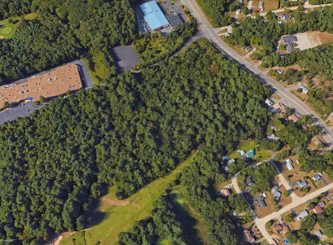
273 Lowell Rd
Commercialacreage
Hillsborough
X
New Hampshire
33011C0656D
10.50 AC
2024
Hillsborough
2024
Boston
012302
Manchester-Nashua, NH
2,484 SF
HDSO-000234-000034
DEMOGRAPHICS near 273 Lowell Rd
1 Mile
3 Mile
5 Mile
2024 Total Population
1,527
39,443
119,883
2029 Population
1,563
40,143
121,771
Pop Growth 2024-2029
+ 2.36%
+ 1.77%
+ 1.57%
Average Age
44
41
41
2024 Total Households
558
16,196
47,641
HH Growth 2024-2029
+ 2.33%
+ 1.79%
+ 1.59%
Median Household Inc
$110,681
$95,080
$93,917
Avg Household Size
2.60
2.40
2.40
2024 Avg HH Vehicles
2.00
2.00
2.00
Median Home Value
$415,530
$385,136
$380,365
Median Year Built
1979
1977
1976
Nearby Places
Map Layers
Map Styles
 Street
 Aerial
- Restaurants
- Banks
- Shops
- Fitness
- Groceries
PUBLIC TRANSPORTATION
COMMUTER RAIL
Lowell (Lowell Line - Massachusetts Bay Transportation Authority Commuter Rail (Purple Line))
DRIVE
WALK
Distance
Lowell (Lowell Line - Massachusetts Bay Transportation Authority Commuter Rail (Purple Line))
18 min
8.6 mi
AIRPORT
Manchester Boston Regional
DRIVE
WALK
Distance
Manchester Boston Regional
32 min
20.6 mi
Freight Ports
Port of Boston
DRIVE
WALK
Distance
Port of Boston
63 min
38.6 mi
Nearby Properties
Address
Land Use
TOTAL SIZE
Lot Size
Zoning
Address
Land Use
TOTAL SIZE
Lot Size
Zoning
38.17 AC
RC
Address
Land Use
TOTAL SIZE
Lot Size
Zoning
29.77 AC
RC
Address
Land Use
TOTAL SIZE
Lot Size
Zoning
80.11 AC
PI
Address
Land Use
TOTAL SIZE
Lot Size
Zoning
27.98 AC
GI
Address
Land Use
TOTAL SIZE
Lot Size
Zoning
20.72 AC
RC
Address
Land Use
TOTAL SIZE
Lot Size
Zoning
15.19 AC
RC
Address
Land Use
TOTAL SIZE
Lot Size
Zoning
522,476 SF
74.89 AC
GD
Address
Land Use
TOTAL SIZE
Lot Size
Zoning
118.50 AC
PI
Address
Land Use
TOTAL SIZE
Lot Size
Zoning
20.80 AC
RC
Address
Land Use
TOTAL SIZE
Lot Size
Zoning
303,508 SF
171.19 AC
G1
Address
Land Use
TOTAL SIZE
Lot Size
Zoning
133,390 SF
97.42 AC
R2
Address
Land Use
TOTAL SIZE
Lot Size
Zoning
206,913 SF
18.30 AC
GB
Address
Land Use
TOTAL SIZE
Lot Size
Zoning
15.16 AC
GI
Address
Land Use
TOTAL SIZE
Lot Size
Zoning
52.45 AC
R18
Address
Land Use
TOTAL SIZE
Lot Size
Zoning
21.40 AC
RC
Address
Land Use
TOTAL SIZE
Lot Size
Zoning
37.57 AC
R9
Address
Land Use
TOTAL SIZE
Lot Size
Zoning
21.16 AC
D3MU
Address
Land Use
TOTAL SIZE
Lot Size
Zoning
312,738 SF
25.84 AC
ID
Address
Land Use
TOTAL SIZE
Lot Size
Zoning
127,494 SF
9.09 AC
GB
Address
Land Use
TOTAL SIZE
Lot Size
Zoning
12.55 AC
RC
Address
Land Use
TOTAL SIZE
Lot Size
Zoning
21.17 AC
RC
Address
Land Use
TOTAL SIZE
Lot Size
Zoning
185,242 SF
35.75 AC
ID
Address
Land Use
TOTAL SIZE
Lot Size
Zoning
8.09 AC
RC
Address
Land Use
TOTAL SIZE
Lot Size
Zoning
154,620 SF
8.63 AC
GB
Address
Land Use
TOTAL SIZE
Lot Size
Zoning
146,536 SF
7.45 AC
GB
Address
Land Use
TOTAL SIZE
Lot Size
Zoning
116,602 SF
11.74 AC
GB
Address
Land Use
TOTAL SIZE
Lot Size
Zoning
12.57 AC
RC
Address
Land Use
TOTAL SIZE
Lot Size
Zoning
144,018 SF
13.89 AC
PI
Address
Land Use
TOTAL SIZE
Lot Size
Zoning
160,329 SF
16.13 AC
RB
The World's #1 Commercial Real Estate Marketplace
Connect with us
© 2025 CoStar Group
The information above has been obtained from sources believed reliable. While we do not doubt its accuracy we have not verified it and make no guarantee, warranty or representation about it. It is your responsibility to independently confirm its accuracy and completeness. Any projections, opinions, assumptions, or estimates used are for example only and do not represent the current or future performance of the property. The value of this transaction to you depends on tax and other factors which should be evaluated by your tax, financial, and legal advisors. You and your advisors should conduct a careful, independent investigation of the property to determine to your satisfaction the suitability of the property for your needs.