Property Record
2730 E Leroy St, Pearland, TX 77581
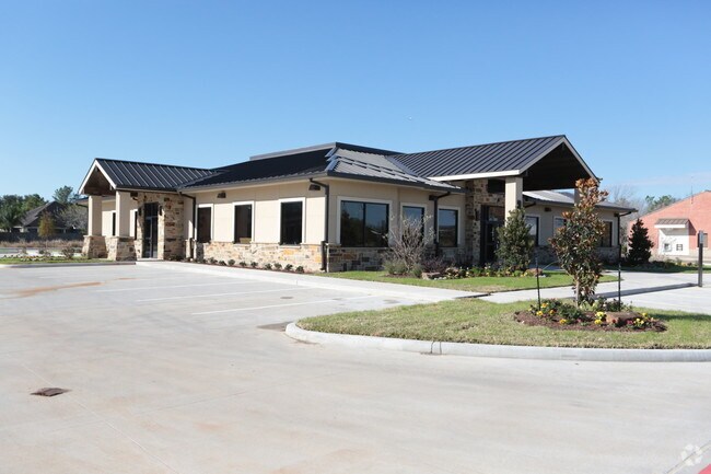

Property Detail
2730 E Leroy St
Houston-Pasadena-The Woodlands, TX
ACHOUR SD (A0111 PERRY & AUSTIN)(PEARLAND) BLK 1 LOT 3A (REPLAT NO 2) ACRES 1.354
1107-0001-003
Brazoria
Commercialnec
Texas
AE The base floodplain where base flood elevations are provided. AE Zones are now used on new format FIRMs instead of A1-A30 Zones.
3a
2024
1.35 AC
2025
Southeast Outlier
660100
Houston
1,574 SF
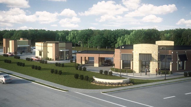
NEARBY LISTINGS FOR SALE OR LEASE
DEMOGRAPHICS near 2730 E Leroy St
1 mile
3 mile
5 mile
2025 Total Population
10,902
68,221
196,113
2030 Population
11,561
72,216
208,264
Pop Growth 2025-2030
+ 6.04%
+ 5.86%
+ 6.20%
Average Age
40
40
38
2025 Total Households
3,898
23,446
67,814
HH Growth 2025-2030
+ 6.13%
+ 6.00%
+ 6.41%
Median Household Inc
$116,439
$117,543
$98,539
Avg Household Size
2.70
2.90
2.80
2025 Avg HH Vehicles
2.00
2.00
2.00
Median Home Value
$329,046
$336,060
$302,895
Median Year Built
1991
1993
1991
Nearby Places
Map Layers
Map Styles
 Street
 Aerial
Layers
 Traffic
 Biking
Places
Listings with unknown addresses are not visible on the map
- Restaurants
- Banks
- Shops
- Fitness
- Groceries
PUBLIC TRANSPORTATION
AIRPORT
William P Hobby
Drive
Walk
Distance
William P Hobby
21 min
10.3 mi
Freight Ports
Port of Houston
Drive
Walk
Distance
Port of Houston
31 min
19.2 mi
SALE & LEASE HISTORY
LISTING DATE
SALE/LEASE

Sep 25, 2016
For Lease
Sep 23, 2016
For Sale
Nearby Properties
Address
Land Use
TOTAL SIZE
Lot Size
Zoning
Address
Land Use
TOTAL SIZE
Lot Size
Zoning
83.37 AC
0004
Address
Land Use
TOTAL SIZE
Lot Size
Zoning
338,667 SF
9.13 AC
Address
Land Use
TOTAL SIZE
Lot Size
Zoning
236,642 SF
11.48 AC
Address
Land Use
TOTAL SIZE
Lot Size
Zoning
128,754 SF
14.83 AC
Address
Land Use
TOTAL SIZE
Lot Size
Zoning
97,736 SF
16.49 AC
Address
Land Use
TOTAL SIZE
Lot Size
Zoning
102,056 SF
5.59 AC
Address
Land Use
TOTAL SIZE
Lot Size
Zoning
142,155 SF
19.16 AC
SP
Address
Land Use
TOTAL SIZE
Lot Size
Zoning
125,028 SF
5.59 AC
Address
Land Use
TOTAL SIZE
Lot Size
Zoning
144,879 SF
8.91 AC
Address
Land Use
TOTAL SIZE
Lot Size
Zoning
161,803 SF
54.82 AC
Address
Land Use
TOTAL SIZE
Lot Size
Zoning
175,087 SF
6.77 AC
Address
Land Use
TOTAL SIZE
Lot Size
Zoning
110,990 SF
18.25 AC
Address
Land Use
TOTAL SIZE
Lot Size
Zoning
113,376 SF
9.80 AC
Address
Land Use
TOTAL SIZE
Lot Size
Zoning
111,642 SF
9.53 AC
Address
Land Use
TOTAL SIZE
Lot Size
Zoning
115,805 SF
10.12 AC
SP
Address
Land Use
TOTAL SIZE
Lot Size
Zoning
99,042 SF
13 AC
MFRM
Address
Land Use
TOTAL SIZE
Lot Size
Zoning
229,097 SF
22.66 AC
Address
Land Use
TOTAL SIZE
Lot Size
Zoning
67,595 SF
4.97 AC
Address
Land Use
TOTAL SIZE
Lot Size
Zoning
138,839 SF
7.46 AC
MFRH
Address
Land Use
TOTAL SIZE
Lot Size
Zoning
68,894 SF
6.11 AC
Address
Land Use
TOTAL SIZE
Lot Size
Zoning
83,995 SF
21.74 AC
CSC
Address
Land Use
TOTAL SIZE
Lot Size
Zoning
54,802 SF
12.63 AC
0014
Address
Land Use
TOTAL SIZE
Lot Size
Zoning
80,715 SF
8.73 AC
Address
Land Use
TOTAL SIZE
Lot Size
Zoning
63,615 SF
6.42 AC
0010
Address
Land Use
TOTAL SIZE
Lot Size
Zoning
6,948 SF
54.94 AC
2080
Address
Land Use
TOTAL SIZE
Lot Size
Zoning
86,550 SF
8.45 AC
Address
Land Use
TOTAL SIZE
Lot Size
Zoning
151,863 SF
15.04 AC
Address
Land Use
TOTAL SIZE
Lot Size
Zoning
63,377 SF
2.71 AC
OBD
Address
Land Use
TOTAL SIZE
Lot Size
Zoning
61,510 SF
4.87 AC
Address
Land Use
TOTAL SIZE
Lot Size
Zoning
76,646 SF
11.39 AC
SP
The World's #1 Commercial Real Estate Marketplace
Connect with us
© 2026 CoStar Group
The information above has been obtained from sources believed reliable. While we do not doubt its accuracy we have not verified it and make no guarantee, warranty or representation about it. It is your responsibility to independently confirm its accuracy and completeness. Any projections, opinions, assumptions, or estimates used are for example only and do not represent the current or future performance of the property. The value of this transaction to you depends on tax and other factors which should be evaluated by your tax, financial, and legal advisors. You and your advisors should conduct a careful, independent investigation of the property to determine to your satisfaction the suitability of the property for your needs.