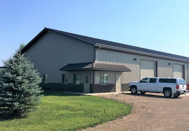
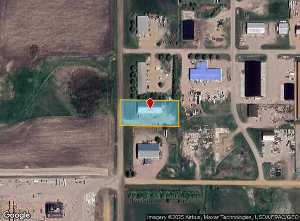
Property Record
27316 471St Ave, Harrisburg, SD 57032
NEARBY LISTINGS FOR SALE OR LEASE
Property Detail
27316 471St Ave
Sioux Falls, SD
La Valley Business Park
099.50.05.E302
LAVALLEY BUSINESS PK LOT 2 - BLK 3 - 5-99-50
Commercialnec
Lincoln
X
South Dakota
46099C0625D
2
2024
1.16 AC
2024
Sioux Falls
010107
Other Market Areas
DEMOGRAPHICS near 27316 471St Ave
1 Mile
3 Mile
5 Mile
2024 Total Population
161
6,631
45,020
2029 Population
195
8,123
54,781
Pop Growth 2024-2029
+ 21.12%
+ 22.50%
+ 21.68%
Average Age
41
35
35
2024 Total Households
53
2,319
16,570
HH Growth 2024-2029
+ 20.75%
+ 22.73%
+ 21.94%
Median Household Inc
$135,000
$87,910
$89,888
Avg Household Size
3.00
2.80
2.70
2024 Avg HH Vehicles
3.00
3.00
2.00
Median Home Value
$463,636
$288,065
$280,601
Median Year Built
1993
2006
2006
Nearby Places
Map Layers
Map Styles
 Street
 Aerial
- Restaurants
- Banks
- Shops
- Fitness
- Groceries
PUBLIC TRANSPORTATION
AIRPORT
Joe Foss Field
DRIVE
WALK
Distance
Joe Foss Field
32 min
14.7 mi
Freight Ports
Port Milwaukee
DRIVE
WALK
Distance
Port Milwaukee
559 min
514.1 mi
SALE & LEASE HISTORY
LISTING DATE
SALE/LEASE

Jul 08, 2020
For Lease
Nearby Properties
Address
Land Use
TOTAL SIZE
Lot Size
Zoning
Address
Land Use
TOTAL SIZE
Lot Size
Zoning
11.80 AC
I-1 LIGHT
Address
Land Use
TOTAL SIZE
Lot Size
Zoning
8.28 AC
MUNICIPALI
Address
Land Use
TOTAL SIZE
Lot Size
Zoning
11.26 AC
MUNICIPALI
Address
Land Use
TOTAL SIZE
Lot Size
Zoning
3.56 AC
MUNICIPALI
Address
Land Use
TOTAL SIZE
Lot Size
Zoning
4.62 AC
MUNICIPALI
Address
Land Use
TOTAL SIZE
Lot Size
Zoning
7 AC
I-1 LIGHT
Address
Land Use
TOTAL SIZE
Lot Size
Zoning
5.14 AC
MUNICIPALI
Address
Land Use
TOTAL SIZE
Lot Size
Zoning
4.04 AC
C COMMERCI
Address
Land Use
TOTAL SIZE
Lot Size
Zoning
2.47 AC
MUNICIPALI
Address
Land Use
TOTAL SIZE
Lot Size
Zoning
1.56 AC
MUNICIPALI
Address
Land Use
TOTAL SIZE
Lot Size
Zoning
5.43 AC
MUNICIPALI
Address
Land Use
TOTAL SIZE
Lot Size
Zoning
2.11 AC
MUNICIPALI
Address
Land Use
TOTAL SIZE
Lot Size
Zoning
3.02 AC
MUNICIPALI
Address
Land Use
TOTAL SIZE
Lot Size
Zoning
9.50 AC
MUNICIPALI
Address
Land Use
TOTAL SIZE
Lot Size
Zoning
7.60 AC
MUNICIPALI
Address
Land Use
TOTAL SIZE
Lot Size
Zoning
3.60 AC
I-1 LIGHT
Address
Land Use
TOTAL SIZE
Lot Size
Zoning
4.72 AC
MUNICIPALI
Address
Land Use
TOTAL SIZE
Lot Size
Zoning
3.18 AC
MUNICIPALI
Address
Land Use
TOTAL SIZE
Lot Size
Zoning
4.68 AC
C COMMERCI
Address
Land Use
TOTAL SIZE
Lot Size
Zoning
2.09 AC
MUNICIPALI
Address
Land Use
TOTAL SIZE
Lot Size
Zoning
2.08 AC
I-1 LIGHT
Address
Land Use
TOTAL SIZE
Lot Size
Zoning
3.04 AC
I-1 LIGHT
Address
Land Use
TOTAL SIZE
Lot Size
Zoning
19.99 AC
I-1 LIGHT
Address
Land Use
TOTAL SIZE
Lot Size
Zoning
14.59 AC
MUNICIPALI
Address
Land Use
TOTAL SIZE
Lot Size
Zoning
4.08 AC
MUNICIPALI
Address
Land Use
TOTAL SIZE
Lot Size
Zoning
1.19 AC
MUNICIPALI
Address
Land Use
TOTAL SIZE
Lot Size
Zoning
100.05 AC
A-1 AGRICU
Address
Land Use
TOTAL SIZE
Lot Size
Zoning
1.94 AC
C COMMERCI
Address
Land Use
TOTAL SIZE
Lot Size
Zoning
2.42 AC
MUNICIPALI
Address
Land Use
TOTAL SIZE
Lot Size
Zoning
2.02 AC
C COMMERCI
The World's #1 Commercial Real Estate Marketplace
Connect with us
© 2025 CoStar Group
The information above has been obtained from sources believed reliable. While we do not doubt its accuracy we have not verified it and make no guarantee, warranty or representation about it. It is your responsibility to independently confirm its accuracy and completeness. Any projections, opinions, assumptions, or estimates used are for example only and do not represent the current or future performance of the property. The value of this transaction to you depends on tax and other factors which should be evaluated by your tax, financial, and legal advisors. You and your advisors should conduct a careful, independent investigation of the property to determine to your satisfaction the suitability of the property for your needs.