Property Record
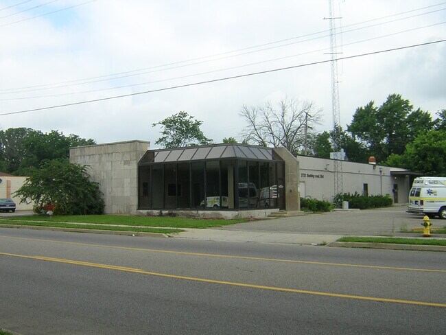
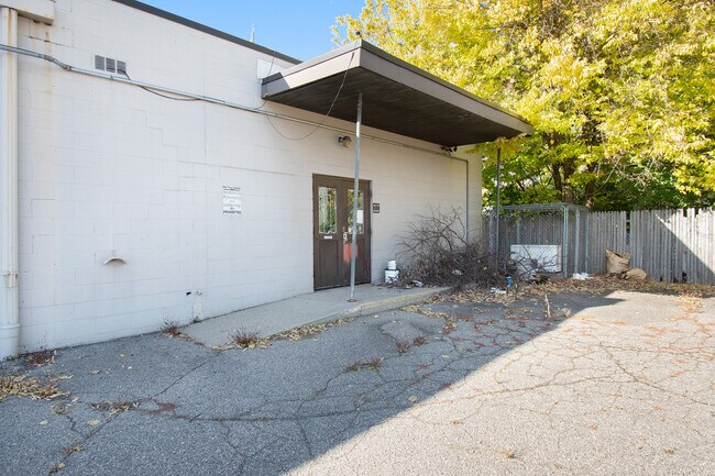
2732 Flushing Rd, Flint, MI 48504

Property Detail
2732 Flushing Rd
40-11-301-028
HOMESITE SUBDIVISION LOTS 159 AND 160
Commercialnec
Genesee
CC
Michigan
B and X Area of moderate flood hazard, usually the area between the limits of the 100-year and 500-year floods.
159-160
2024
0.31 AC
2025
Flint
001300
Detroit
6,316 SF
Flint, MI
NEARBY LISTINGS FOR SALE OR LEASE
DEMOGRAPHICS near 2732 Flushing Rd
1 mile
3 mile
5 mile
2025 Total Population
13,067
67,479
147,559
2030 Population
13,283
68,654
149,369
Pop Growth 2025-2030
+ 1.65%
+ 1.74%
+ 1.23%
Average Age
38
40
40
2025 Total Households
5,277
28,354
61,343
HH Growth 2025-2030
+ 1.59%
+ 1.75%
+ 1.20%
Median Household Inc
$46,534
$40,510
$41,262
Avg Household Size
2.30
2.20
2.30
2025 Avg HH Vehicles
1.00
1.00
1.00
Median Home Value
$64,593
$72,320
$82,775
Median Year Built
1953
1957
1959
Nearby Places
Map Layers
Map Styles
 Street
 Aerial
Transit
 Traffic
 Biking
Places
Listings with unknown addresses are not visible on the map
- Restaurants
- Banks
- Shops
- Fitness
- Groceries
PUBLIC TRANSPORTATION
COMMUTER RAIL
Flint Amtrak Station (Blue Water - Amtrak)
Drive
Walk
Distance
Flint Amtrak Station (Blue Water - Amtrak)
11 min
5.1 mi
AIRPORT
Bishop International
Drive
Walk
Distance
Bishop International
23 min
7.9 mi
Freight Ports
Port of Toledo
Drive
Walk
Distance
Port of Toledo
137 min
114.9 mi
SALE & LEASE HISTORY
LISTING DATE
SALE/LEASE

Oct 06, 2020
For Sale
Nearby Properties
Address
Land Use
TOTAL SIZE
Lot Size
Zoning
Address
Land Use
TOTAL SIZE
Lot Size
Zoning
381,509 SF
371.45 AC
PC
Address
Land Use
TOTAL SIZE
Lot Size
Zoning
911,140 SF
Address
Land Use
TOTAL SIZE
Lot Size
Zoning
101,590 SF
5.54 AC
Address
Land Use
TOTAL SIZE
Lot Size
Zoning
54,651 SF
3.06 AC
Address
Land Use
TOTAL SIZE
Lot Size
Zoning
130,291 SF
Address
Land Use
TOTAL SIZE
Lot Size
Zoning
571,389 SF
584 AC
Address
Land Use
TOTAL SIZE
Lot Size
Zoning
112,232 SF
196 AC
Address
Land Use
TOTAL SIZE
Lot Size
Zoning
144,896 SF
0.23 AC
DC
Address
Land Use
TOTAL SIZE
Lot Size
Zoning
115,556 SF
2.50 AC
DE
Address
Land Use
TOTAL SIZE
Lot Size
Zoning
59,232 SF
3.65 AC
Address
Land Use
TOTAL SIZE
Lot Size
Zoning
329,849 SF
21.20 AC
CE
Address
Land Use
TOTAL SIZE
Lot Size
Zoning
247,555 SF
198 AC
Address
Land Use
TOTAL SIZE
Lot Size
Zoning
68,571 SF
0.81 AC
DC
Address
Land Use
TOTAL SIZE
Lot Size
Zoning
48,557 SF
2.99 AC
Address
Land Use
TOTAL SIZE
Lot Size
Zoning
156,250 SF
Address
Land Use
TOTAL SIZE
Lot Size
Zoning
76,823 SF
114 AC
Address
Land Use
TOTAL SIZE
Lot Size
Zoning
23,500 SF
4.96 AC
Address
Land Use
TOTAL SIZE
Lot Size
Zoning
207,043 SF
24.20 AC
Address
Land Use
TOTAL SIZE
Lot Size
Zoning
290,502 SF
272.83 AC
Address
Land Use
TOTAL SIZE
Lot Size
Zoning
10,212 SF
2.60 AC
UC
Address
Land Use
TOTAL SIZE
Lot Size
Zoning
157,068 SF
160 AC
Address
Land Use
TOTAL SIZE
Lot Size
Zoning
6,051 SF
3.82 AC
Address
Land Use
TOTAL SIZE
Lot Size
Zoning
85,697 SF
0.30 AC
DC
Address
Land Use
TOTAL SIZE
Lot Size
Zoning
209,058 SF
9.02 AC
Address
Land Use
TOTAL SIZE
Lot Size
Zoning
95,300 SF
9.26 AC
Address
Land Use
TOTAL SIZE
Lot Size
Zoning
131,641 SF
136 AC
Address
Land Use
TOTAL SIZE
Lot Size
Zoning
403,803 SF
252 AC
Address
Land Use
TOTAL SIZE
Lot Size
Zoning
46,308 SF
4.24 AC
Address
Land Use
TOTAL SIZE
Lot Size
Zoning
79,828 SF
6.48 AC
Address
Land Use
TOTAL SIZE
Lot Size
Zoning
123,170 SF
3.41 AC
DE
The World's #1 Commercial Real Estate Marketplace
Connect with us
© 2026 CoStar Group
The information above has been obtained from sources believed reliable. While we do not doubt its accuracy we have not verified it and make no guarantee, warranty or representation about it. It is your responsibility to independently confirm its accuracy and completeness. Any projections, opinions, assumptions, or estimates used are for example only and do not represent the current or future performance of the property. The value of this transaction to you depends on tax and other factors which should be evaluated by your tax, financial, and legal advisors. You and your advisors should conduct a careful, independent investigation of the property to determine to your satisfaction the suitability of the property for your needs.