Property Record
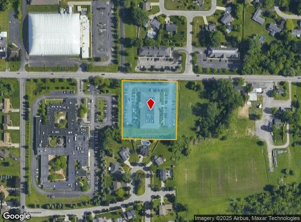
2733 Wehrle Dr, Lancaster, NY 14086

Current Lease Availabilities
NEARBY LISTINGS FOR SALE OR LEASE
Property Detail
2733 Wehrle Dr
145289-082-100-0004-002-112
Holland Land Companys Survey
Professionalbldglegalinsurancerealestateetc
Erie
X
New York
36029C0233H
2.112
2025
2.46 AC
2024
East
014400
Buffalo/Niagara Falls
18,833 SF
Buffalo-Cheektowaga-Niagara Falls, NY
DEMOGRAPHICS near 2733 Wehrle Dr
1 Mile
3 Mile
5 Mile
2024 Total Population
4,257
48,232
155,037
2029 Population
4,235
48,191
154,767
Pop Growth 2024-2029
(0.52%)
(0.09%)
(0.17%)
Average Age
44
45
44
2024 Total Households
1,856
20,713
65,981
HH Growth 2024-2029
(0.65%)
(0.15%)
(0.27%)
Median Household Inc
$89,570
$84,058
$81,306
Avg Household Size
2.20
2.30
2.30
2024 Avg HH Vehicles
2.00
2.00
2.00
Median Home Value
$243,371
$244,821
$233,793
Median Year Built
1963
1971
1966
Nearby Places
- Restaurants
- Banks
- Shops
- Fitness
- Groceries
PUBLIC TRANSPORTATION
COMMUTER RAIL
DRIVE
WALK
Distance
11 min
5.2 mi
DRIVE
WALK
Distance
12 min
5.7 mi
AIRPORT
Buffalo Niagara International
DRIVE
WALK
Distance
Buffalo Niagara International
8 min
3.0 mi
Niagara Falls International
DRIVE
WALK
Distance
Niagara Falls International
34 min
19.5 mi
Nearby Properties
Address
Land Use
TOTAL SIZE
Lot Size
Zoning
Address
Land Use
TOTAL SIZE
Lot Size
Zoning
462,256 SF
568.62 AC
05C
Address
Land Use
TOTAL SIZE
Lot Size
Zoning
Address
Land Use
TOTAL SIZE
Lot Size
Zoning
868,362 SF
135.20 AC
Address
Land Use
TOTAL SIZE
Lot Size
Zoning
24,600 SF
19.20 AC
00000
Address
Land Use
TOTAL SIZE
Lot Size
Zoning
176,108 SF
20.04 AC
GB
Address
Land Use
TOTAL SIZE
Lot Size
Zoning
82,802 SF
12.80 AC
05C
Address
Land Use
TOTAL SIZE
Lot Size
Zoning
172,400 SF
116.50 AC
Address
Land Use
TOTAL SIZE
Lot Size
Zoning
82.29 AC
05C
Address
Land Use
TOTAL SIZE
Lot Size
Zoning
260,326 SF
22.70 AC
Address
Land Use
TOTAL SIZE
Lot Size
Zoning
203,546 SF
13.55 AC
Address
Land Use
TOTAL SIZE
Lot Size
Zoning
12,576 SF
18.15 AC
Address
Land Use
TOTAL SIZE
Lot Size
Zoning
2,173 SF
15.33 AC
Address
Land Use
TOTAL SIZE
Lot Size
Zoning
Address
Land Use
TOTAL SIZE
Lot Size
Zoning
8,296 SF
16.60 AC
Address
Land Use
TOTAL SIZE
Lot Size
Zoning
172,001 SF
23.49 AC
Address
Land Use
TOTAL SIZE
Lot Size
Zoning
Address
Land Use
TOTAL SIZE
Lot Size
Zoning
3,630 SF
10.50 AC
Address
Land Use
TOTAL SIZE
Lot Size
Zoning
7,744 SF
17.82 AC
Address
Land Use
TOTAL SIZE
Lot Size
Zoning
196,113 SF
21.09 AC
Address
Land Use
TOTAL SIZE
Lot Size
Zoning
54,109 SF
6.19 AC
OB
Address
Land Use
TOTAL SIZE
Lot Size
Zoning
Address
Land Use
TOTAL SIZE
Lot Size
Zoning
124,407 SF
10.38 AC
SC
Address
Land Use
TOTAL SIZE
Lot Size
Zoning
11,520 SF
8.70 AC
Address
Land Use
TOTAL SIZE
Lot Size
Zoning
6,618 SF
36.08 AC
MFMU
Address
Land Use
TOTAL SIZE
Lot Size
Zoning
19,558 SF
11.07 AC
Address
Land Use
TOTAL SIZE
Lot Size
Zoning
146,776 SF
9.19 AC
Address
Land Use
TOTAL SIZE
Lot Size
Zoning
19,640 SF
13.34 AC
00000
Address
Land Use
TOTAL SIZE
Lot Size
Zoning
320,945 SF
62.80 AC
RES
Address
Land Use
TOTAL SIZE
Lot Size
Zoning
108,824 SF
9.34 AC
Address
Land Use
TOTAL SIZE
Lot Size
Zoning
8,347 SF
14.04 AC
The World's #1 Commercial Real Estate Marketplace
Connect with us
© 2025 CoStar Group
The information above has been obtained from sources believed reliable. While we do not doubt its accuracy we have not verified it and make no guarantee, warranty or representation about it. It is your responsibility to independently confirm its accuracy and completeness. Any projections, opinions, assumptions, or estimates used are for example only and do not represent the current or future performance of the property. The value of this transaction to you depends on tax and other factors which should be evaluated by your tax, financial, and legal advisors. You and your advisors should conduct a careful, independent investigation of the property to determine to your satisfaction the suitability of the property for your needs.