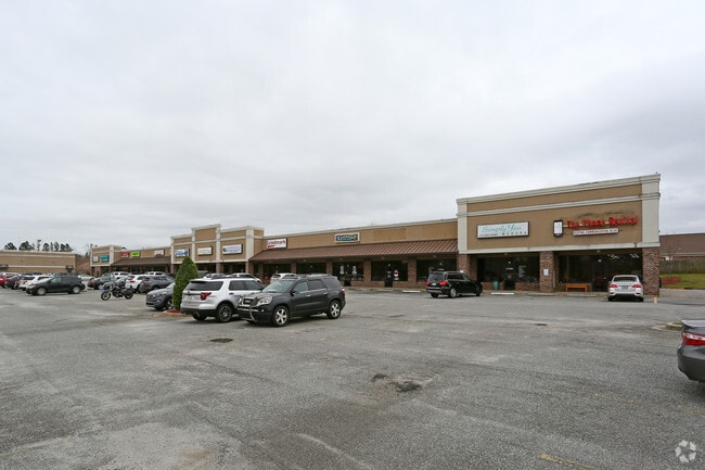
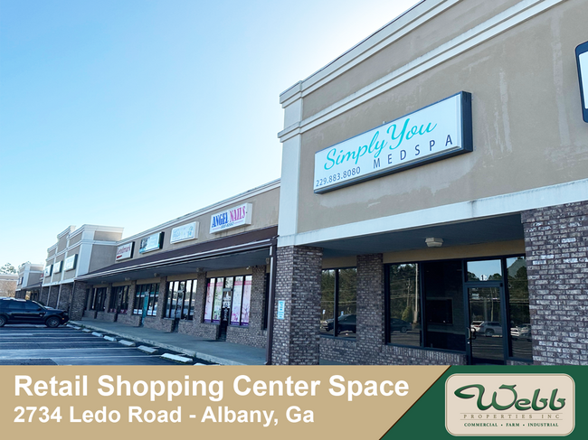
Property Record
2734 Ledo Rd, Albany, GA 31707
Property Detail
2734 Ledo Rd
00300-00001-1SH
UNIT 17 LEDO CROSSING COMM CONDO
Stripcommercialcenter
Dougherty
C-2NC
Georgia
B and X Area of moderate flood hazard, usually the area between the limits of the 100-year and 500-year floods.
0.04 AC
2025
Albany/Southwest
2025
Other Market Areas
000400
Albany, GA
1,750 SF
NEARBY LISTINGS FOR SALE OR LEASE
DEMOGRAPHICS near 2734 Ledo Rd
1 mile
3 mile
5 mile
2025 Total Population
3,341
30,985
61,227
2030 Population
3,252
30,362
60,486
Pop Growth 2025-2030
(2.66%)
(2.01%)
(1.21%)
Average Age
40
40
39
2025 Total Households
1,613
13,340
25,579
HH Growth 2025-2030
(3.10%)
(2.28%)
(1.41%)
Median Household Inc
$58,314
$70,249
$60,264
Avg Household Size
2.00
2.30
2.30
2025 Avg HH Vehicles
1.00
2.00
2.00
Median Home Value
$162,453
$223,522
$223,467
Median Year Built
1983
1983
1980
Nearby Places
Map Layers
Map Styles
 Street
 Aerial
Layers
 Traffic
 Biking
Places
Listings with unknown addresses are not visible on the map
- Restaurants
- Banks
- Shops
- Fitness
- Groceries
PUBLIC TRANSPORTATION
AIRPORT
Southwest Georgia Regional
Drive
Walk
Distance
Southwest Georgia Regional
18 min
8.7 mi
SALE & LEASE HISTORY
LISTING DATE
SALE/LEASE

Sep 25, 2016
For Lease
Oct 29, 2019
For Lease
Mar 19, 2019
For Lease
Jun 06, 2022
For Sale
Jul 12, 2023
For Sale
Feb 01, 2021
For Sale
Nearby Properties
Address
Land Use
TOTAL SIZE
Lot Size
Zoning
Address
Land Use
TOTAL SIZE
Lot Size
Zoning
126,650 SF
19.41 AC
C-2
Address
Land Use
TOTAL SIZE
Lot Size
Zoning
2,659 SF
42.40 AC
R2
Address
Land Use
TOTAL SIZE
Lot Size
Zoning
274,484 SF
16.31 AC
C-5
Address
Land Use
TOTAL SIZE
Lot Size
Zoning
42,880 SF
31.25 AC
C-R
Address
Land Use
TOTAL SIZE
Lot Size
Zoning
186,956 SF
29.23 AC
C-R
Address
Land Use
TOTAL SIZE
Lot Size
Zoning
147,258 SF
36.94 AC
C-7
Address
Land Use
TOTAL SIZE
Lot Size
Zoning
224,080 SF
21.72 AC
R2
Address
Land Use
TOTAL SIZE
Lot Size
Zoning
1,752 SF
13.25 AC
R2
Address
Land Use
TOTAL SIZE
Lot Size
Zoning
131,385 SF
21.89 AC
C-3
Address
Land Use
TOTAL SIZE
Lot Size
Zoning
125,299 SF
14.05 AC
C-7
Address
Land Use
TOTAL SIZE
Lot Size
Zoning
88,144 SF
12.47 AC
C-3
Address
Land Use
TOTAL SIZE
Lot Size
Zoning
95,923 SF
8.53 AC
C-2
Address
Land Use
TOTAL SIZE
Lot Size
Zoning
107,500 SF
11.27 AC
C-2
Address
Land Use
TOTAL SIZE
Lot Size
Zoning
129,973 SF
21.89 AC
C-3
Address
Land Use
TOTAL SIZE
Lot Size
Zoning
21,760 SF
10.76 AC
C-R
Address
Land Use
TOTAL SIZE
Lot Size
Zoning
21,144 SF
11.79 AC
C-R
Address
Land Use
TOTAL SIZE
Lot Size
Zoning
35,650 SF
3.73 AC
C-5
Address
Land Use
TOTAL SIZE
Lot Size
Zoning
44,671 SF
4 AC
C-2
Address
Land Use
TOTAL SIZE
Lot Size
Zoning
9,216 SF
14.31 AC
R2
Address
Land Use
TOTAL SIZE
Lot Size
Zoning
3,002 SF
9.64 AC
R2
Address
Land Use
TOTAL SIZE
Lot Size
Zoning
51,552 SF
13.26 AC
C-R
Address
Land Use
TOTAL SIZE
Lot Size
Zoning
31,835 SF
30 AC
COMMERCIAL
Address
Land Use
TOTAL SIZE
Lot Size
Zoning
17,758 SF
5.73 AC
C-3
Address
Land Use
TOTAL SIZE
Lot Size
Zoning
5,768 SF
16.40 AC
C-R
Address
Land Use
TOTAL SIZE
Lot Size
Zoning
32,000 SF
14.19 AC
R-1
Address
Land Use
TOTAL SIZE
Lot Size
Zoning
19,104 SF
10.81 AC
C-R
Address
Land Use
TOTAL SIZE
Lot Size
Zoning
56,014 SF
8.56 AC
C-7
Address
Land Use
TOTAL SIZE
Lot Size
Zoning
126,650 SF
0.96 AC
C-2
Address
Land Use
TOTAL SIZE
Lot Size
Zoning
73,610 SF
7.34 AC
C-2
Address
Land Use
TOTAL SIZE
Lot Size
Zoning
60,780 SF
2.18 AC
C-2
The World's #1 Commercial Real Estate Marketplace
Connect with us
© 2026 CoStar Group
The information above has been obtained from sources believed reliable. While we do not doubt its accuracy we have not verified it and make no guarantee, warranty or representation about it. It is your responsibility to independently confirm its accuracy and completeness. Any projections, opinions, assumptions, or estimates used are for example only and do not represent the current or future performance of the property. The value of this transaction to you depends on tax and other factors which should be evaluated by your tax, financial, and legal advisors. You and your advisors should conduct a careful, independent investigation of the property to determine to your satisfaction the suitability of the property for your needs.