Property Record
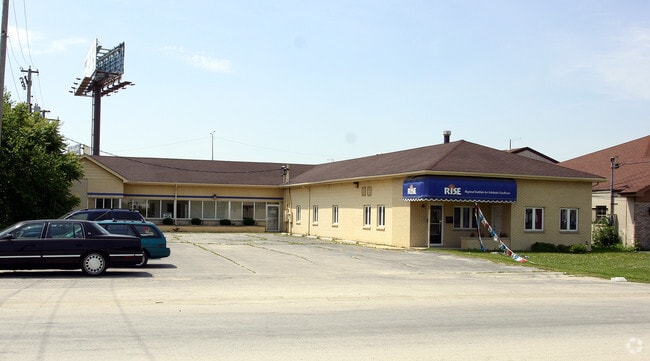
2735 Bernice Rd, Lansing, IL 60438

NEARBY LISTINGS FOR SALE OR LEASE
Property Detail
2735 Bernice Rd
30-30-304-010-0000
1300 Lake Shore Drive Condo
Commercialbuilding
Cook
X
Illinois
17031C0758J
4-7
2023
0.40 AC
2025
Near South Cook
827902
Chicago
5,303 SF
Chicago-Naperville-Elgin, IL-IN
DEMOGRAPHICS near 2735 Bernice Rd
1 Mile
3 Mile
5 Mile
2024 Total Population
12,240
99,301
236,404
2029 Population
11,915
97,422
232,250
Pop Growth 2024-2029
(2.66%)
(1.89%)
(1.76%)
Average Age
40
41
40
2024 Total Households
4,552
38,077
89,281
HH Growth 2024-2029
(2.94%)
(2.18%)
(1.99%)
Median Household Inc
$59,001
$58,216
$59,044
Avg Household Size
2.60
2.50
2.50
2024 Avg HH Vehicles
2.00
2.00
2.00
Median Home Value
$140,642
$155,207
$153,416
Median Year Built
1962
1962
1963
Nearby Places
Map Layers
Map Styles
 Street
 Aerial
- Restaurants
- Banks
- Shops
- Fitness
- Groceries
PUBLIC TRANSPORTATION
COMMUTER RAIL
Hammond Station (South Shore Line - Northern Indiana Commuter Transportation District (South Shore Line))
DRIVE
WALK
Distance
Hammond Station (South Shore Line - Northern Indiana Commuter Transportation District (South Shore Line))
11 min
5.6 mi
AIRPORT
Chicago Midway International
DRIVE
WALK
Distance
Chicago Midway International
36 min
23.7 mi
Freight Ports
Port Milwaukee
DRIVE
WALK
Distance
Port Milwaukee
139 min
110.2 mi
Nearby Properties
Address
Land Use
TOTAL SIZE
Lot Size
Zoning
Address
Land Use
TOTAL SIZE
Lot Size
Zoning
125,938 SF
13.32 AC
Address
Land Use
TOTAL SIZE
Lot Size
Zoning
350,110 SF
24.01 AC
R33
Address
Land Use
TOTAL SIZE
Lot Size
Zoning
668,326 SF
26.90 AC
Address
Land Use
TOTAL SIZE
Lot Size
Zoning
197,080 SF
R33
Address
Land Use
TOTAL SIZE
Lot Size
Zoning
24.56 AC
Address
Land Use
TOTAL SIZE
Lot Size
Zoning
Address
Land Use
TOTAL SIZE
Lot Size
Zoning
97,046 SF
3.36 AC
Address
Land Use
TOTAL SIZE
Lot Size
Zoning
126,648 SF
3.71 AC
Address
Land Use
TOTAL SIZE
Lot Size
Zoning
140,360 SF
15 AC
R33
Address
Land Use
TOTAL SIZE
Lot Size
Zoning
135,617 SF
7.80 AC
Address
Land Use
TOTAL SIZE
Lot Size
Zoning
186,608 SF
18.11 AC
R3
Address
Land Use
TOTAL SIZE
Lot Size
Zoning
52,731 SF
2.24 AC
R33
Address
Land Use
TOTAL SIZE
Lot Size
Zoning
94,500 SF
2.68 AC
Address
Land Use
TOTAL SIZE
Lot Size
Zoning
244,310 SF
9.32 AC
Address
Land Use
TOTAL SIZE
Lot Size
Zoning
87,166 SF
7.82 AC
Address
Land Use
TOTAL SIZE
Lot Size
Zoning
36,704 SF
3.12 AC
Address
Land Use
TOTAL SIZE
Lot Size
Zoning
117,855 SF
8.51 AC
Address
Land Use
TOTAL SIZE
Lot Size
Zoning
149,623 SF
4.93 AC
Address
Land Use
TOTAL SIZE
Lot Size
Zoning
5.01 AC
Address
Land Use
TOTAL SIZE
Lot Size
Zoning
122,628 SF
9.40 AC
Address
Land Use
TOTAL SIZE
Lot Size
Zoning
120,033 SF
30.10 AC
Address
Land Use
TOTAL SIZE
Lot Size
Zoning
41,928 SF
3.71 AC
Address
Land Use
TOTAL SIZE
Lot Size
Zoning
102,264 SF
8.61 AC
R3
Address
Land Use
TOTAL SIZE
Lot Size
Zoning
73,960 SF
3.84 AC
R33
Address
Land Use
TOTAL SIZE
Lot Size
Zoning
755,859 SF
8.77 AC
Address
Land Use
TOTAL SIZE
Lot Size
Zoning
106,812 SF
8.78 AC
Address
Land Use
TOTAL SIZE
Lot Size
Zoning
65,100 SF
5.50 AC
R33
Address
Land Use
TOTAL SIZE
Lot Size
Zoning
119,082 SF
11.26 AC
Address
Land Use
TOTAL SIZE
Lot Size
Zoning
48,134 SF
5.33 AC
Address
Land Use
TOTAL SIZE
Lot Size
Zoning
21,009 SF
1.82 AC
The World's #1 Commercial Real Estate Marketplace
Connect with us
© 2026 CoStar Group
The information above has been obtained from sources believed reliable. While we do not doubt its accuracy we have not verified it and make no guarantee, warranty or representation about it. It is your responsibility to independently confirm its accuracy and completeness. Any projections, opinions, assumptions, or estimates used are for example only and do not represent the current or future performance of the property. The value of this transaction to you depends on tax and other factors which should be evaluated by your tax, financial, and legal advisors. You and your advisors should conduct a careful, independent investigation of the property to determine to your satisfaction the suitability of the property for your needs.