Property Record
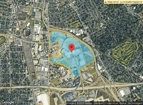
2735 Crittenden Dr, Louisville, KY 40209


NEARBY LISTINGS FOR SALE OR LEASE
-
-
View all Louisville listings for sale on LoopNet.com
Property Detail
2735 Crittenden Dr
083F0057LH02
Evans Griffin Inc
Hotelormotel
(BLDG #1)
X
Jefferson
18043C0200E
Kentucky
2025
Louisville South/Airport
2025
Louisville
007101
Louisville/Jefferson County, KY-IN
139,830 SF
DEMOGRAPHICS near 2735 Crittenden Dr
1 Mile
3 Mile
5 Mile
2024 Total Population
7,545
109,858
267,003
2029 Population
7,296
108,790
265,355
Pop Growth 2024-2029
(3.30%)
(0.97%)
(0.62%)
Average Age
37
38
39
2024 Total Households
3,783
48,516
116,114
HH Growth 2024-2029
(3.73%)
(0.96%)
(0.58%)
Median Household Inc
$43,996
$42,687
$44,742
Avg Household Size
1.90
2.10
2.10
2024 Avg HH Vehicles
1.00
1.00
1.00
Median Home Value
$182,464
$169,010
$171,984
Median Year Built
1947
1948
1954
Nearby Places
Map Layers
Map Styles
 Street
 Aerial
- Restaurants
- Banks
- Shops
- Fitness
- Groceries
PUBLIC TRANSPORTATION
AIRPORT
Louisville Muhammad Ali International
DRIVE
WALK
Distance
Louisville Muhammad Ali International
11 min
3.7 mi
Freight Ports
Port of Toledo
DRIVE
WALK
Distance
Port of Toledo
359 min
308.3 mi
Nearby Properties
Address
Land Use
TOTAL SIZE
Lot Size
Zoning
Address
Land Use
TOTAL SIZE
Lot Size
Zoning
42,228 SF
144.63 AC
R5-RESIDEN
Address
Land Use
TOTAL SIZE
Lot Size
Zoning
Address
Land Use
TOTAL SIZE
Lot Size
Zoning
377,041 SF
469.53 AC
Address
Land Use
TOTAL SIZE
Lot Size
Zoning
85,882 SF
80.13 AC
R1-RESIDEN
Address
Land Use
TOTAL SIZE
Lot Size
Zoning
17,916 SF
21.76 AC
EZ1-ENTERP
Address
Land Use
TOTAL SIZE
Lot Size
Zoning
1,584 SF
4.71 AC
R7-RESIDEN
Address
Land Use
TOTAL SIZE
Lot Size
Zoning
260,488 SF
8.07 AC
EZ1-ENTERP
Address
Land Use
TOTAL SIZE
Lot Size
Zoning
Address
Land Use
TOTAL SIZE
Lot Size
Zoning
549,563 SF
26.13 AC
OTF-OFFICE
Address
Land Use
TOTAL SIZE
Lot Size
Zoning
228,447 SF
7.70 AC
M2-INDUSTR
Address
Land Use
TOTAL SIZE
Lot Size
Zoning
58,935 SF
1.92 AC
TNZD-TRADI
Address
Land Use
TOTAL SIZE
Lot Size
Zoning
398,435 SF
9.93 AC
Address
Land Use
TOTAL SIZE
Lot Size
Zoning
6.75 AC
M2-INDUSTR
Address
Land Use
TOTAL SIZE
Lot Size
Zoning
19.50 AC
Address
Land Use
TOTAL SIZE
Lot Size
Zoning
273,585 SF
42.27 AC
Address
Land Use
TOTAL SIZE
Lot Size
Zoning
142,874 SF
21.93 AC
R5-RESIDEN
Address
Land Use
TOTAL SIZE
Lot Size
Zoning
217,082 SF
26.08 AC
C1-COMMERC
Address
Land Use
TOTAL SIZE
Lot Size
Zoning
2,575 SF
4.39 AC
CM-COMMERC
Address
Land Use
TOTAL SIZE
Lot Size
Zoning
31.15 AC
EZ1-ENTERP
Address
Land Use
TOTAL SIZE
Lot Size
Zoning
17,444 SF
1.47 AC
C2-COMMERC
Address
Land Use
TOTAL SIZE
Lot Size
Zoning
85,979 SF
2.68 AC
R6-RESIDEN
Address
Land Use
TOTAL SIZE
Lot Size
Zoning
1.61 AC
EZ1-ENTERP
Address
Land Use
TOTAL SIZE
Lot Size
Zoning
2.62 AC
OR2-OFFICE
Address
Land Use
TOTAL SIZE
Lot Size
Zoning
18,770 SF
EZ1-ENTERP
Address
Land Use
TOTAL SIZE
Lot Size
Zoning
9,323 SF
31.90 AC
EZ1-ENTERP
Address
Land Use
TOTAL SIZE
Lot Size
Zoning
16.11 AC
C1-COMMERC
Address
Land Use
TOTAL SIZE
Lot Size
Zoning
39,205 SF
15.50 AC
EZ1-ENTERP
Address
Land Use
TOTAL SIZE
Lot Size
Zoning
2.32 AC
TNZD-TRADI
Address
Land Use
TOTAL SIZE
Lot Size
Zoning
80,685 SF
12 AC
M2-INDUSTR
The World's #1 Commercial Real Estate Marketplace
Connect with us
© 2026 CoStar Group
The information above has been obtained from sources believed reliable. While we do not doubt its accuracy we have not verified it and make no guarantee, warranty or representation about it. It is your responsibility to independently confirm its accuracy and completeness. Any projections, opinions, assumptions, or estimates used are for example only and do not represent the current or future performance of the property. The value of this transaction to you depends on tax and other factors which should be evaluated by your tax, financial, and legal advisors. You and your advisors should conduct a careful, independent investigation of the property to determine to your satisfaction the suitability of the property for your needs.