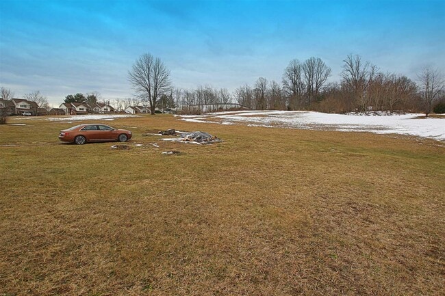
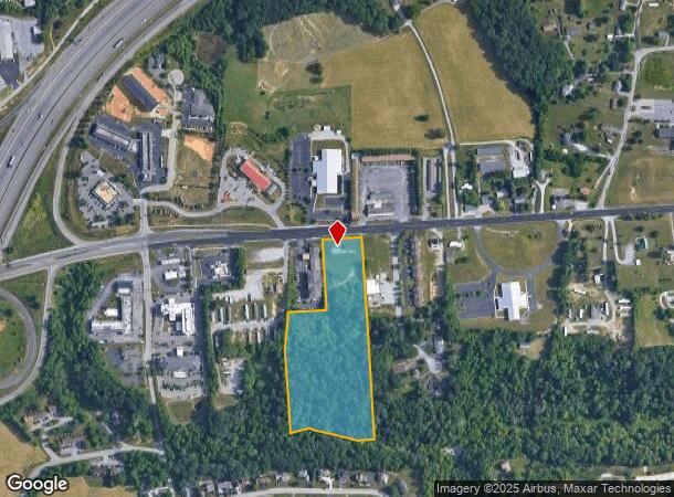
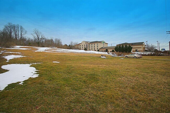
Property Record
2735 Roanoke St, Christiansburg, VA 24073
NEARBY LISTINGS FOR SALE OR LEASE
Property Detail
2735 Roanoke St
Blacksburg-Christiansburg-Radford, VA
Resubdivision Plat For Bandy Property
012825
ROANOKE ROAD
Commercialacreage
Montgomery
X
Virginia
51121C0165C
9.66 AC
2025
Blacksburg & Wytheville
2025
Other Market Areas
021101
DEMOGRAPHICS near 2735 Roanoke St
1 Mile
3 Mile
5 Mile
2024 Total Population
1,317
9,630
25,241
2029 Population
1,300
9,505
24,869
Pop Growth 2024-2029
(1.29%)
(1.30%)
(1.47%)
Average Age
40
40
40
2024 Total Households
534
4,060
10,791
HH Growth 2024-2029
(1.31%)
(1.31%)
(1.49%)
Median Household Inc
$63,529
$58,547
$63,893
Avg Household Size
2.40
2.30
2.30
2024 Avg HH Vehicles
2.00
2.00
2.00
Median Home Value
$158,264
$190,255
$222,564
Median Year Built
1991
1984
1988
Nearby Places
Map Layers
Map Styles
 Street
 Aerial
- Restaurants
- Banks
- Shops
- Fitness
- Groceries
PUBLIC TRANSPORTATION
AIRPORT
Roanoke/Blacksburg Regional (Woodrum Field)
DRIVE
WALK
Distance
Roanoke/Blacksburg Regional (Woodrum Field)
41 min
30.2 mi
Freight Ports
Virginia Port Authority - Richmond
DRIVE
WALK
Distance
Virginia Port Authority - Richmond
243 min
214.0 mi
SALE & LEASE HISTORY
LISTING DATE
SALE/LEASE

Sep 24, 2016
For Sale
Oct 15, 2018
For Sale
Mar 03, 2021
For Sale
Jan 21, 2020
For Sale
Nearby Properties
Address
Land Use
TOTAL SIZE
Lot Size
Zoning
Address
Land Use
TOTAL SIZE
Lot Size
Zoning
Address
Land Use
TOTAL SIZE
Lot Size
Zoning
315,000 SF
46.09 AC
I2
Address
Land Use
TOTAL SIZE
Lot Size
Zoning
16.65 AC
I2
Address
Land Use
TOTAL SIZE
Lot Size
Zoning
61,682 SF
21.65 AC
A
Address
Land Use
TOTAL SIZE
Lot Size
Zoning
147,552 SF
4.54 AC
I2
Address
Land Use
TOTAL SIZE
Lot Size
Zoning
281,082 SF
33.56 AC
I2
Address
Land Use
TOTAL SIZE
Lot Size
Zoning
128,416 SF
17.24 AC
B3
Address
Land Use
TOTAL SIZE
Lot Size
Zoning
2.39 AC
B3
Address
Land Use
TOTAL SIZE
Lot Size
Zoning
7,800 SF
11.47 AC
B3
Address
Land Use
TOTAL SIZE
Lot Size
Zoning
2.02 AC
B3
Address
Land Use
TOTAL SIZE
Lot Size
Zoning
25,578 SF
6.99 AC
B3
Address
Land Use
TOTAL SIZE
Lot Size
Zoning
101,304 SF
19.33 AC
I2
Address
Land Use
TOTAL SIZE
Lot Size
Zoning
1.52 AC
B3
Address
Land Use
TOTAL SIZE
Lot Size
Zoning
87,104 SF
11.32 AC
R3
Address
Land Use
TOTAL SIZE
Lot Size
Zoning
24,096 SF
8.59 AC
R3
Address
Land Use
TOTAL SIZE
Lot Size
Zoning
1.71 AC
B3
Address
Land Use
TOTAL SIZE
Lot Size
Zoning
48,036 SF
4.20 AC
B3
Address
Land Use
TOTAL SIZE
Lot Size
Zoning
40,736 SF
6.64 AC
I2
Address
Land Use
TOTAL SIZE
Lot Size
Zoning
46,116 SF
1.78 AC
B3
Address
Land Use
TOTAL SIZE
Lot Size
Zoning
35,474 SF
5.68 AC
B3
Address
Land Use
TOTAL SIZE
Lot Size
Zoning
34,789 SF
3.79 AC
B3
Address
Land Use
TOTAL SIZE
Lot Size
Zoning
30,418 SF
8 AC
B3
Address
Land Use
TOTAL SIZE
Lot Size
Zoning
44,496 SF
3.53 AC
B3
Address
Land Use
TOTAL SIZE
Lot Size
Zoning
26,250 SF
5 AC
I2
Address
Land Use
TOTAL SIZE
Lot Size
Zoning
12,060 SF
7.29 AC
B3
Address
Land Use
TOTAL SIZE
Lot Size
Zoning
20,100 SF
4.10 AC
I2
Address
Land Use
TOTAL SIZE
Lot Size
Zoning
27,456 SF
2.81 AC
B3
Address
Land Use
TOTAL SIZE
Lot Size
Zoning
36,460 SF
3.16 AC
B3
Address
Land Use
TOTAL SIZE
Lot Size
Zoning
5,200 SF
3.20 AC
I2
Address
Land Use
TOTAL SIZE
Lot Size
Zoning
3.59 AC
B3
The World's #1 Commercial Real Estate Marketplace
Connect with us
© 2026 CoStar Group
The information above has been obtained from sources believed reliable. While we do not doubt its accuracy we have not verified it and make no guarantee, warranty or representation about it. It is your responsibility to independently confirm its accuracy and completeness. Any projections, opinions, assumptions, or estimates used are for example only and do not represent the current or future performance of the property. The value of this transaction to you depends on tax and other factors which should be evaluated by your tax, financial, and legal advisors. You and your advisors should conduct a careful, independent investigation of the property to determine to your satisfaction the suitability of the property for your needs.