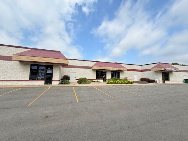
Property Record
2735 N Calhoun Rd, Brookfield, WI 53005


NEARBY LISTINGS FOR SALE OR LEASE
Property Detail
2735 N Calhoun Rd
BRC-1069-999
PT NE1/4 SEC 16 T7N R20E COMM AT SE COR, TH N89 08 30 W 23.36 FT TH ALG CURVE--TH N 08 30 W 83.49 FT, FTH S 83 05 15 E 1350.09 FT, S 01 50 W 287.59 FT TO BGN V756/5 EXCEPT THAT TAKEN FOR ROW REC 9/4/20 DOC 4508074
Commercialnec
Waukesha
X
Wisconsin
55133C0209H
4.56 AC
2024
Brookfield/New Berlin
2024
Milwaukee/Madison
200804
Milwaukee-Waukesha-West Allis, WI
DEMOGRAPHICS near 2735 N Calhoun Rd
1 Mile
3 Mile
5 Mile
2024 Total Population
6,759
47,590
122,655
2029 Population
7,098
49,727
126,167
Pop Growth 2024-2029
+ 5.02%
+ 4.49%
+ 2.86%
Average Age
43
43
42
2024 Total Households
2,621
18,069
50,676
HH Growth 2024-2029
+ 5.07%
+ 4.55%
+ 2.77%
Median Household Inc
$98,622
$115,676
$94,653
Avg Household Size
2.50
2.60
2.40
2024 Avg HH Vehicles
2.00
2.00
2.00
Median Home Value
$407,775
$397,174
$340,508
Median Year Built
1981
1976
1973
Nearby Places
Map Layers
Map Styles
 Street
 Aerial
- Restaurants
- Banks
- Shops
- Fitness
- Groceries
PUBLIC TRANSPORTATION
AIRPORT
General Mitchell International
DRIVE
WALK
Distance
General Mitchell International
31 min
19.2 mi
Freight Ports
Port Milwaukee
DRIVE
WALK
Distance
Port Milwaukee
27 min
15.3 mi
SALE & LEASE HISTORY
LISTING DATE
SALE/LEASE

Mar 03, 2023
For Lease
Mar 03, 2023
For Sale
Jun 30, 2025
For Lease
Jun 30, 2025
For Sale
Nearby Properties
Address
Land Use
TOTAL SIZE
Lot Size
Zoning
Address
Land Use
TOTAL SIZE
Lot Size
Zoning
24.46 AC
Address
Land Use
TOTAL SIZE
Lot Size
Zoning
19.25 AC
Address
Land Use
TOTAL SIZE
Lot Size
Zoning
12.50 AC
Address
Land Use
TOTAL SIZE
Lot Size
Zoning
20.02 AC
Address
Land Use
TOTAL SIZE
Lot Size
Zoning
Address
Land Use
TOTAL SIZE
Lot Size
Zoning
34.31 AC
Address
Land Use
TOTAL SIZE
Lot Size
Zoning
17.45 AC
Address
Land Use
TOTAL SIZE
Lot Size
Zoning
10.48 AC
Address
Land Use
TOTAL SIZE
Lot Size
Zoning
Address
Land Use
TOTAL SIZE
Lot Size
Zoning
7.20 AC
Address
Land Use
TOTAL SIZE
Lot Size
Zoning
Address
Land Use
TOTAL SIZE
Lot Size
Zoning
Address
Land Use
TOTAL SIZE
Lot Size
Zoning
Address
Land Use
TOTAL SIZE
Lot Size
Zoning
21.87 AC
Address
Land Use
TOTAL SIZE
Lot Size
Zoning
3.55 AC
Address
Land Use
TOTAL SIZE
Lot Size
Zoning
Address
Land Use
TOTAL SIZE
Lot Size
Zoning
Address
Land Use
TOTAL SIZE
Lot Size
Zoning
11.34 AC
Address
Land Use
TOTAL SIZE
Lot Size
Zoning
13.14 AC
Address
Land Use
TOTAL SIZE
Lot Size
Zoning
Address
Land Use
TOTAL SIZE
Lot Size
Zoning
16.79 AC
Address
Land Use
TOTAL SIZE
Lot Size
Zoning
10.41 AC
Address
Land Use
TOTAL SIZE
Lot Size
Zoning
4.94 AC
Address
Land Use
TOTAL SIZE
Lot Size
Zoning
10.53 AC
Address
Land Use
TOTAL SIZE
Lot Size
Zoning
9.57 AC
Address
Land Use
TOTAL SIZE
Lot Size
Zoning
11.09 AC
Address
Land Use
TOTAL SIZE
Lot Size
Zoning
Address
Land Use
TOTAL SIZE
Lot Size
Zoning
Address
Land Use
TOTAL SIZE
Lot Size
Zoning
Address
Land Use
TOTAL SIZE
Lot Size
Zoning
The World's #1 Commercial Real Estate Marketplace
Connect with us
© 2025 CoStar Group
The information above has been obtained from sources believed reliable. While we do not doubt its accuracy we have not verified it and make no guarantee, warranty or representation about it. It is your responsibility to independently confirm its accuracy and completeness. Any projections, opinions, assumptions, or estimates used are for example only and do not represent the current or future performance of the property. The value of this transaction to you depends on tax and other factors which should be evaluated by your tax, financial, and legal advisors. You and your advisors should conduct a careful, independent investigation of the property to determine to your satisfaction the suitability of the property for your needs.