Property Record
2737 Brundage Rd, Baldwinsville, NY 13027
This Property Is For Sale
NEARBY LISTINGS FOR SALE OR LEASE
Property Detail
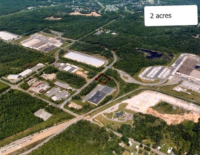
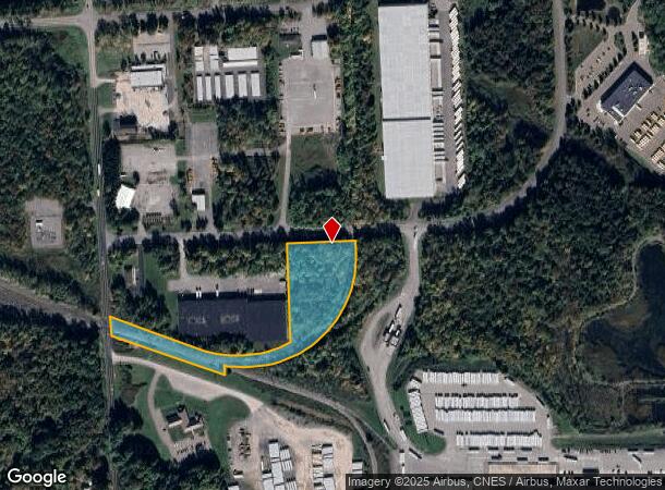
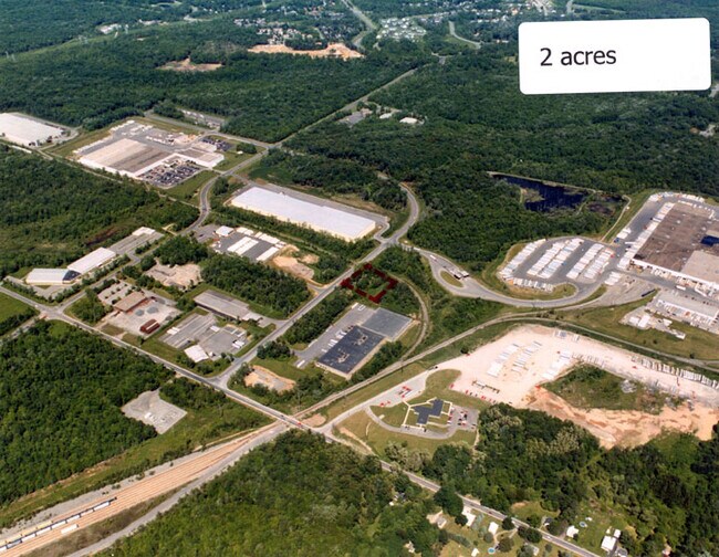
2737 Brundage Rd
Syracuse, NY
FL 81
313689-057-000-0002-028-001-0000
Onondaga
Residentialacreage
New York
X
28.001
36067C0062F
5.20 AC
2025
W Outer Onondaga County
2024
Syracuse
011401
DEMOGRAPHICS near 2737 Brundage Rd
1 Mile
3 Mile
5 Mile
2024 Total Population
2,207
26,668
54,110
2029 Population
2,146
26,018
52,795
Pop Growth 2024-2029
(2.76%)
(2.44%)
(2.43%)
Average Age
43
42
42
2024 Total Households
1,003
11,191
22,638
HH Growth 2024-2029
(2.99%)
(2.59%)
(2.60%)
Median Household Inc
$64,515
$83,503
$77,992
Avg Household Size
2.20
2.30
2.30
2024 Avg HH Vehicles
2.00
2.00
2.00
Median Home Value
$214,977
$212,690
$189,296
Median Year Built
1985
1982
1979
Nearby Places
- Restaurants
- Banks
- Shops
- Fitness
- Groceries
PUBLIC TRANSPORTATION
AIRPORT
Syracuse Hancock International
DRIVE
WALK
Distance
Syracuse Hancock International
25 min
16.3 mi
Freight Ports
Albany, NY Port
DRIVE
WALK
Distance
Albany, NY Port
188 min
156.3 mi
Nearby Properties
Address
Land Use
TOTAL SIZE
Lot Size
Zoning
Address
Land Use
TOTAL SIZE
Lot Size
Zoning
5,000 SF
187.65 AC
PUD
Address
Land Use
TOTAL SIZE
Lot Size
Zoning
355,510 SF
84.92 AC
03 - MULTI
Address
Land Use
TOTAL SIZE
Lot Size
Zoning
252,000 SF
58.54 AC
INA
Address
Land Use
TOTAL SIZE
Lot Size
Zoning
442,970 SF
33.63 AC
PUD
Address
Land Use
TOTAL SIZE
Lot Size
Zoning
37,021 SF
14.88 AC
B1
Address
Land Use
TOTAL SIZE
Lot Size
Zoning
247,864 SF
39.34 AC
PUD
Address
Land Use
TOTAL SIZE
Lot Size
Zoning
82,045 SF
18.38 AC
PUD
Address
Land Use
TOTAL SIZE
Lot Size
Zoning
152,197 SF
31.39 AC
LB
Address
Land Use
TOTAL SIZE
Lot Size
Zoning
38,960 SF
21.26 AC
PUD
Address
Land Use
TOTAL SIZE
Lot Size
Zoning
40,008 SF
10.82 AC
PUD
Address
Land Use
TOTAL SIZE
Lot Size
Zoning
115,472 SF
47.08 AC
03 - MULTI
Address
Land Use
TOTAL SIZE
Lot Size
Zoning
47,617 SF
4.90 AC
03 - MULTI
Address
Land Use
TOTAL SIZE
Lot Size
Zoning
250,000 SF
20.19 AC
PUD
Address
Land Use
TOTAL SIZE
Lot Size
Zoning
107,336 SF
28.62 AC
PUD
Address
Land Use
TOTAL SIZE
Lot Size
Zoning
1,148 SF
33.26 AC
PDV
Address
Land Use
TOTAL SIZE
Lot Size
Zoning
21,696 SF
11.96 AC
PUD
Address
Land Use
TOTAL SIZE
Lot Size
Zoning
5,376 SF
13.93 AC
R2
Address
Land Use
TOTAL SIZE
Lot Size
Zoning
99,442 SF
11.75 AC
PUD
Address
Land Use
TOTAL SIZE
Lot Size
Zoning
169,829 SF
15.46 AC
PUD
Address
Land Use
TOTAL SIZE
Lot Size
Zoning
28,800 SF
6.86 AC
R40
Address
Land Use
TOTAL SIZE
Lot Size
Zoning
5,400 SF
6.47 AC
PUD
Address
Land Use
TOTAL SIZE
Lot Size
Zoning
60,910 SF
21.77 AC
GB
Address
Land Use
TOTAL SIZE
Lot Size
Zoning
29,776 SF
1.08 AC
05 - COMME
Address
Land Use
TOTAL SIZE
Lot Size
Zoning
56,216 SF
18.97 AC
R15
Address
Land Use
TOTAL SIZE
Lot Size
Zoning
61,701 SF
15.87 AC
R40
Address
Land Use
TOTAL SIZE
Lot Size
Zoning
6,983 SF
9.21 AC
PUD
Address
Land Use
TOTAL SIZE
Lot Size
Zoning
2,520 SF
16.28 AC
FED
Address
Land Use
TOTAL SIZE
Lot Size
Zoning
28,800 SF
4.72 AC
PUD
Address
Land Use
TOTAL SIZE
Lot Size
Zoning
11,606 SF
6.53 AC
PUD
Address
Land Use
TOTAL SIZE
Lot Size
Zoning
34,535 SF
5 AC
PUD
The World's #1 Commercial Real Estate Marketplace
Connect with us
© 2025 CoStar Group
The information above has been obtained from sources believed reliable. While we do not doubt its accuracy we have not verified it and make no guarantee, warranty or representation about it. It is your responsibility to independently confirm its accuracy and completeness. Any projections, opinions, assumptions, or estimates used are for example only and do not represent the current or future performance of the property. The value of this transaction to you depends on tax and other factors which should be evaluated by your tax, financial, and legal advisors. You and your advisors should conduct a careful, independent investigation of the property to determine to your satisfaction the suitability of the property for your needs.