Property Record
276 Route 87 Hwy, Montoursville, PA 17754
NEARBY LISTINGS FOR SALE OR LEASE
-
-
View all Montoursville listings for lease on LoopNet.com
Property Detail
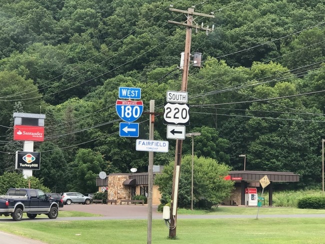
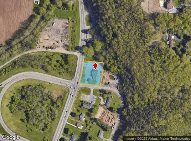
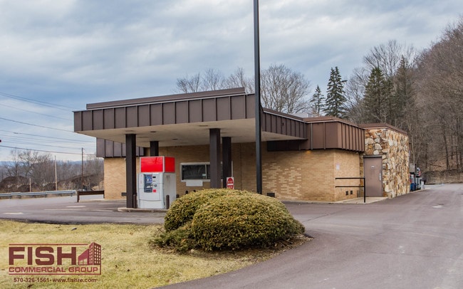
276 Route 87 Hwy
Retailwithmorethanonenonretailuse
Lycoming
X
Pennsylvania
42081C0363F
0.70 AC
2025
Other Market Areas
2025
Williamsport, PA
010900
12-351.0-0101.B-000
1,897 SF
DEMOGRAPHICS near 276 Route 87 Hwy
1 Mile
3 Mile
5 Mile
2024 Total Population
3,089
13,294
30,673
2029 Population
3,068
13,206
30,555
Pop Growth 2024-2029
(0.68%)
(0.66%)
(0.38%)
Average Age
44
45
43
2024 Total Households
1,331
5,645
12,849
HH Growth 2024-2029
(0.90%)
(0.81%)
(0.47%)
Median Household Inc
$70,265
$66,566
$64,519
Avg Household Size
2.30
2.30
2.20
2024 Avg HH Vehicles
2.00
2.00
2.00
Median Home Value
$173,556
$187,016
$176,765
Median Year Built
1960
1969
1961
Nearby Places
Map Layers
Map Styles
 Street
 Aerial
- Restaurants
- Banks
- Shops
- Fitness
- Groceries
SALE & LEASE HISTORY
LISTING DATE
SALE/LEASE

Apr 17, 2019
For Lease
Nearby Properties
Address
Land Use
TOTAL SIZE
Lot Size
Zoning
Address
Land Use
TOTAL SIZE
Lot Size
Zoning
120 SF
27.17 AC
04REP
Address
Land Use
TOTAL SIZE
Lot Size
Zoning
39,227 SF
18 AC
RESR
Address
Land Use
TOTAL SIZE
Lot Size
Zoning
3,400 SF
36.41 AC
RESR
Address
Land Use
TOTAL SIZE
Lot Size
Zoning
32,084 SF
35.40 AC
RESR
Address
Land Use
TOTAL SIZE
Lot Size
Zoning
7,417 SF
934.82 AC
FWR
Address
Land Use
TOTAL SIZE
Lot Size
Zoning
19,779 SF
5.65 AC
OPEP
Address
Land Use
TOTAL SIZE
Lot Size
Zoning
23,856 SF
166.76 AC
Address
Land Use
TOTAL SIZE
Lot Size
Zoning
32,361 SF
7.56 AC
RESP
Address
Land Use
TOTAL SIZE
Lot Size
Zoning
61,371 SF
6 AC
05RER
Address
Land Use
TOTAL SIZE
Lot Size
Zoning
4,800 SF
16.63 AC
COMR
Address
Land Use
TOTAL SIZE
Lot Size
Zoning
67,035 SF
12.60 AC
COMP
Address
Land Use
TOTAL SIZE
Lot Size
Zoning
1,728 SF
12.40 AC
RESR
Address
Land Use
TOTAL SIZE
Lot Size
Zoning
14,064 SF
4.84 AC
Address
Land Use
TOTAL SIZE
Lot Size
Zoning
13,132 SF
155.50 AC
COMR
Address
Land Use
TOTAL SIZE
Lot Size
Zoning
9,918 SF
1.15 AC
COMP
Address
Land Use
TOTAL SIZE
Lot Size
Zoning
46,240 SF
10.64 AC
OPER
Address
Land Use
TOTAL SIZE
Lot Size
Zoning
18,436 SF
9.32 AC
4REC
Address
Land Use
TOTAL SIZE
Lot Size
Zoning
45,315 SF
28.11 AC
Address
Land Use
TOTAL SIZE
Lot Size
Zoning
12,872 SF
2.95 AC
COMC
Address
Land Use
TOTAL SIZE
Lot Size
Zoning
19,316 SF
6.26 AC
RESR
Address
Land Use
TOTAL SIZE
Lot Size
Zoning
33,542 SF
5.59 AC
Address
Land Use
TOTAL SIZE
Lot Size
Zoning
5,810 SF
2.67 AC
RESR
Address
Land Use
TOTAL SIZE
Lot Size
Zoning
50,273 SF
7.82 AC
04INI
Address
Land Use
TOTAL SIZE
Lot Size
Zoning
8,662 SF
21 AC
04REP
The World's #1 Commercial Real Estate Marketplace
Connect with us
© 2025 CoStar Group
The information above has been obtained from sources believed reliable. While we do not doubt its accuracy we have not verified it and make no guarantee, warranty or representation about it. It is your responsibility to independently confirm its accuracy and completeness. Any projections, opinions, assumptions, or estimates used are for example only and do not represent the current or future performance of the property. The value of this transaction to you depends on tax and other factors which should be evaluated by your tax, financial, and legal advisors. You and your advisors should conduct a careful, independent investigation of the property to determine to your satisfaction the suitability of the property for your needs.