Property Record
274 Derry Rd, Litchfield, NH 03052
NEARBY LISTINGS FOR SALE OR LEASE
Property Detail
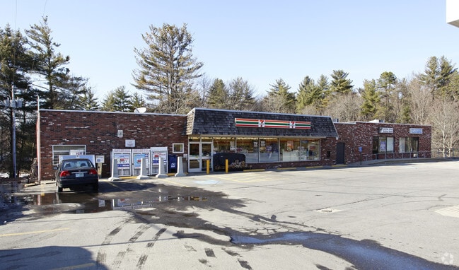
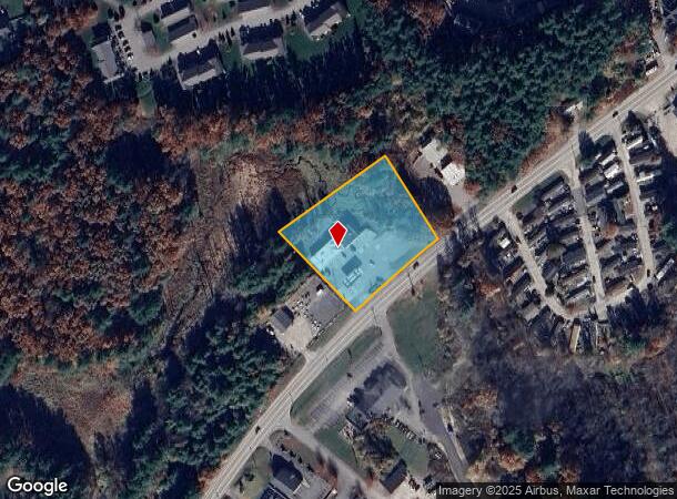
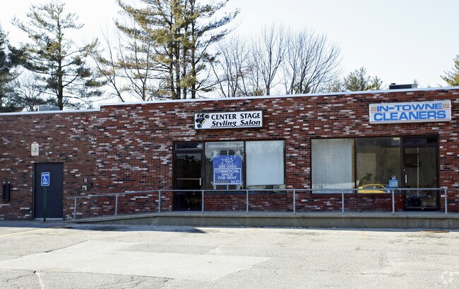
274 Derry Rd
LTCH-000002-000000-000039
Hillsborough
Commercialbuilding
New Hampshire
X
39
33011C0516D
1.60 AC
2024
Hillsborough
2024
Boston
013101
Manchester-Nashua, NH
6,106 SF
DEMOGRAPHICS near 274 Derry Rd
1 mile
3 mile
5 mile
2024 Total Population
1,873
23,185
95,935
2029 Population
1,927
23,811
98,420
Pop Growth 2024-2029
+ 2.88%
+ 2.70%
+ 2.59%
Average Age
44
43
41
2024 Total Households
754
8,921
38,091
HH Growth 2024-2029
+ 2.92%
+ 2.69%
+ 2.57%
Median Household Inc
$109,469
$113,481
$96,849
Avg Household Size
2.50
2.60
2.50
2024 Avg HH Vehicles
2.00
2.00
2.00
Median Home Value
$409,149
$389,139
$377,979
Median Year Built
1987
1983
1977
Nearby Places
Map Layers
Map Styles
 Street
 Aerial
Transit
 Traffic
 Biking
Places
Listings with unknown addresses are not visible on the map
- Restaurants
- Banks
- Shops
- Fitness
- Groceries
PUBLIC TRANSPORTATION
AIRPORT
Manchester Boston Regional
Drive
Walk
Distance
Manchester Boston Regional
27 min
11.4 mi
Nearby Properties
Address
Land Use
TOTAL SIZE
Lot Size
Zoning
Address
Land Use
TOTAL SIZE
Lot Size
Zoning
26.55 AC
INDUST
Address
Land Use
TOTAL SIZE
Lot Size
Zoning
188,520 SF
111.12 AC
GD
Address
Land Use
TOTAL SIZE
Lot Size
Zoning
51,684 SF
36.58 AC
INDUST
Address
Land Use
TOTAL SIZE
Lot Size
Zoning
471,525 SF
28.76 AC
INDUST
Address
Land Use
TOTAL SIZE
Lot Size
Zoning
30,406 SF
16.74 AC
INDUST
Address
Land Use
TOTAL SIZE
Lot Size
Zoning
80,863 SF
18 AC
R1
Address
Land Use
TOTAL SIZE
Lot Size
Zoning
57,128 SF
10.60 AC
BD
Address
Land Use
TOTAL SIZE
Lot Size
Zoning
2,724 SF
43.90 AC
RA
Address
Land Use
TOTAL SIZE
Lot Size
Zoning
31,226 SF
7.22 AC
C2- GE
Address
Land Use
TOTAL SIZE
Lot Size
Zoning
38 AC
RES
Address
Land Use
TOTAL SIZE
Lot Size
Zoning
7.74 AC
RA
Address
Land Use
TOTAL SIZE
Lot Size
Zoning
91,498 SF
18.35 AC
INDUST
Address
Land Use
TOTAL SIZE
Lot Size
Zoning
63,972 SF
6 AC
R18
Address
Land Use
TOTAL SIZE
Lot Size
Zoning
119,547 SF
3.78 AC
B
Address
Land Use
TOTAL SIZE
Lot Size
Zoning
17.55 AC
RES
Address
Land Use
TOTAL SIZE
Lot Size
Zoning
45,330 SF
1 AC
R3
Address
Land Use
TOTAL SIZE
Lot Size
Zoning
93,403 SF
9.87 AC
INDUST
Address
Land Use
TOTAL SIZE
Lot Size
Zoning
30.75 AC
RA
Address
Land Use
TOTAL SIZE
Lot Size
Zoning
69,900 SF
18.10 AC
BD
Address
Land Use
TOTAL SIZE
Lot Size
Zoning
44,280 SF
1 AC
R3
Address
Land Use
TOTAL SIZE
Lot Size
Zoning
2,400 SF
15.50 AC
G1
Address
Land Use
TOTAL SIZE
Lot Size
Zoning
115,747 SF
9.99 AC
ID
Address
Land Use
TOTAL SIZE
Lot Size
Zoning
31,091 SF
3.42 AC
BD
Address
Land Use
TOTAL SIZE
Lot Size
Zoning
120,684 SF
6.35 AC
INDUST
Address
Land Use
TOTAL SIZE
Lot Size
Zoning
3,885 SF
8.24 AC
BD
Address
Land Use
TOTAL SIZE
Lot Size
Zoning
684 SF
178.86 AC
R2
Address
Land Use
TOTAL SIZE
Lot Size
Zoning
8,596 SF
9.97 AC
GD
Address
Land Use
TOTAL SIZE
Lot Size
Zoning
49,064 SF
7.59 AC
INDUST
Address
Land Use
TOTAL SIZE
Lot Size
Zoning
5.74 AC
INDUST
Address
Land Use
TOTAL SIZE
Lot Size
Zoning
13,560 SF
27.43 AC
R2
The World's #1 Commercial Real Estate Marketplace
Connect with us
© 2026 CoStar Group
The information above has been obtained from sources believed reliable. While we do not doubt its accuracy we have not verified it and make no guarantee, warranty or representation about it. It is your responsibility to independently confirm its accuracy and completeness. Any projections, opinions, assumptions, or estimates used are for example only and do not represent the current or future performance of the property. The value of this transaction to you depends on tax and other factors which should be evaluated by your tax, financial, and legal advisors. You and your advisors should conduct a careful, independent investigation of the property to determine to your satisfaction the suitability of the property for your needs.