Property Record
2 High Range Rd, Londonderry, NH 03053
NEARBY LISTINGS FOR SALE OR LEASE
-
-
View all Londonderry listings for sale on LoopNet.com
Property Detail
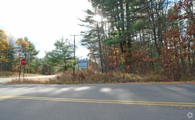
2 High Range Rd
LOND-000002-000000-000008
Rockingham
Governmentalpublicusegeneral
New Hampshire
AE
8-0
33011C0509D
0.23 AC
0
Rockingham
2025
Boston
003801
Boston-Cambridge-Newton, MA-NH
1,665 SF
DEMOGRAPHICS near 2 High Range Rd
1 mile
3 mile
5 mile
2024 Total Population
2,541
19,657
63,499
2029 Population
2,645
20,330
65,588
Pop Growth 2024-2029
+ 4.09%
+ 3.42%
+ 3.29%
Average Age
42
42
42
2024 Total Households
880
7,170
23,807
HH Growth 2024-2029
+ 4.09%
+ 3.36%
+ 3.27%
Median Household Inc
$137,062
$125,690
$116,910
Avg Household Size
2.80
2.70
2.60
2024 Avg HH Vehicles
2.00
2.00
2.00
Median Home Value
$449,433
$406,403
$393,110
Median Year Built
1984
1983
1984
Nearby Places
Map Layers
Map Styles
 Street
 Aerial
Transit
 Traffic
 Biking
Places
Listings with unknown addresses are not visible on the map
- Restaurants
- Banks
- Shops
- Fitness
- Groceries
PUBLIC TRANSPORTATION
AIRPORT
Manchester Boston Regional
Drive
Walk
Distance
Manchester Boston Regional
23 min
8.9 mi
Freight Ports
Port of Boston
Drive
Walk
Distance
Port of Boston
71 min
48.1 mi
SALE & LEASE HISTORY
LISTING DATE
SALE/LEASE

Dec 28, 2021
For Sale
Nearby Properties
Address
Land Use
TOTAL SIZE
Lot Size
Zoning
Address
Land Use
TOTAL SIZE
Lot Size
Zoning
214,583 SF
110.37 AC
AR-I
Address
Land Use
TOTAL SIZE
Lot Size
Zoning
12.73 AC
C-I
Address
Land Use
TOTAL SIZE
Lot Size
Zoning
31.14 AC
AR-I
Address
Land Use
TOTAL SIZE
Lot Size
Zoning
22.09 AC
AR-I
Address
Land Use
TOTAL SIZE
Lot Size
Zoning
90,406 SF
24.78 AC
AR-I
Address
Land Use
TOTAL SIZE
Lot Size
Zoning
80,710 SF
20 AC
AR-I
Address
Land Use
TOTAL SIZE
Lot Size
Zoning
41,989 SF
C-III
Address
Land Use
TOTAL SIZE
Lot Size
Zoning
38 AC
RES
Address
Land Use
TOTAL SIZE
Lot Size
Zoning
60,572 SF
5.65 AC
C-I
Address
Land Use
TOTAL SIZE
Lot Size
Zoning
11.28 AC
C-I
Address
Land Use
TOTAL SIZE
Lot Size
Zoning
34,442 SF
99.29 AC
AR-I
Address
Land Use
TOTAL SIZE
Lot Size
Zoning
15,000 SF
C-III
Address
Land Use
TOTAL SIZE
Lot Size
Zoning
17.55 AC
RES
Address
Land Use
TOTAL SIZE
Lot Size
Zoning
45,330 SF
1 AC
R3
Address
Land Use
TOTAL SIZE
Lot Size
Zoning
69,900 SF
18.10 AC
BD
Address
Land Use
TOTAL SIZE
Lot Size
Zoning
44,280 SF
1 AC
R3
Address
Land Use
TOTAL SIZE
Lot Size
Zoning
25,083 SF
1.42 AC
C-III
Address
Land Use
TOTAL SIZE
Lot Size
Zoning
2,400 SF
15.50 AC
G1
Address
Land Use
TOTAL SIZE
Lot Size
Zoning
31,091 SF
3.42 AC
BD
Address
Land Use
TOTAL SIZE
Lot Size
Zoning
20,986 SF
2.41 AC
C-III
Address
Land Use
TOTAL SIZE
Lot Size
Zoning
41,225 SF
7.35 AC
C-I
Address
Land Use
TOTAL SIZE
Lot Size
Zoning
11.94 AC
I1/2
Address
Land Use
TOTAL SIZE
Lot Size
Zoning
32,946 SF
1.20 AC
C-I
Address
Land Use
TOTAL SIZE
Lot Size
Zoning
9,800 SF
10.09 AC
B
Address
Land Use
TOTAL SIZE
Lot Size
Zoning
12,300 SF
9.93 AC
AR-1/C
Address
Land Use
TOTAL SIZE
Lot Size
Zoning
4.15 AC
C-I
Address
Land Use
TOTAL SIZE
Lot Size
Zoning
4.10 AC
C-I
Address
Land Use
TOTAL SIZE
Lot Size
Zoning
67.75 AC
I1/2
Address
Land Use
TOTAL SIZE
Lot Size
Zoning
24,225 SF
7 AC
AR-I
Address
Land Use
TOTAL SIZE
Lot Size
Zoning
9,960 SF
3.11 AC
C-I
The World's #1 Commercial Real Estate Marketplace
Connect with us
© 2026 CoStar Group
The information above has been obtained from sources believed reliable. While we do not doubt its accuracy we have not verified it and make no guarantee, warranty or representation about it. It is your responsibility to independently confirm its accuracy and completeness. Any projections, opinions, assumptions, or estimates used are for example only and do not represent the current or future performance of the property. The value of this transaction to you depends on tax and other factors which should be evaluated by your tax, financial, and legal advisors. You and your advisors should conduct a careful, independent investigation of the property to determine to your satisfaction the suitability of the property for your needs.