Property Record
274 S River Rd, New Hope, PA 18938


Save to a Folder
{{folder.Name}}
{{folder.ListingIds.length}} Properties
{{folder.ListingIds.length}} Property
Create a New Folder
Property Detail
274 S River Rd
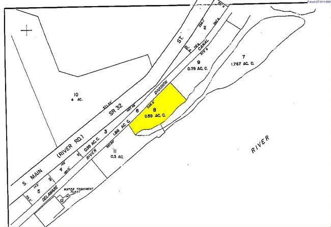
27-011-008
0.59AC 274 S. RIVER RD LOT 60 FT E MAIN ST 2155 FT S MECHANIC ST
Restaurantbuilding
BUCKS
RB
Pennsylvania
AE The base floodplain where base flood elevations are provided. AE Zones are now used on new format FIRMs instead of A1-A30 Zones.
60
2025
0.59 AC
2026
Lower Bucks County
104303
Philadelphia
33,721 SF
Philadelphia-Camden-Wilmington, PA-NJ-DE-MD
NEARBY LISTINGS FOR SALE OR LEASE
DEMOGRAPHICS near 274 S River Rd
1 mile
3 mile
5 mile
2025 Total Population
4,941
13,756
23,531
2030 Population
5,040
13,914
23,661
Pop Growth 2025-2030
+ 2.00%
+ 1.15%
+ 0.55%
Average Age
49
48
48
2025 Total Households
2,511
6,205
9,948
HH Growth 2025-2030
+ 1.99%
+ 1.22%
+ 0.62%
Median Household Inc
$135,393
$145,662
$160,439
Avg Household Size
2.00
2.20
2.30
2025 Avg HH Vehicles
2.00
2.00
2.00
Median Home Value
$671,321
$717,725
$753,835
Median Year Built
1970
1973
1974
Nearby Places
Map Layers
Map Styles
 Street
 Aerial
Layers
 Traffic
 Biking
Places
Listings with unknown addresses are not visible on the map
- Restaurants
- Banks
- Shops
- Fitness
- Groceries
PUBLIC TRANSPORTATION
AIRPORT
Trenton Mercer
Drive
Walk
Distance
Trenton Mercer
24 min
12.8 mi
Lehigh Valley International
Drive
Walk
Distance
Lehigh Valley International
75 min
41.2 mi
Philadelphia International
Drive
Walk
Distance
Philadelphia International
75 min
49.5 mi
Freight Ports
Port of Philadelphia
Drive
Walk
Distance
Port of Philadelphia
55 min
35.8 mi
Nearby Properties
Address
Land Use
TOTAL SIZE
Lot Size
Zoning
Address
Land Use
TOTAL SIZE
Lot Size
Zoning
11.51 AC
PRD
Address
Land Use
TOTAL SIZE
Lot Size
Zoning
4 AC
PRD
Address
Land Use
TOTAL SIZE
Lot Size
Zoning
Address
Land Use
TOTAL SIZE
Lot Size
Zoning
44,252 SF
2.36 AC
R-2
Address
Land Use
TOTAL SIZE
Lot Size
Zoning
24,768 SF
1.47 AC
FP
Address
Land Use
TOTAL SIZE
Lot Size
Zoning
7,765 SF
0.13 AC
CBD
Address
Land Use
TOTAL SIZE
Lot Size
Zoning
0.36 AC
CBD
Address
Land Use
TOTAL SIZE
Lot Size
Zoning
6,320 SF
0.23 AC
Address
Land Use
TOTAL SIZE
Lot Size
Zoning
24,552 SF
0.57 AC
CBD
Address
Land Use
TOTAL SIZE
Lot Size
Zoning
30,048 SF
22.12 AC
SRPD
Address
Land Use
TOTAL SIZE
Lot Size
Zoning
4,434 SF
1.47 AC
HC
Address
Land Use
TOTAL SIZE
Lot Size
Zoning
34,429 SF
2.20 AC
COM
Address
Land Use
TOTAL SIZE
Lot Size
Zoning
127.42 AC
MRC
Address
Land Use
TOTAL SIZE
Lot Size
Zoning
39,390 SF
1.80 AC
R-2
Address
Land Use
TOTAL SIZE
Lot Size
Zoning
64,200 SF
14.98 AC
HC
Address
Land Use
TOTAL SIZE
Lot Size
Zoning
147.58 AC
Q
Address
Land Use
TOTAL SIZE
Lot Size
Zoning
100 AC
I-2
Address
Land Use
TOTAL SIZE
Lot Size
Zoning
14,653 SF
0.40 AC
R-2
Address
Land Use
TOTAL SIZE
Lot Size
Zoning
132.95 AC
MRC
Address
Land Use
TOTAL SIZE
Lot Size
Zoning
2,618 SF
83.19 AC
MRC
Address
Land Use
TOTAL SIZE
Lot Size
Zoning
30,596 SF
3.88 AC
HC
Address
Land Use
TOTAL SIZE
Lot Size
Zoning
13,413 SF
4.09 AC
HC
Address
Land Use
TOTAL SIZE
Lot Size
Zoning
16,102 SF
0.11 AC
CBD
Address
Land Use
TOTAL SIZE
Lot Size
Zoning
11,452 SF
3.95 AC
PRD
Address
Land Use
TOTAL SIZE
Lot Size
Zoning
29,600 SF
10.99 AC
HC
Address
Land Use
TOTAL SIZE
Lot Size
Zoning
9,100 SF
5.40 AC
HC
Address
Land Use
TOTAL SIZE
Lot Size
Zoning
20,505 SF
0.14 AC
CBD
Address
Land Use
TOTAL SIZE
Lot Size
Zoning
9,975 SF
0.11 AC
CBD
Address
Land Use
TOTAL SIZE
Lot Size
Zoning
0.42 AC
CBD
Address
Land Use
TOTAL SIZE
Lot Size
Zoning
9,076 SF
8.55 AC
RL
The World's #1 Commercial Real Estate Marketplace
Connect with us
© 2026 CoStar Group
The information above has been obtained from sources believed reliable. While we do not doubt its accuracy we have not verified it and make no guarantee, warranty or representation about it. It is your responsibility to independently confirm its accuracy and completeness. Any projections, opinions, assumptions, or estimates used are for example only and do not represent the current or future performance of the property. The value of this transaction to you depends on tax and other factors which should be evaluated by your tax, financial, and legal advisors. You and your advisors should conduct a careful, independent investigation of the property to determine to your satisfaction the suitability of the property for your needs.