Property Record
274 W Smith St, Upper Deerfield, NJ 08360
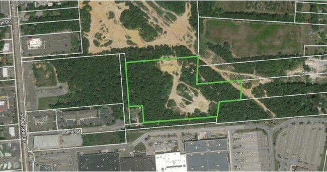


This Property Is For Sale
Property Detail
274 W Smith St
14-07004-0000-00038
CUMBERLAND
Vacantlandnec
New Jersey
I3
38
B and X Area of moderate flood hazard, usually the area between the limits of the 100-year and 500-year floods.
9.81 AC
2024
Vineland/Bridgeton
2025
Philadelphia
041002
Vineland, NJ
NEARBY LISTINGS FOR SALE OR LEASE
DEMOGRAPHICS near 274 W Smith St
1 mile
3 mile
5 mile
2025 Total Population
1,911
32,754
78,762
2030 Population
2,028
33,882
80,820
Pop Growth 2025-2030
+ 6.12%
+ 3.44%
+ 2.61%
Average Age
41
39
40
2025 Total Households
724
12,504
29,273
HH Growth 2025-2030
+ 6.08%
+ 3.45%
+ 2.68%
Median Household Inc
$80,197
$61,414
$67,820
Avg Household Size
2.60
2.50
2.60
2025 Avg HH Vehicles
2.00
2.00
2.00
Median Home Value
$238,181
$204,513
$227,752
Median Year Built
1974
1965
1967
Nearby Places
Map Layers
Map Styles
 Street
 Aerial
Layers
 Traffic
 Biking
Places
Listings with unknown addresses are not visible on the map
- Restaurants
- Banks
- Shops
- Fitness
- Groceries
PUBLIC TRANSPORTATION
AIRPORT
Atlantic City International
Drive
Walk
Distance
Atlantic City International
67 min
32.0 mi
Freight Ports
Port of Wilmington, RI
Drive
Walk
Distance
Port of Wilmington, RI
62 min
43.8 mi
Nearby Properties
Address
Land Use
TOTAL SIZE
Lot Size
Zoning
Address
Land Use
TOTAL SIZE
Lot Size
Zoning
57.51 AC
W
Address
Land Use
TOTAL SIZE
Lot Size
Zoning
40 AC
A
Address
Land Use
TOTAL SIZE
Lot Size
Zoning
43.69 AC
X/T
Address
Land Use
TOTAL SIZE
Lot Size
Zoning
51.67 AC
Address
Land Use
TOTAL SIZE
Lot Size
Zoning
39.21 AC
W
Address
Land Use
TOTAL SIZE
Lot Size
Zoning
276.61 AC
I4
Address
Land Use
TOTAL SIZE
Lot Size
Zoning
57.43 AC
B4
Address
Land Use
TOTAL SIZE
Lot Size
Zoning
Address
Land Use
TOTAL SIZE
Lot Size
Zoning
5.90 AC
Address
Land Use
TOTAL SIZE
Lot Size
Zoning
5.90 AC
Address
Land Use
TOTAL SIZE
Lot Size
Zoning
31.69 AC
B-4
Address
Land Use
TOTAL SIZE
Lot Size
Zoning
47.01 AC
Address
Land Use
TOTAL SIZE
Lot Size
Zoning
11.81 AC
X
Address
Land Use
TOTAL SIZE
Lot Size
Zoning
Address
Land Use
TOTAL SIZE
Lot Size
Zoning
3.02 AC
Address
Land Use
TOTAL SIZE
Lot Size
Zoning
16.94 AC
Address
Land Use
TOTAL SIZE
Lot Size
Zoning
16.70 AC
X
Address
Land Use
TOTAL SIZE
Lot Size
Zoning
33.79 AC
I3
Address
Land Use
TOTAL SIZE
Lot Size
Zoning
4.65 AC
Address
Land Use
TOTAL SIZE
Lot Size
Zoning
44.55 AC
R3
Address
Land Use
TOTAL SIZE
Lot Size
Zoning
7.24 AC
R4
Address
Land Use
TOTAL SIZE
Lot Size
Zoning
7.20 AC
R4
Address
Land Use
TOTAL SIZE
Lot Size
Zoning
24,820 SF
15 AC
R3
Address
Land Use
TOTAL SIZE
Lot Size
Zoning
1,124 SF
36.90 AC
Address
Land Use
TOTAL SIZE
Lot Size
Zoning
11.79 AC
R3
Address
Land Use
TOTAL SIZE
Lot Size
Zoning
2.67 AC
Address
Land Use
TOTAL SIZE
Lot Size
Zoning
63,012 SF
8.72 AC
Address
Land Use
TOTAL SIZE
Lot Size
Zoning
22.26 AC
Address
Land Use
TOTAL SIZE
Lot Size
Zoning
63,104 SF
11.11 AC
B-4
Address
Land Use
TOTAL SIZE
Lot Size
Zoning
The World's #1 Commercial Real Estate Marketplace
Connect with us
© 2026 CoStar Group
The information above has been obtained from sources believed reliable. While we do not doubt its accuracy we have not verified it and make no guarantee, warranty or representation about it. It is your responsibility to independently confirm its accuracy and completeness. Any projections, opinions, assumptions, or estimates used are for example only and do not represent the current or future performance of the property. The value of this transaction to you depends on tax and other factors which should be evaluated by your tax, financial, and legal advisors. You and your advisors should conduct a careful, independent investigation of the property to determine to your satisfaction the suitability of the property for your needs.