Property Record
27411 Wick Rd, Romulus, MI 48174
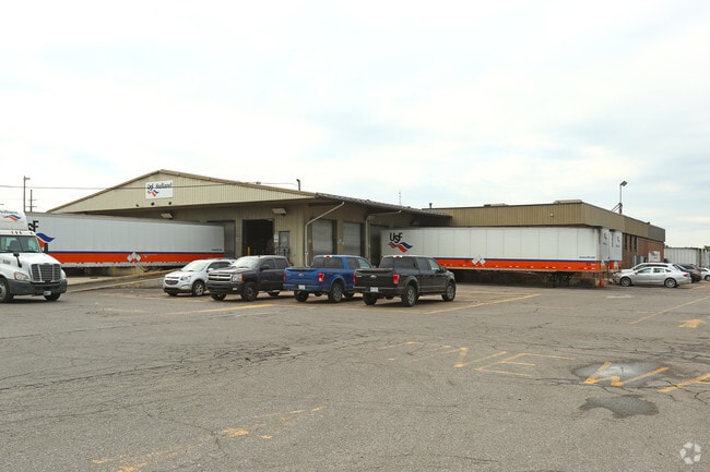

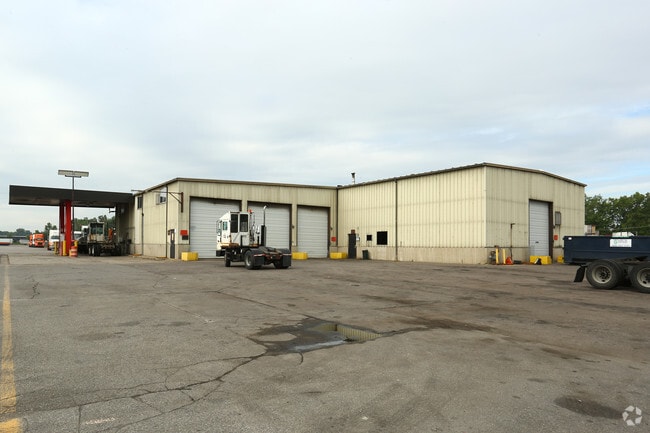
Property Detail
27411 Wick Rd
80-049-99-0001-716
13A1A1B1A, A1A2A1, B1A, 13A1A1A1, A1A1B1B, A1A2A2 PT OF NE 1/4 SEC 13 T3S R9E BEG S 00D 29M 49S W 60 FT AND N 88D 56M 45S W 60 FT FROM NE COR SEC 13 TH S 00D 29M 49S W 1624 FT TH N 88D 56M 45S W 1166.15 FT TH N 00D 29M 49S E 875 FT TH N 00D 58M 23S E
Industrialgeneral
WAYNE
M-T
Michigan
B and X Area of moderate flood hazard, usually the area between the limits of the 100-year and 500-year floods.
0001
2025
35.81 AC
2025
Airport District
586201
Detroit
76,520 SF
Detroit-Warren-Dearborn, MI
NEARBY LISTINGS FOR SALE OR LEASE
DEMOGRAPHICS near 27411 Wick Rd
1 mile
3 mile
5 mile
2025 Total Population
1,903
46,347
174,885
2030 Population
1,854
45,821
172,492
Pop Growth 2025-2030
(2.57%)
(1.13%)
(1.37%)
Average Age
43
40
40
2025 Total Households
851
18,298
69,845
HH Growth 2025-2030
(2.59%)
(1.18%)
(1.43%)
Median Household Inc
$65,972
$60,820
$61,380
Avg Household Size
2.20
2.40
2.40
2025 Avg HH Vehicles
2.00
2.00
2.00
Median Home Value
$190,186
$150,586
$155,821
Median Year Built
1971
1962
1958
Nearby Places
Map Layers
Map Styles
 Street
 Aerial
Layers
 Traffic
 Biking
Places
Listings with unknown addresses are not visible on the map
- Restaurants
- Banks
- Shops
- Fitness
- Groceries
PUBLIC TRANSPORTATION
COMMUTER RAIL
Dearborn (Wolverine - Amtrak)
Drive
Walk
Distance
Dearborn (Wolverine - Amtrak)
15 min
7.9 mi
AIRPORT
Detroit Metro Wayne County
Drive
Walk
Distance
Detroit Metro Wayne County
12 min
5.2 mi
Windsor International
Drive
Walk
Distance
Windsor International
46 min
28.3 mi
Freight Ports
Port of Toledo
Drive
Walk
Distance
Port of Toledo
68 min
51.6 mi
Nearby Properties
Address
Land Use
TOTAL SIZE
Lot Size
Zoning
Address
Land Use
TOTAL SIZE
Lot Size
Zoning
857,173 SF
84.70 AC
M-1/COND
Address
Land Use
TOTAL SIZE
Lot Size
Zoning
307,524 SF
63.94 AC
AP-AIRPORT
Address
Land Use
TOTAL SIZE
Lot Size
Zoning
108,809 SF
AP-AIRPORT
Address
Land Use
TOTAL SIZE
Lot Size
Zoning
354,968 SF
25.72 AC
RC/M-1
Address
Land Use
TOTAL SIZE
Lot Size
Zoning
366,820 SF
20.83 AC
RC/M-1
Address
Land Use
TOTAL SIZE
Lot Size
Zoning
366,820 SF
20.72 AC
RC/M-1
Address
Land Use
TOTAL SIZE
Lot Size
Zoning
268,272 SF
22.70 AC
M-1/COND
Address
Land Use
TOTAL SIZE
Lot Size
Zoning
244,760 SF
22.63 AC
M-1/COND
Address
Land Use
TOTAL SIZE
Lot Size
Zoning
260,000 SF
20.50 AC
M-T
Address
Land Use
TOTAL SIZE
Lot Size
Zoning
302,868 SF
19.94 AC
M-T
Address
Land Use
TOTAL SIZE
Lot Size
Zoning
6,128 SF
50.14 AC
RC-REG
Address
Land Use
TOTAL SIZE
Lot Size
Zoning
312,000 SF
21.91 AC
M-T
Address
Land Use
TOTAL SIZE
Lot Size
Zoning
299,904 SF
20.13 AC
M-T
Address
Land Use
TOTAL SIZE
Lot Size
Zoning
299,904 SF
18.68 AC
M-T
Address
Land Use
TOTAL SIZE
Lot Size
Zoning
165,200 SF
14.85 AC
M-1/COND
Address
Land Use
TOTAL SIZE
Lot Size
Zoning
1,278 SF
17.59 AC
M-T
Address
Land Use
TOTAL SIZE
Lot Size
Zoning
960 SF
62.42 AC
RC-REG
Address
Land Use
TOTAL SIZE
Lot Size
Zoning
280,510 SF
32.49 AC
M-T
Address
Land Use
TOTAL SIZE
Lot Size
Zoning
214,489 SF
17.64 AC
RM-1
Address
Land Use
TOTAL SIZE
Lot Size
Zoning
132,248 SF
5.96 AC
RC-REG
Address
Land Use
TOTAL SIZE
Lot Size
Zoning
129,260 SF
5.25 AC
AP-AIRPORT
Address
Land Use
TOTAL SIZE
Lot Size
Zoning
261,835 SF
45.99 AC
M-T
Address
Land Use
TOTAL SIZE
Lot Size
Zoning
229,395 SF
15.46 AC
RM-1
Address
Land Use
TOTAL SIZE
Lot Size
Zoning
202,394 SF
15.29 AC
RM-1
Address
Land Use
TOTAL SIZE
Lot Size
Zoning
219,144 SF
24.53 AC
B-2
Address
Land Use
TOTAL SIZE
Lot Size
Zoning
235,200 SF
21.93 AC
M-T
Address
Land Use
TOTAL SIZE
Lot Size
Zoning
32,767 SF
17.81 AC
RM-1
Address
Land Use
TOTAL SIZE
Lot Size
Zoning
207,205 SF
28.02 AC
I-1
Address
Land Use
TOTAL SIZE
Lot Size
Zoning
292,254 SF
23.61 AC
RM-1
Address
Land Use
TOTAL SIZE
Lot Size
Zoning
172,500 SF
6.52 AC
RM-1
The World's #1 Commercial Real Estate Marketplace
Connect with us
© 2026 CoStar Group
The information above has been obtained from sources believed reliable. While we do not doubt its accuracy we have not verified it and make no guarantee, warranty or representation about it. It is your responsibility to independently confirm its accuracy and completeness. Any projections, opinions, assumptions, or estimates used are for example only and do not represent the current or future performance of the property. The value of this transaction to you depends on tax and other factors which should be evaluated by your tax, financial, and legal advisors. You and your advisors should conduct a careful, independent investigation of the property to determine to your satisfaction the suitability of the property for your needs.