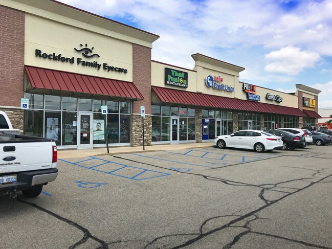
Property Record
2745 10 Mile Rd Ne, Rockford, MI 49341


NEARBY LISTINGS FOR SALE OR LEASE
Property Detail
2745 10 Mile Rd Ne
41-06-34-300-006
PART SW 1/4 COM 269.45 FT S 89D 23M 09S W ALONG S SEC LINE & 275.0 FT N 00D 36M 51S W FROM S 1/4 COR OF SEC TH S 00D 36M 51S
Commercialnec
Kent
X
Michigan
26081C0301D
1.84 AC
2024
Outlying Kent County
2025
West Michigan
010602
Grand Rapids-Wyoming-Kentwood, MI
18,630 SF
DEMOGRAPHICS near 2745 10 Mile Rd Ne
1 Mile
3 Mile
5 Mile
2024 Total Population
1,921
20,179
46,708
2029 Population
1,978
20,451
47,246
Pop Growth 2024-2029
+ 2.97%
+ 1.35%
+ 1.15%
Average Age
38
39
40
2024 Total Households
696
7,358
17,156
HH Growth 2024-2029
+ 3.02%
+ 1.33%
+ 1.13%
Median Household Inc
$101,071
$99,148
$96,080
Avg Household Size
2.70
2.70
2.70
2024 Avg HH Vehicles
2.00
2.00
2.00
Median Home Value
$329,430
$289,037
$285,286
Median Year Built
2010
1991
1989
Nearby Places
Map Layers
Map Styles
 Street
 Aerial
- Restaurants
- Banks
- Shops
- Fitness
- Groceries
PUBLIC TRANSPORTATION
AIRPORT
Gerald R Ford International
DRIVE
WALK
Distance
Gerald R Ford International
34 min
25.5 mi
SALE & LEASE HISTORY
LISTING DATE
SALE/LEASE

Oct 12, 2021
For Lease
Aug 26, 2021
For Lease
Aug 02, 2017
For Lease
Nearby Properties
Address
Land Use
TOTAL SIZE
Lot Size
Zoning
Address
Land Use
TOTAL SIZE
Lot Size
Zoning
32.53 AC
Address
Land Use
TOTAL SIZE
Lot Size
Zoning
22.40 AC
Address
Land Use
TOTAL SIZE
Lot Size
Zoning
128,148 SF
42.93 AC
PUD
Address
Land Use
TOTAL SIZE
Lot Size
Zoning
17.30 AC
Address
Land Use
TOTAL SIZE
Lot Size
Zoning
4.51 AC
Address
Land Use
TOTAL SIZE
Lot Size
Zoning
97.71 AC
Address
Land Use
TOTAL SIZE
Lot Size
Zoning
97.84 AC
Address
Land Use
TOTAL SIZE
Lot Size
Zoning
113,165 SF
10.94 AC
R-3
Address
Land Use
TOTAL SIZE
Lot Size
Zoning
74,756 SF
9.86 AC
C-3
Address
Land Use
TOTAL SIZE
Lot Size
Zoning
53.97 AC
Address
Land Use
TOTAL SIZE
Lot Size
Zoning
79.34 AC
Address
Land Use
TOTAL SIZE
Lot Size
Zoning
9.88 AC
Address
Land Use
TOTAL SIZE
Lot Size
Zoning
10.08 AC
Address
Land Use
TOTAL SIZE
Lot Size
Zoning
101,815 SF
9.23 AC
C-3
Address
Land Use
TOTAL SIZE
Lot Size
Zoning
11.26 AC
Address
Land Use
TOTAL SIZE
Lot Size
Zoning
8.20 AC
R-3
Address
Land Use
TOTAL SIZE
Lot Size
Zoning
10.12 AC
Address
Land Use
TOTAL SIZE
Lot Size
Zoning
6.51 AC
Address
Land Use
TOTAL SIZE
Lot Size
Zoning
10.61 AC
Address
Land Use
TOTAL SIZE
Lot Size
Zoning
44.69 AC
Address
Land Use
TOTAL SIZE
Lot Size
Zoning
64,075 SF
11.13 AC
I-1
Address
Land Use
TOTAL SIZE
Lot Size
Zoning
17.70 AC
Address
Land Use
TOTAL SIZE
Lot Size
Zoning
Address
Land Use
TOTAL SIZE
Lot Size
Zoning
1,725 SF
4.90 AC
R-3
Address
Land Use
TOTAL SIZE
Lot Size
Zoning
2.28 AC
Address
Land Use
TOTAL SIZE
Lot Size
Zoning
66,590 SF
4.06 AC
I-1
Address
Land Use
TOTAL SIZE
Lot Size
Zoning
3.62 AC
Address
Land Use
TOTAL SIZE
Lot Size
Zoning
49,647 SF
5.30 AC
I-1
Address
Land Use
TOTAL SIZE
Lot Size
Zoning
68,724 SF
7.53 AC
I-1
The World's #1 Commercial Real Estate Marketplace
Connect with us
© 2026 CoStar Group
The information above has been obtained from sources believed reliable. While we do not doubt its accuracy we have not verified it and make no guarantee, warranty or representation about it. It is your responsibility to independently confirm its accuracy and completeness. Any projections, opinions, assumptions, or estimates used are for example only and do not represent the current or future performance of the property. The value of this transaction to you depends on tax and other factors which should be evaluated by your tax, financial, and legal advisors. You and your advisors should conduct a careful, independent investigation of the property to determine to your satisfaction the suitability of the property for your needs.