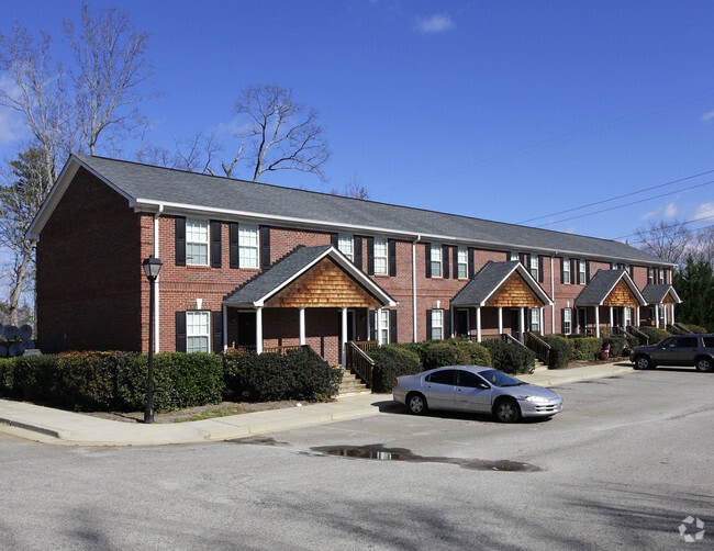
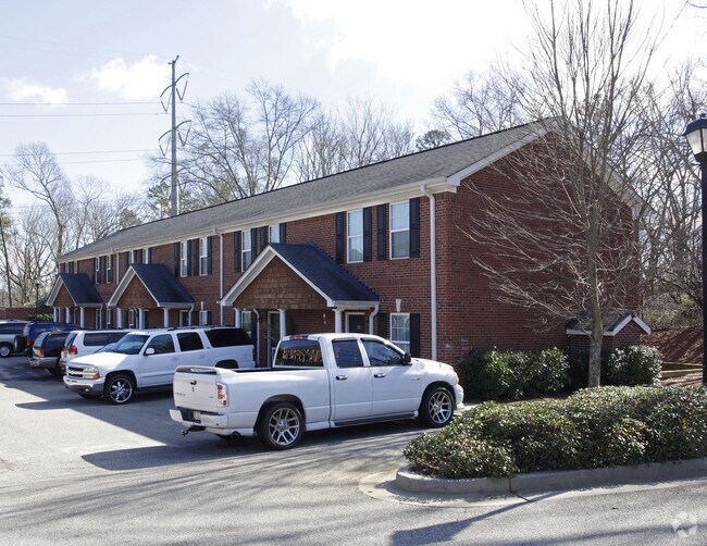
Property Record
2745 Marietta Hwy, Canton, GA 30114


NEARBY LISTINGS FOR SALE OR LEASE
-
-
View all Canton listings for sale on LoopNet.com
Property Detail
2745 Marietta Hwy
Atlanta-Sandy Springs-Roswell, GA
Rich Estate Canton Copper Mine
091N12-00000-006-00B-0000
LL 162; 14TH D
Apartment
Cherokee
X
Georgia
13057C0234E
162
2025
1.33 AC
2025
Cherokee County
090606
Atlanta
6,760 SF
DEMOGRAPHICS near 2745 Marietta Hwy
1 Mile
3 Mile
5 Mile
2024 Total Population
4,781
42,540
92,154
2029 Population
5,469
48,552
105,610
Pop Growth 2024-2029
+ 14.39%
+ 14.13%
+ 14.60%
Average Age
36
37
39
2024 Total Households
1,628
14,672
32,409
HH Growth 2024-2029
+ 14.68%
+ 14.32%
+ 14.79%
Median Household Inc
$77,713
$86,792
$94,538
Avg Household Size
2.80
2.80
2.80
2024 Avg HH Vehicles
2.00
2.00
2.00
Median Home Value
$303,318
$318,353
$362,620
Median Year Built
2000
2002
2002
Nearby Places
- Restaurants
- Banks
- Shops
- Fitness
- Groceries
Nearby Properties
Address
Land Use
TOTAL SIZE
Lot Size
Zoning
Address
Land Use
TOTAL SIZE
Lot Size
Zoning
242,502 SF
41.65 AC
PD
Address
Land Use
TOTAL SIZE
Lot Size
Zoning
255,483 SF
138.30 AC
LI
Address
Land Use
TOTAL SIZE
Lot Size
Zoning
443,973 SF
70.02 AC
GC
Address
Land Use
TOTAL SIZE
Lot Size
Zoning
353,395 SF
29.15 AC
GC
Address
Land Use
TOTAL SIZE
Lot Size
Zoning
162,243 SF
29.44 AC
R-5
Address
Land Use
TOTAL SIZE
Lot Size
Zoning
369,520 SF
4.50 AC
ERC
Address
Land Use
TOTAL SIZE
Lot Size
Zoning
79,162 SF
8.54 AC
RM16
Address
Land Use
TOTAL SIZE
Lot Size
Zoning
103,620 SF
19.78 AC
R-5
Address
Land Use
TOTAL SIZE
Lot Size
Zoning
302,757 SF
62.80 AC
PUD
Address
Land Use
TOTAL SIZE
Lot Size
Zoning
177,744 SF
23.73 AC
PUD
Address
Land Use
TOTAL SIZE
Lot Size
Zoning
155,341 SF
14.54 AC
R-5
Address
Land Use
TOTAL SIZE
Lot Size
Zoning
204,826 SF
4.91 AC
PD
Address
Land Use
TOTAL SIZE
Lot Size
Zoning
241,482 SF
31.65 AC
PD
Address
Land Use
TOTAL SIZE
Lot Size
Zoning
489,988 SF
20.20 AC
LI
Address
Land Use
TOTAL SIZE
Lot Size
Zoning
43,897 SF
8.45 AC
PUD
Address
Land Use
TOTAL SIZE
Lot Size
Zoning
24,586 SF
PD
Address
Land Use
TOTAL SIZE
Lot Size
Zoning
62,308 SF
7.57 AC
ERC
Address
Land Use
TOTAL SIZE
Lot Size
Zoning
31,428 SF
10.21 AC
R-3
Address
Land Use
TOTAL SIZE
Lot Size
Zoning
149,713 SF
36.97 AC
R-80
Address
Land Use
TOTAL SIZE
Lot Size
Zoning
138,048 SF
21.40 AC
R-40
Address
Land Use
TOTAL SIZE
Lot Size
Zoning
182,067 SF
23.83 AC
GC
Address
Land Use
TOTAL SIZE
Lot Size
Zoning
111,630 SF
38.45 AC
LI
Address
Land Use
TOTAL SIZE
Lot Size
Zoning
159,645 SF
14.05 AC
RM-15
Address
Land Use
TOTAL SIZE
Lot Size
Zoning
108,076 SF
15.50 AC
PD-MU
Address
Land Use
TOTAL SIZE
Lot Size
Zoning
85,408 SF
37.56 AC
AG
Address
Land Use
TOTAL SIZE
Lot Size
Zoning
107.28 AC
PD
Address
Land Use
TOTAL SIZE
Lot Size
Zoning
52,164 SF
9.47 AC
LI
Address
Land Use
TOTAL SIZE
Lot Size
Zoning
81,237 SF
11.63 AC
R-5
Address
Land Use
TOTAL SIZE
Lot Size
Zoning
35,443 SF
OI
Address
Land Use
TOTAL SIZE
Lot Size
Zoning
58.97 AC
OI
The World's #1 Commercial Real Estate Marketplace
Connect with us
© 2025 CoStar Group
The information above has been obtained from sources believed reliable. While we do not doubt its accuracy we have not verified it and make no guarantee, warranty or representation about it. It is your responsibility to independently confirm its accuracy and completeness. Any projections, opinions, assumptions, or estimates used are for example only and do not represent the current or future performance of the property. The value of this transaction to you depends on tax and other factors which should be evaluated by your tax, financial, and legal advisors. You and your advisors should conduct a careful, independent investigation of the property to determine to your satisfaction the suitability of the property for your needs.