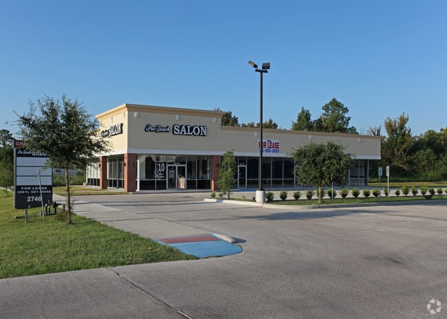
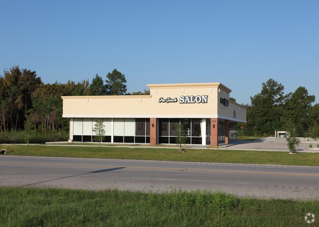
Property Record
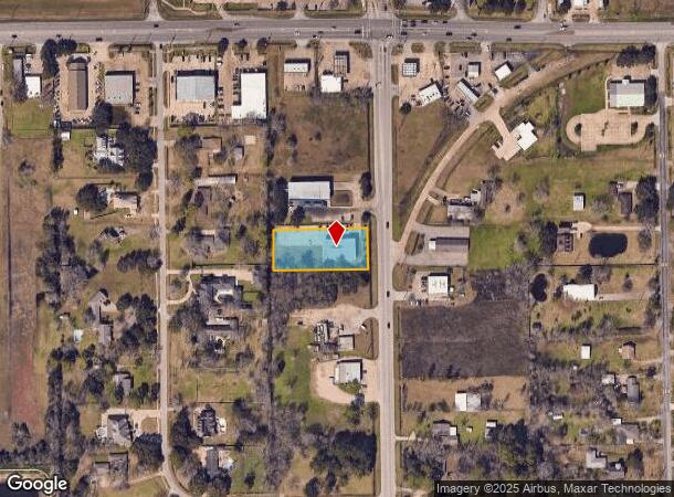
2746 Manvel Rd, Pearland, TX 77584
NEARBY LISTINGS FOR SALE OR LEASE
Property Detail
2746 Manvel Rd
Houston-The Woodlands-Sugar Land, TX
Le Investment (A0242 Ht&Brr) (Pearland)
6155-0001-001
LE INVESTMENT (A0242 HT&BRR) (PEARLAND) BLK 1 LOT 1 ACRES .8264
Commercialnec
Brazoria
X
Texas
48039C0040K
1
2024
0.83 AC
2025
Far South
660705
Houston
5,040 SF
DEMOGRAPHICS near 2746 Manvel Rd
1 Mile
3 Mile
5 Mile
2024 Total Population
8,329
61,389
151,161
2029 Population
9,212
67,522
164,633
Pop Growth 2024-2029
+ 10.60%
+ 9.99%
+ 8.91%
Average Age
35
37
36
2024 Total Households
2,919
20,468
51,207
HH Growth 2024-2029
+ 10.86%
+ 10.09%
+ 8.97%
Median Household Inc
$94,382
$104,491
$96,783
Avg Household Size
2.80
2.90
2.90
2024 Avg HH Vehicles
2.00
2.00
2.00
Median Home Value
$262,636
$281,059
$289,640
Median Year Built
2001
1998
2002
Nearby Places
Map Layers
Map Styles
 Street
 Aerial
- Restaurants
- Banks
- Shops
- Fitness
- Groceries
PUBLIC TRANSPORTATION
AIRPORT
William P Hobby
DRIVE
WALK
Distance
William P Hobby
20 min
9.2 mi
George Bush Intcntl/Houston
DRIVE
WALK
Distance
George Bush Intcntl/Houston
50 min
36.7 mi
Freight Ports
Port of Houston
DRIVE
WALK
Distance
Port of Houston
32 min
17.4 mi
SALE & LEASE HISTORY
LISTING DATE
SALE/LEASE

Sep 25, 2016
For Lease
Jul 10, 2017
For Lease
Nearby Properties
Address
Land Use
TOTAL SIZE
Lot Size
Zoning
Address
Land Use
TOTAL SIZE
Lot Size
Zoning
66.85 AC
0047
Address
Land Use
TOTAL SIZE
Lot Size
Zoning
64.56 AC
0016
Address
Land Use
TOTAL SIZE
Lot Size
Zoning
379,071 SF
20.02 AC
Address
Land Use
TOTAL SIZE
Lot Size
Zoning
321,409 SF
13.90 AC
Address
Land Use
TOTAL SIZE
Lot Size
Zoning
334,628 SF
13.87 AC
Address
Land Use
TOTAL SIZE
Lot Size
Zoning
387,389 SF
21.40 AC
Address
Land Use
TOTAL SIZE
Lot Size
Zoning
225,854 SF
10.44 AC
Address
Land Use
TOTAL SIZE
Lot Size
Zoning
240,616 SF
10.01 AC
Address
Land Use
TOTAL SIZE
Lot Size
Zoning
252,472 SF
13.28 AC
Address
Land Use
TOTAL SIZE
Lot Size
Zoning
79.45 AC
1000
Address
Land Use
TOTAL SIZE
Lot Size
Zoning
16,677 SF
12.38 AC
Address
Land Use
TOTAL SIZE
Lot Size
Zoning
241,488 SF
9.81 AC
Address
Land Use
TOTAL SIZE
Lot Size
Zoning
221,401 SF
11 AC
Address
Land Use
TOTAL SIZE
Lot Size
Zoning
14.93 AC
Address
Land Use
TOTAL SIZE
Lot Size
Zoning
65,854 SF
18.96 AC
Address
Land Use
TOTAL SIZE
Lot Size
Zoning
344,782 SF
14.14 AC
Address
Land Use
TOTAL SIZE
Lot Size
Zoning
81,170 SF
50 AC
Address
Land Use
TOTAL SIZE
Lot Size
Zoning
114,828 SF
7.94 AC
Address
Land Use
TOTAL SIZE
Lot Size
Zoning
71,700 SF
6.08 AC
Address
Land Use
TOTAL SIZE
Lot Size
Zoning
70,964 SF
6.51 AC
Address
Land Use
TOTAL SIZE
Lot Size
Zoning
106,341 SF
12.12 AC
0550
Address
Land Use
TOTAL SIZE
Lot Size
Zoning
62,572 SF
11.38 AC
0041
Address
Land Use
TOTAL SIZE
Lot Size
Zoning
19.61 AC
Address
Land Use
TOTAL SIZE
Lot Size
Zoning
34,416 SF
4.69 AC
Address
Land Use
TOTAL SIZE
Lot Size
Zoning
122,473 SF
2.30 AC
Address
Land Use
TOTAL SIZE
Lot Size
Zoning
66,399 SF
6.10 AC
Address
Land Use
TOTAL SIZE
Lot Size
Zoning
90,000 SF
6.63 AC
Address
Land Use
TOTAL SIZE
Lot Size
Zoning
64,290 SF
3.14 AC
Address
Land Use
TOTAL SIZE
Lot Size
Zoning
72,000 SF
10.75 AC
Address
Land Use
TOTAL SIZE
Lot Size
Zoning
39,856 SF
5.65 AC
The World's #1 Commercial Real Estate Marketplace
Connect with us
© 2025 CoStar Group
The information above has been obtained from sources believed reliable. While we do not doubt its accuracy we have not verified it and make no guarantee, warranty or representation about it. It is your responsibility to independently confirm its accuracy and completeness. Any projections, opinions, assumptions, or estimates used are for example only and do not represent the current or future performance of the property. The value of this transaction to you depends on tax and other factors which should be evaluated by your tax, financial, and legal advisors. You and your advisors should conduct a careful, independent investigation of the property to determine to your satisfaction the suitability of the property for your needs.