Property Record
27485 San Jacinto Ave, Perris, CA 92570

Property Detail
27485 San Jacinto Ave
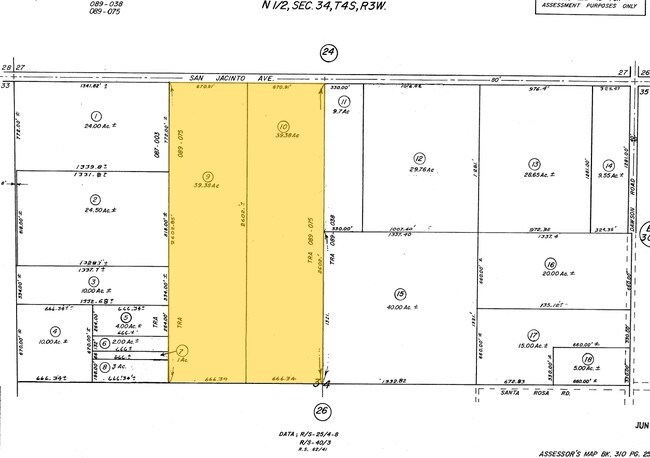
310-250-010
39.38 ACRES M/L IN POR NW 1/4 OF SEC 34 T4S R3W FOR TOTAL DESCRIPTION SEE ASSESSORS MAPS
Agriculturalland
RIVERSIDE
RR
California
AE The base floodplain where base flood elevations are provided. AE Zones are now used on new format FIRMs instead of A1-A30 Zones.
39.38 AC
2024
South Riverside
2025
Inland Empire (California)
042719
Riverside-San Bernardino-Ontario, CA
672 SF
NEARBY LISTINGS FOR SALE OR LEASE
DEMOGRAPHICS near 27485 San Jacinto Ave
1 mile
3 mile
5 mile
2025 Total Population
133
52,170
126,921
2030 Population
138
53,914
130,852
Pop Growth 2025-2030
+ 3.76%
+ 3.34%
+ 3.10%
Average Age
35
33
36
2025 Total Households
38
12,831
34,236
HH Growth 2025-2030
+ 2.63%
+ 3.26%
+ 2.90%
Median Household Inc
$72,499
$81,073
$80,835
Avg Household Size
3.30
3.90
3.60
2025 Avg HH Vehicles
2.00
2.00
2.00
Median Home Value
$568,182
$464,104
$467,143
Median Year Built
1991
1993
1994
Nearby Places
Map Layers
Map Styles
 Street
 Aerial
Layers
 Traffic
 Biking
Places
Listings with unknown addresses are not visible on the map
- Restaurants
- Banks
- Shops
- Fitness
- Groceries
PUBLIC TRANSPORTATION
COMMUTER RAIL
Perris Downtown (Metrolink 91-Perris Valley Line - Metrolink Trains)
Drive
Walk
Distance
Perris Downtown (Metrolink 91-Perris Valley Line - Metrolink Trains)
6 min
3.2 mi
South Perris (Metrolink 91-Perris Valley Line - Metrolink Trains)
Drive
Walk
Distance
South Perris (Metrolink 91-Perris Valley Line - Metrolink Trains)
7 min
4.0 mi
Freight Ports
Port of Long Beach
Drive
Walk
Distance
Port of Long Beach
95 min
71.1 mi
SALE & LEASE HISTORY
LISTING DATE
SALE/LEASE

Sep 24, 2016
For Sale
Sep 24, 2016
For Sale
Nearby Properties
Address
Land Use
TOTAL SIZE
Lot Size
Zoning
Address
Land Use
TOTAL SIZE
Lot Size
Zoning
28.13 AC
RR
Address
Land Use
TOTAL SIZE
Lot Size
Zoning
34.84 AC
Address
Land Use
TOTAL SIZE
Lot Size
Zoning
57,600 SF
51.69 AC
Address
Land Use
TOTAL SIZE
Lot Size
Zoning
32,709 SF
4.61 AC
C2
Address
Land Use
TOTAL SIZE
Lot Size
Zoning
104,208 SF
10.96 AC
Address
Land Use
TOTAL SIZE
Lot Size
Zoning
89,409 SF
6.18 AC
Address
Land Use
TOTAL SIZE
Lot Size
Zoning
22,119 SF
4.59 AC
R3
Address
Land Use
TOTAL SIZE
Lot Size
Zoning
75,109 SF
9.39 AC
Address
Land Use
TOTAL SIZE
Lot Size
Zoning
1,080 SF
9.53 AC
A02
Address
Land Use
TOTAL SIZE
Lot Size
Zoning
122,824 SF
5.18 AC
CC
Address
Land Use
TOTAL SIZE
Lot Size
Zoning
13.95 AC
Address
Land Use
TOTAL SIZE
Lot Size
Zoning
50,000 SF
5.36 AC
CC
Address
Land Use
TOTAL SIZE
Lot Size
Zoning
47,440 SF
5.32 AC
C2
Address
Land Use
TOTAL SIZE
Lot Size
Zoning
1,018,178 SF
57.91 AC
Address
Land Use
TOTAL SIZE
Lot Size
Zoning
3,750 SF
37.79 AC
GI
Address
Land Use
TOTAL SIZE
Lot Size
Zoning
97,942 SF
11 AC
Address
Land Use
TOTAL SIZE
Lot Size
Zoning
7,250 SF
2.35 AC
Address
Land Use
TOTAL SIZE
Lot Size
Zoning
35,600 SF
3.19 AC
Address
Land Use
TOTAL SIZE
Lot Size
Zoning
41,840 SF
8.92 AC
Address
Land Use
TOTAL SIZE
Lot Size
Zoning
13,489 SF
6.18 AC
R3
Address
Land Use
TOTAL SIZE
Lot Size
Zoning
114,400 SF
9.88 AC
Address
Land Use
TOTAL SIZE
Lot Size
Zoning
12,665 SF
1.34 AC
CC
Address
Land Use
TOTAL SIZE
Lot Size
Zoning
9,974 SF
1.05 AC
CC
Address
Land Use
TOTAL SIZE
Lot Size
Zoning
17,976 SF
6.03 AC
Address
Land Use
TOTAL SIZE
Lot Size
Zoning
17,776 SF
14.92 AC
Address
Land Use
TOTAL SIZE
Lot Size
Zoning
24,754 SF
3.93 AC
The World's #1 Commercial Real Estate Marketplace
Connect with us
© 2026 CoStar Group
The information above has been obtained from sources believed reliable. While we do not doubt its accuracy we have not verified it and make no guarantee, warranty or representation about it. It is your responsibility to independently confirm its accuracy and completeness. Any projections, opinions, assumptions, or estimates used are for example only and do not represent the current or future performance of the property. The value of this transaction to you depends on tax and other factors which should be evaluated by your tax, financial, and legal advisors. You and your advisors should conduct a careful, independent investigation of the property to determine to your satisfaction the suitability of the property for your needs.