Property Record
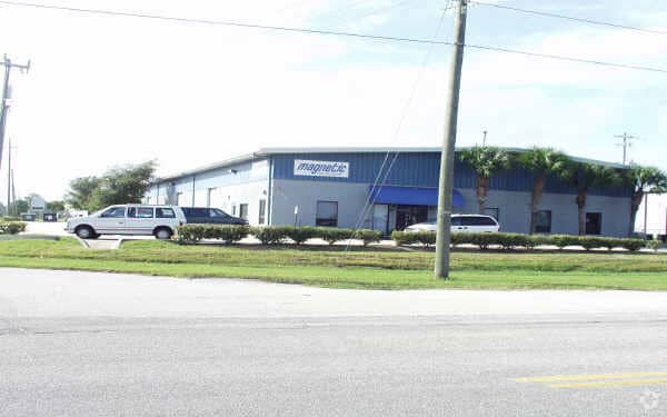
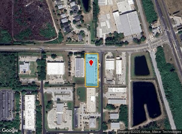
275 Barnes Blvd, Rockledge, FL 32955
NEARBY LISTINGS FOR SALE OR LEASE
Property Detail
275 Barnes Blvd
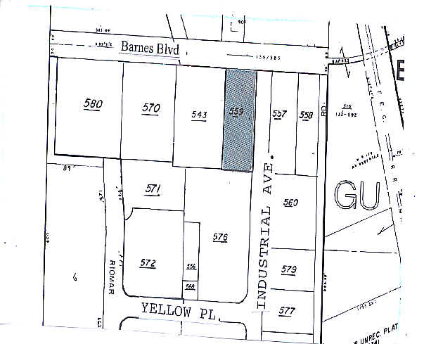
25-36-23-00-00559.0-0000.00
PART OF S 1/2 OF NW 1/4 OF SW 1/4 AS DES IN ORB 2498 PG 2184
Lightindustrial
Brevard
X
Florida
12009C0437H
1.29 AC
2024
Brevard County
2025
Orlando
063102
Palm Bay-Melbourne-Titusville, FL
26,522 SF
DEMOGRAPHICS near 275 Barnes Blvd
1 Mile
3 Mile
5 Mile
2024 Total Population
3,298
37,152
86,264
2029 Population
3,549
40,100
94,147
Pop Growth 2024-2029
+ 7.61%
+ 7.93%
+ 9.14%
Average Age
43
45
45
2024 Total Households
1,233
15,231
36,614
HH Growth 2024-2029
+ 7.38%
+ 7.70%
+ 9.01%
Median Household Inc
$104,142
$91,936
$79,793
Avg Household Size
2.60
2.40
2.30
2024 Avg HH Vehicles
2.00
2.00
2.00
Median Home Value
$355,099
$309,588
$318,251
Median Year Built
2001
1995
1995
Nearby Places
Map Layers
Map Styles
 Street
 Aerial
- Restaurants
- Banks
- Shops
- Fitness
- Groceries
PUBLIC TRANSPORTATION
AIRPORT
Melbourne Orlando International
DRIVE
WALK
Distance
Melbourne Orlando International
31 min
17.1 mi
Nearby Properties
Address
Land Use
TOTAL SIZE
Lot Size
Zoning
Address
Land Use
TOTAL SIZE
Lot Size
Zoning
520,272 SF
17.31 AC
Address
Land Use
TOTAL SIZE
Lot Size
Zoning
379,920 SF
19.73 AC
RU215
Address
Land Use
TOTAL SIZE
Lot Size
Zoning
308,576 SF
16.41 AC
C2
Address
Land Use
TOTAL SIZE
Lot Size
Zoning
375,112 SF
30.84 AC
PUD
Address
Land Use
TOTAL SIZE
Lot Size
Zoning
181,848 SF
8.20 AC
C2
Address
Land Use
TOTAL SIZE
Lot Size
Zoning
117,175 SF
8.06 AC
C2
Address
Land Use
TOTAL SIZE
Lot Size
Zoning
176,800 SF
19.23 AC
R3141
Address
Land Use
TOTAL SIZE
Lot Size
Zoning
230,561 SF
13.74 AC
R3141
Address
Land Use
TOTAL SIZE
Lot Size
Zoning
206,696 SF
11.43 AC
R3
Address
Land Use
TOTAL SIZE
Lot Size
Zoning
112,095 SF
9.50 AC
C2
Address
Land Use
TOTAL SIZE
Lot Size
Zoning
86,852 SF
5.03 AC
Address
Land Use
TOTAL SIZE
Lot Size
Zoning
110,902 SF
10.67 AC
Address
Land Use
TOTAL SIZE
Lot Size
Zoning
104,705 SF
15.14 AC
PUD
Address
Land Use
TOTAL SIZE
Lot Size
Zoning
120,445 SF
9.40 AC
Address
Land Use
TOTAL SIZE
Lot Size
Zoning
170,721 SF
28.52 AC
PIP
Address
Land Use
TOTAL SIZE
Lot Size
Zoning
95,862 SF
5 AC
C2
Address
Land Use
TOTAL SIZE
Lot Size
Zoning
100,050 SF
14.94 AC
R2
Address
Land Use
TOTAL SIZE
Lot Size
Zoning
87,441 SF
20.89 AC
R2
Address
Land Use
TOTAL SIZE
Lot Size
Zoning
156,248 SF
20.16 AC
C2
Address
Land Use
TOTAL SIZE
Lot Size
Zoning
112,250 SF
6.76 AC
IU
Address
Land Use
TOTAL SIZE
Lot Size
Zoning
99,379 SF
2.34 AC
Address
Land Use
TOTAL SIZE
Lot Size
Zoning
49,320 SF
4.03 AC
C2
Address
Land Use
TOTAL SIZE
Lot Size
Zoning
128,347 SF
8.60 AC
IP
Address
Land Use
TOTAL SIZE
Lot Size
Zoning
200,270 SF
16.63 AC
IP
Address
Land Use
TOTAL SIZE
Lot Size
Zoning
7,284 SF
9.22 AC
Address
Land Use
TOTAL SIZE
Lot Size
Zoning
61,819 SF
3.63 AC
Address
Land Use
TOTAL SIZE
Lot Size
Zoning
72,883 SF
9.53 AC
PUD
Address
Land Use
TOTAL SIZE
Lot Size
Zoning
88,649 SF
10.75 AC
C2
Address
Land Use
TOTAL SIZE
Lot Size
Zoning
86,915 SF
10 AC
IP
Address
Land Use
TOTAL SIZE
Lot Size
Zoning
13,181 SF
23.70 AC
RVP
The World's #1 Commercial Real Estate Marketplace
Connect with us
© 2025 CoStar Group
The information above has been obtained from sources believed reliable. While we do not doubt its accuracy we have not verified it and make no guarantee, warranty or representation about it. It is your responsibility to independently confirm its accuracy and completeness. Any projections, opinions, assumptions, or estimates used are for example only and do not represent the current or future performance of the property. The value of this transaction to you depends on tax and other factors which should be evaluated by your tax, financial, and legal advisors. You and your advisors should conduct a careful, independent investigation of the property to determine to your satisfaction the suitability of the property for your needs.