Property Record
275 Benson Junction Rd, Debary, FL 32713
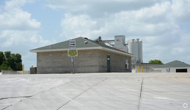

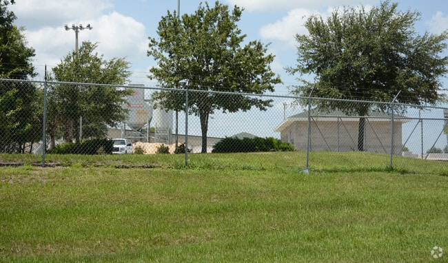
Property Detail
275 Benson Junction Rd
Deltona-Daytona Beach-Ormond Beach, FL
4-19-30 IRREG PARCEL BEING ALL BLK 10 & N PORTION OF LOT 7 VACATED KONOMOC SUB & INC N PORTION OF BLK 10 & ALL BLK 9 VOLUSIA PARK MB 22 PG 34 PER OR 5531 PG 4595 PER OR 6803 PG 0637 PER OR 7061 PG 3460
9004-00-00-0081
Volusia
Warehouse
Florida
B and X Area of moderate flood hazard, usually the area between the limits of the 100-year and 500-year floods.
7
2025
11.57 AC
2026
Deltona
090904
Deltona/Daytona Beach
29,140 SF
NEARBY LISTINGS FOR SALE OR LEASE
DEMOGRAPHICS near 275 Benson Junction Rd
1 mile
3 mile
5 mile
2024 Total Population
3,314
22,394
76,712
2029 Population
3,567
24,030
82,368
Pop Growth 2024-2029
+ 7.63%
+ 7.31%
+ 7.37%
Average Age
42
43
41
2024 Total Households
1,264
8,721
30,102
HH Growth 2024-2029
+ 7.59%
+ 7.16%
+ 7.38%
Median Household Inc
$93,921
$91,568
$74,282
Avg Household Size
2.60
2.50
2.50
2024 Avg HH Vehicles
2.00
2.00
2.00
Median Home Value
$368,135
$381,801
$359,571
Median Year Built
1993
1994
1998
Nearby Places
Map Layers
Map Styles
 Street
 Aerial
Transit
 Traffic
 Biking
Places
Listings with unknown addresses are not visible on the map
- Restaurants
- Banks
- Shops
- Fitness
- Groceries
PUBLIC TRANSPORTATION
COMMUTER RAIL
Debary (SunRail - Florida Department of Transportation)
Drive
Walk
Distance
Debary (SunRail - Florida Department of Transportation)
4 min
1.6 mi
Sanford (SunRail - Florida Department of Transportation)
Drive
Walk
Distance
Sanford (SunRail - Florida Department of Transportation)
13 min
7.2 mi
AIRPORT
Orlando Sanford International
Drive
Walk
Distance
Orlando Sanford International
24 min
12.5 mi
Daytona Beach International
Drive
Walk
Distance
Daytona Beach International
40 min
30.4 mi
Freight Ports
Port Canaveral
Drive
Walk
Distance
Port Canaveral
91 min
73.7 mi
Nearby Properties
Address
Land Use
TOTAL SIZE
Lot Size
Zoning
Address
Land Use
TOTAL SIZE
Lot Size
Zoning
381,678 SF
15.85 AC
Address
Land Use
TOTAL SIZE
Lot Size
Zoning
2.42 AC
A1
Address
Land Use
TOTAL SIZE
Lot Size
Zoning
180,500 SF
13.03 AC
PCD
Address
Land Use
TOTAL SIZE
Lot Size
Zoning
9,460 SF
208.56 AC
Address
Land Use
TOTAL SIZE
Lot Size
Zoning
158,247 SF
1,708.99 AC
Address
Land Use
TOTAL SIZE
Lot Size
Zoning
135,845 SF
18.34 AC
Address
Land Use
TOTAL SIZE
Lot Size
Zoning
16,070 SF
30.33 AC
Address
Land Use
TOTAL SIZE
Lot Size
Zoning
6,400 SF
10.86 AC
PD
Address
Land Use
TOTAL SIZE
Lot Size
Zoning
44,666 SF
4.77 AC
01B4
Address
Land Use
TOTAL SIZE
Lot Size
Zoning
Address
Land Use
TOTAL SIZE
Lot Size
Zoning
1,850 SF
11.30 AC
C3
Address
Land Use
TOTAL SIZE
Lot Size
Zoning
71,035 SF
5.03 AC
Address
Land Use
TOTAL SIZE
Lot Size
Zoning
29.21 AC
M1
Address
Land Use
TOTAL SIZE
Lot Size
Zoning
101,705 SF
7.97 AC
Address
Land Use
TOTAL SIZE
Lot Size
Zoning
71,146 SF
3.67 AC
01B
Address
Land Use
TOTAL SIZE
Lot Size
Zoning
70,095 SF
6.62 AC
A1
Address
Land Use
TOTAL SIZE
Lot Size
Zoning
40,578 SF
2.51 AC
01B4
Address
Land Use
TOTAL SIZE
Lot Size
Zoning
41,237 SF
5 AC
PCD
Address
Land Use
TOTAL SIZE
Lot Size
Zoning
48,226 SF
6.92 AC
PCD
Address
Land Use
TOTAL SIZE
Lot Size
Zoning
22,730 SF
0.30 AC
01A2
Address
Land Use
TOTAL SIZE
Lot Size
Zoning
44,638 SF
4.77 AC
Address
Land Use
TOTAL SIZE
Lot Size
Zoning
69,387 SF
5.83 AC
01B4
Address
Land Use
TOTAL SIZE
Lot Size
Zoning
33,336 SF
5.92 AC
01A1
Address
Land Use
TOTAL SIZE
Lot Size
Zoning
85,414 SF
6.28 AC
M1
Address
Land Use
TOTAL SIZE
Lot Size
Zoning
37,459 SF
15.33 AC
01R6
Address
Land Use
TOTAL SIZE
Lot Size
Zoning
40,717 SF
4.30 AC
01B
Address
Land Use
TOTAL SIZE
Lot Size
Zoning
17.48 AC
M1
Address
Land Use
TOTAL SIZE
Lot Size
Zoning
13,002 SF
80.51 AC
A1
Address
Land Use
TOTAL SIZE
Lot Size
Zoning
40.30 AC
The World's #1 Commercial Real Estate Marketplace
Connect with us
© 2026 CoStar Group
The information above has been obtained from sources believed reliable. While we do not doubt its accuracy we have not verified it and make no guarantee, warranty or representation about it. It is your responsibility to independently confirm its accuracy and completeness. Any projections, opinions, assumptions, or estimates used are for example only and do not represent the current or future performance of the property. The value of this transaction to you depends on tax and other factors which should be evaluated by your tax, financial, and legal advisors. You and your advisors should conduct a careful, independent investigation of the property to determine to your satisfaction the suitability of the property for your needs.