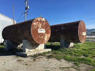
Property Record
275 Coward Rd, Watsonville, CA 95076


NEARBY LISTINGS FOR SALE OR LEASE
Property Detail
275 Coward Rd
051-731-06-000
Santa Cruz
Stateproperty
California
X
16.40 AC
06087C0412E
Outlying Santa Cruz Cnty
2024
Santa Cruz/Watsonville
2025
Santa Cruz-Watsonville, CA
123300
DEMOGRAPHICS near 275 Coward Rd
1 Mile
3 Mile
5 Mile
2024 Total Population
401
36,014
72,884
2029 Population
378
34,794
70,460
Pop Growth 2024-2029
(5.74%)
(3.39%)
(3.33%)
Average Age
39
36
36
2024 Total Households
117
9,715
19,249
HH Growth 2024-2029
(5.98%)
(3.73%)
(3.74%)
Median Household Inc
$132,065
$72,437
$77,726
Avg Household Size
3.40
3.50
3.60
2024 Avg HH Vehicles
3.00
2.00
2.00
Median Home Value
$818,181
$665,140
$667,309
Median Year Built
1972
1971
1974
Nearby Places
Map Layers
Map Styles
 Street
 Aerial
- Restaurants
- Banks
- Shops
- Fitness
- Groceries
PUBLIC TRANSPORTATION
AIRPORT
Monterey Regional
DRIVE
WALK
Distance
Monterey Regional
42 min
31.0 mi
Freight Ports
Port of Redwood City
DRIVE
WALK
Distance
Port of Redwood City
89 min
67.0 mi
SALE & LEASE HISTORY
LISTING DATE
SALE/LEASE

Dec 27, 2023
For Sale
Aug 20, 2019
For Lease
Nearby Properties
Address
Land Use
TOTAL SIZE
Lot Size
Zoning
Address
Land Use
TOTAL SIZE
Lot Size
Zoning
77,449 SF
14.38 AC
R-1-6
Address
Land Use
TOTAL SIZE
Lot Size
Zoning
59,897 SF
1.54 AC
Address
Land Use
TOTAL SIZE
Lot Size
Zoning
58,495 SF
1.77 AC
Address
Land Use
TOTAL SIZE
Lot Size
Zoning
40,585 SF
2.40 AC
R-1-6
Address
Land Use
TOTAL SIZE
Lot Size
Zoning
14.98 AC
PF
Address
Land Use
TOTAL SIZE
Lot Size
Zoning
45,000 SF
1.56 AC
Address
Land Use
TOTAL SIZE
Lot Size
Zoning
64,472 SF
3.27 AC
Address
Land Use
TOTAL SIZE
Lot Size
Zoning
65,782 SF
3.60 AC
Address
Land Use
TOTAL SIZE
Lot Size
Zoning
75,884 SF
2.03 AC
Address
Land Use
TOTAL SIZE
Lot Size
Zoning
2.56 AC
Address
Land Use
TOTAL SIZE
Lot Size
Zoning
44,210 SF
0.54 AC
Address
Land Use
TOTAL SIZE
Lot Size
Zoning
0.53 AC
Address
Land Use
TOTAL SIZE
Lot Size
Zoning
28,611 SF
1.34 AC
R16
Address
Land Use
TOTAL SIZE
Lot Size
Zoning
3.38 AC
Address
Land Use
TOTAL SIZE
Lot Size
Zoning
35,226 SF
2.15 AC
Address
Land Use
TOTAL SIZE
Lot Size
Zoning
50,964 SF
2.99 AC
Address
Land Use
TOTAL SIZE
Lot Size
Zoning
85,523 SF
4.36 AC
PF
Address
Land Use
TOTAL SIZE
Lot Size
Zoning
44,400 SF
5 AC
Address
Land Use
TOTAL SIZE
Lot Size
Zoning
23,816 SF
0.63 AC
Address
Land Use
TOTAL SIZE
Lot Size
Zoning
75,348 SF
0.90 AC
Address
Land Use
TOTAL SIZE
Lot Size
Zoning
3,528 SF
127.83 AC
CA
Address
Land Use
TOTAL SIZE
Lot Size
Zoning
62,274 SF
2.24 AC
Address
Land Use
TOTAL SIZE
Lot Size
Zoning
16,722 SF
1.07 AC
PF
Address
Land Use
TOTAL SIZE
Lot Size
Zoning
32,434 SF
1.48 AC
Address
Land Use
TOTAL SIZE
Lot Size
Zoning
48,055 SF
5.07 AC
A
Address
Land Use
TOTAL SIZE
Lot Size
Zoning
19,634 SF
0.99 AC
Address
Land Use
TOTAL SIZE
Lot Size
Zoning
13.61 AC
CA
Address
Land Use
TOTAL SIZE
Lot Size
Zoning
31,200 SF
0.12 AC
Address
Land Use
TOTAL SIZE
Lot Size
Zoning
The World's #1 Commercial Real Estate Marketplace
Connect with us
© 2025 CoStar Group
The information above has been obtained from sources believed reliable. While we do not doubt its accuracy we have not verified it and make no guarantee, warranty or representation about it. It is your responsibility to independently confirm its accuracy and completeness. Any projections, opinions, assumptions, or estimates used are for example only and do not represent the current or future performance of the property. The value of this transaction to you depends on tax and other factors which should be evaluated by your tax, financial, and legal advisors. You and your advisors should conduct a careful, independent investigation of the property to determine to your satisfaction the suitability of the property for your needs.