Property Record
275 S Legacy Trl, Saint Augustine, FL 32092
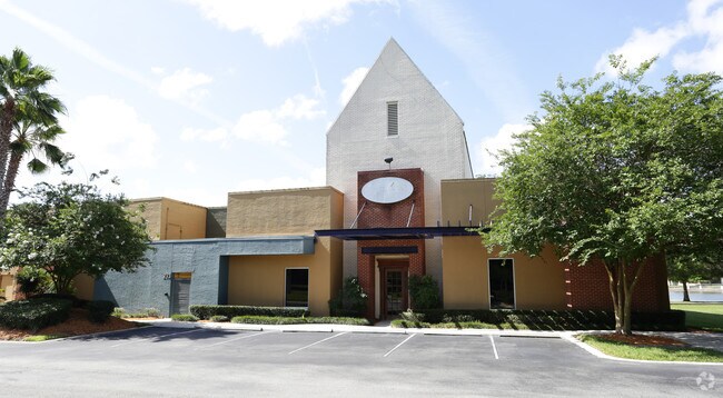

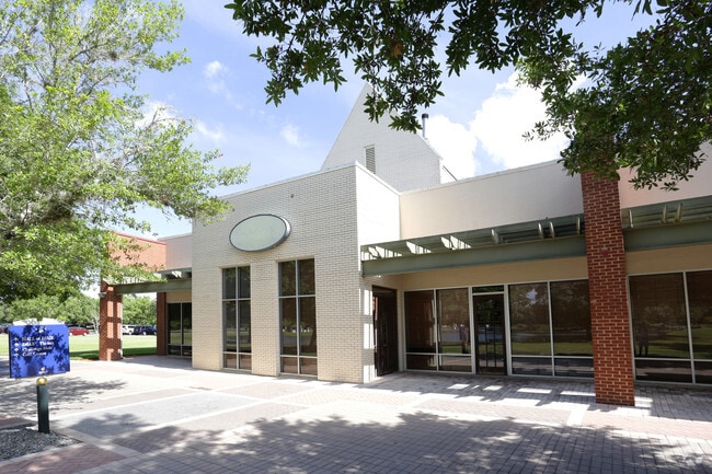
Property Detail
275 S Legacy Trl
027010-0100
1-10 PT LYING W OF I-95 & E OF SOUTH LEGACY TRAIL - VILLAGE RETAIL PARCEL I OR4399/1946
Regionalshoppingcenterormallwithanchorstore
ST. JOHNS
DRI
Florida
A Areas with a 1% annual chance of flooding and a 26% chance of flooding over the life of a 30-year mortgage.
1-a
2025
0.60 AC
2026
St Johns County
020908
Jacksonville (Florida)
10,243 SF
Jacksonville, FL
NEARBY LISTINGS FOR SALE OR LEASE
DEMOGRAPHICS near 275 S Legacy Trl
1 mile
3 mile
5 mile
2025 Total Population
2,309
13,295
44,421
2030 Population
2,812
15,876
52,265
Pop Growth 2025-2030
+ 21.78%
+ 19.41%
+ 17.66%
Average Age
48
46
41
2025 Total Households
1,001
5,388
15,628
HH Growth 2025-2030
+ 21.48%
+ 20.14%
+ 18.40%
Median Household Inc
$107,632
$108,898
$121,418
Avg Household Size
2.30
2.40
2.80
2025 Avg HH Vehicles
2.00
2.00
2.00
Median Home Value
$461,706
$466,623
$512,458
Median Year Built
2010
2010
2010
Nearby Places
Map Layers
Map Styles
 Street
 Aerial
Layers
 Traffic
 Biking
Places
Listings with unknown addresses are not visible on the map
- Restaurants
- Banks
- Shops
- Fitness
- Groceries
PUBLIC TRANSPORTATION
AIRPORT
Jacksonville International
Drive
Walk
Distance
Jacksonville International
59 min
44.4 mi
SALE & LEASE HISTORY
LISTING DATE
SALE/LEASE

Jul 05, 2017
For Lease
Nearby Properties
Address
Land Use
TOTAL SIZE
Lot Size
Zoning
Address
Land Use
TOTAL SIZE
Lot Size
Zoning
38.75 AC
Address
Land Use
TOTAL SIZE
Lot Size
Zoning
312,893 SF
12.30 AC
Address
Land Use
TOTAL SIZE
Lot Size
Zoning
460,132 SF
26.61 AC
Address
Land Use
TOTAL SIZE
Lot Size
Zoning
223,545 SF
68.79 AC
OR
Address
Land Use
TOTAL SIZE
Lot Size
Zoning
252,962 SF
6.86 AC
Address
Land Use
TOTAL SIZE
Lot Size
Zoning
228,680 SF
11.13 AC
Address
Land Use
TOTAL SIZE
Lot Size
Zoning
157,964 SF
66.39 AC
PUD
Address
Land Use
TOTAL SIZE
Lot Size
Zoning
90,363 SF
15.69 AC
PUD
Address
Land Use
TOTAL SIZE
Lot Size
Zoning
99,542 SF
18.10 AC
Address
Land Use
TOTAL SIZE
Lot Size
Zoning
346,647 SF
40.12 AC
PUD
Address
Land Use
TOTAL SIZE
Lot Size
Zoning
50,439 SF
15.50 AC
PUD
Address
Land Use
TOTAL SIZE
Lot Size
Zoning
91,029 SF
15.68 AC
DRI
Address
Land Use
TOTAL SIZE
Lot Size
Zoning
151,858 SF
17.24 AC
Address
Land Use
TOTAL SIZE
Lot Size
Zoning
52,896 SF
13.70 AC
Address
Land Use
TOTAL SIZE
Lot Size
Zoning
109,852 SF
12.62 AC
Address
Land Use
TOTAL SIZE
Lot Size
Zoning
81,978 SF
2.48 AC
PUD
Address
Land Use
TOTAL SIZE
Lot Size
Zoning
150,535 SF
31.11 AC
OR
Address
Land Use
TOTAL SIZE
Lot Size
Zoning
63,355 SF
8.01 AC
Address
Land Use
TOTAL SIZE
Lot Size
Zoning
78,878 SF
12.18 AC
PUD
Address
Land Use
TOTAL SIZE
Lot Size
Zoning
27.10 AC
Address
Land Use
TOTAL SIZE
Lot Size
Zoning
267,806 SF
2.19 AC
Address
Land Use
TOTAL SIZE
Lot Size
Zoning
107,352 SF
15.88 AC
Address
Land Use
TOTAL SIZE
Lot Size
Zoning
42,168 SF
11.07 AC
PUD
Address
Land Use
TOTAL SIZE
Lot Size
Zoning
47,784 SF
9.61 AC
Address
Land Use
TOTAL SIZE
Lot Size
Zoning
84,211 SF
10.39 AC
DRI
Address
Land Use
TOTAL SIZE
Lot Size
Zoning
67.16 AC
PUD
Address
Land Use
TOTAL SIZE
Lot Size
Zoning
27,037 SF
9 AC
OR
Address
Land Use
TOTAL SIZE
Lot Size
Zoning
71,968 SF
4.28 AC
PUD
Address
Land Use
TOTAL SIZE
Lot Size
Zoning
174.60 AC
OR
Address
Land Use
TOTAL SIZE
Lot Size
Zoning
91.92 AC
PUD
The World's #1 Commercial Real Estate Marketplace
Connect with us
© 2026 CoStar Group
The information above has been obtained from sources believed reliable. While we do not doubt its accuracy we have not verified it and make no guarantee, warranty or representation about it. It is your responsibility to independently confirm its accuracy and completeness. Any projections, opinions, assumptions, or estimates used are for example only and do not represent the current or future performance of the property. The value of this transaction to you depends on tax and other factors which should be evaluated by your tax, financial, and legal advisors. You and your advisors should conduct a careful, independent investigation of the property to determine to your satisfaction the suitability of the property for your needs.