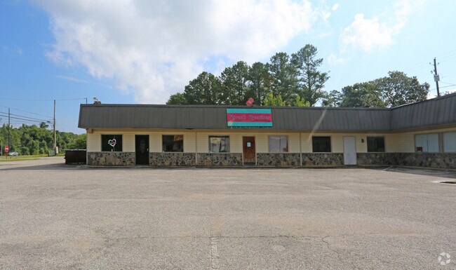
Property Record
2750 Pelham Rd S, Anniston, AL 36206
NEARBY LISTINGS FOR SALE OR LEASE
Property Detail
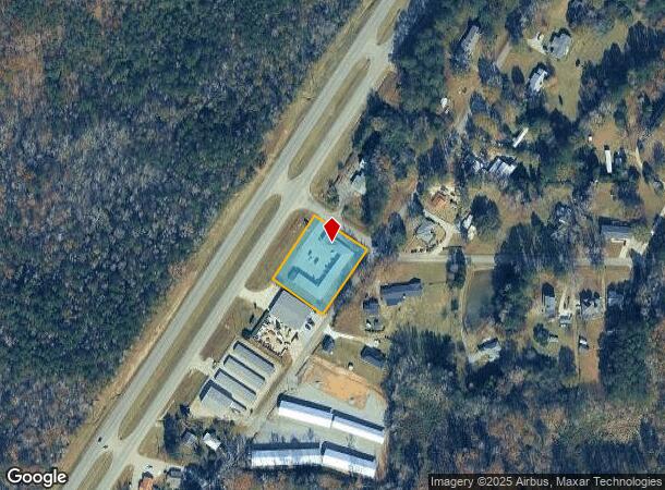
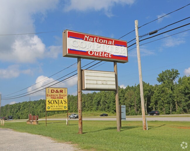
2750 Pelham Rd S
12-07-35-0-001-070.000
Stonewood Village Condo Unit No 4
Vacantlandnec
S 35 T 14S R 8E STONEWOOD VILLAGE CONDOMINIUM COMMON ELEMENT BEG SE INT AL HWY 21 & GREENLEAF SPRINGS RD TH SE 186.7 SW 220 N
X
Calhoun
01015C0169E
Alabama
2025
0.98 AC
2025
Gadsden/Anniston Area
001801
Other Market Areas
6,600 SF
Anniston-Oxford-Jacksonville, AL
DEMOGRAPHICS near 2750 Pelham Rd S
1 Mile
3 Mile
5 Mile
2024 Total Population
561
9,947
29,516
2029 Population
559
9,726
29,296
Pop Growth 2024-2029
(0.36%)
(2.22%)
(0.75%)
Average Age
40
39
37
2024 Total Households
231
4,056
11,129
HH Growth 2024-2029
(0.43%)
(2.32%)
(0.60%)
Median Household Inc
$37,500
$47,208
$42,448
Avg Household Size
2.40
2.40
2.30
2024 Avg HH Vehicles
2.00
2.00
2.00
Median Home Value
$133,333
$146,384
$143,283
Median Year Built
1978
1984
1981
Nearby Places
Map Layers
Map Styles
 Street
 Aerial
- Restaurants
- Banks
- Shops
- Fitness
- Groceries
PUBLIC TRANSPORTATION
COMMUTER RAIL
Anniston Amtrak Station (Crescent - Amtrak)
DRIVE
WALK
Distance
Anniston Amtrak Station (Crescent - Amtrak)
15 min
9.9 mi
Freight Ports
Port of Panama City
DRIVE
WALK
Distance
Port of Panama City
377 min
301.7 mi
SALE & LEASE HISTORY
LISTING DATE
SALE/LEASE

Aug 16, 2018
For Lease
Nearby Properties
Address
Land Use
TOTAL SIZE
Lot Size
Zoning
Address
Land Use
TOTAL SIZE
Lot Size
Zoning
2,784 SF
17 AC
Address
Land Use
TOTAL SIZE
Lot Size
Zoning
20,074 SF
12 AC
Address
Land Use
TOTAL SIZE
Lot Size
Zoning
163,080 SF
17 AC
Address
Land Use
TOTAL SIZE
Lot Size
Zoning
50,524 SF
3.73 AC
Address
Land Use
TOTAL SIZE
Lot Size
Zoning
34,354 SF
29 AC
Address
Land Use
TOTAL SIZE
Lot Size
Zoning
23,512 SF
4.60 AC
Address
Land Use
TOTAL SIZE
Lot Size
Zoning
3,360 SF
10.80 AC
Address
Land Use
TOTAL SIZE
Lot Size
Zoning
14,208 SF
19 AC
Address
Land Use
TOTAL SIZE
Lot Size
Zoning
56,080 SF
5.15 AC
Address
Land Use
TOTAL SIZE
Lot Size
Zoning
11,762 SF
12 AC
Address
Land Use
TOTAL SIZE
Lot Size
Zoning
33,413 SF
4.50 AC
Address
Land Use
TOTAL SIZE
Lot Size
Zoning
25,993 SF
6.05 AC
Address
Land Use
TOTAL SIZE
Lot Size
Zoning
7,776 SF
1.85 AC
Address
Land Use
TOTAL SIZE
Lot Size
Zoning
26,654 SF
10 AC
Address
Land Use
TOTAL SIZE
Lot Size
Zoning
3,504 SF
6.74 AC
Address
Land Use
TOTAL SIZE
Lot Size
Zoning
3,207 SF
9.50 AC
Address
Land Use
TOTAL SIZE
Lot Size
Zoning
Address
Land Use
TOTAL SIZE
Lot Size
Zoning
19.22 AC
Address
Land Use
TOTAL SIZE
Lot Size
Zoning
39,828 SF
3.60 AC
Address
Land Use
TOTAL SIZE
Lot Size
Zoning
1,800 SF
6.40 AC
Address
Land Use
TOTAL SIZE
Lot Size
Zoning
3,811 SF
1.82 AC
Address
Land Use
TOTAL SIZE
Lot Size
Zoning
6,808 SF
9 AC
Address
Land Use
TOTAL SIZE
Lot Size
Zoning
1,751 SF
8.30 AC
Address
Land Use
TOTAL SIZE
Lot Size
Zoning
72,962 SF
2.72 AC
Address
Land Use
TOTAL SIZE
Lot Size
Zoning
13.69 AC
Address
Land Use
TOTAL SIZE
Lot Size
Zoning
4,698 SF
1.95 AC
Address
Land Use
TOTAL SIZE
Lot Size
Zoning
7,190 SF
0.75 AC
Address
Land Use
TOTAL SIZE
Lot Size
Zoning
3,852 SF
1.81 AC
Address
Land Use
TOTAL SIZE
Lot Size
Zoning
3,196 SF
1.42 AC
Address
Land Use
TOTAL SIZE
Lot Size
Zoning
1,920 SF
4.04 AC
The World's #1 Commercial Real Estate Marketplace
Connect with us
© 2025 CoStar Group
The information above has been obtained from sources believed reliable. While we do not doubt its accuracy we have not verified it and make no guarantee, warranty or representation about it. It is your responsibility to independently confirm its accuracy and completeness. Any projections, opinions, assumptions, or estimates used are for example only and do not represent the current or future performance of the property. The value of this transaction to you depends on tax and other factors which should be evaluated by your tax, financial, and legal advisors. You and your advisors should conduct a careful, independent investigation of the property to determine to your satisfaction the suitability of the property for your needs.