Property Record
2750A Roanoke Rd, Lagrange, GA 30240
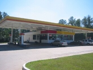

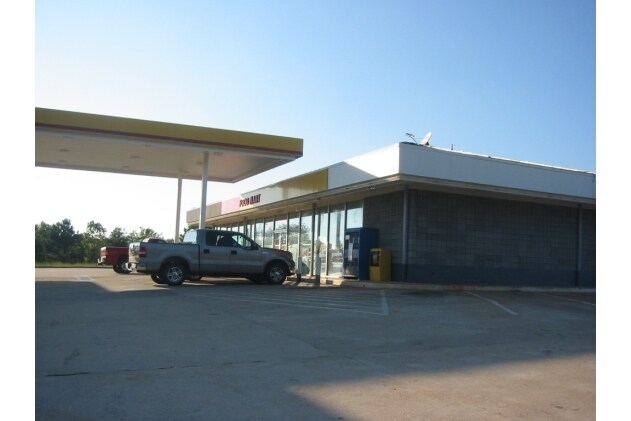
Property Detail
2750A Roanoke Rd
070-3-001-090
2750 ROANOKE RD & SUITE A/TR PB 17 PG 63
Conveniencestore
TROUP
01-LC
Georgia
B and X Area of moderate flood hazard, usually the area between the limits of the 100-year and 500-year floods.
73
2025
0.51 AC
2025
Troup County
960300
Columbus GA
4,060 SF
LaGrange, GA-AL
NEARBY LISTINGS FOR SALE OR LEASE
DEMOGRAPHICS near 2750A Roanoke Rd
1 mile
3 mile
5 mile
2025 Total Population
1,022
10,813
32,271
2030 Population
1,039
11,062
33,199
Pop Growth 2025-2030
+ 1.66%
+ 2.30%
+ 2.88%
Average Age
43
41
39
2025 Total Households
400
4,169
12,568
HH Growth 2025-2030
+ 2.00%
+ 2.54%
+ 3.09%
Median Household Inc
$89,062
$78,405
$60,880
Avg Household Size
2.50
2.50
2.50
2025 Avg HH Vehicles
2.00
2.00
2.00
Median Home Value
$289,332
$261,549
$236,881
Median Year Built
1986
1986
1981
Nearby Places
Map Layers
Map Styles
 Street
 Aerial
Layers
 Traffic
 Biking
Places
Listings with unknown addresses are not visible on the map
- Restaurants
- Banks
- Shops
- Fitness
- Groceries
Nearby Properties
Address
Land Use
TOTAL SIZE
Lot Size
Zoning
Address
Land Use
TOTAL SIZE
Lot Size
Zoning
35,964 SF
72.39 AC
16- CP-GI
Address
Land Use
TOTAL SIZE
Lot Size
Zoning
17,328 SF
9.75 AC
16- CP-GB
Address
Land Use
TOTAL SIZE
Lot Size
Zoning
35,269 SF
22.34 AC
16- CR-MR
Address
Land Use
TOTAL SIZE
Lot Size
Zoning
95,472 SF
30.05 AC
16- CR-MR
Address
Land Use
TOTAL SIZE
Lot Size
Zoning
4,909 SF
715.68 AC
16- CP-GI
Address
Land Use
TOTAL SIZE
Lot Size
Zoning
Address
Land Use
TOTAL SIZE
Lot Size
Zoning
343,734 SF
19.82 AC
16- CP-GI
Address
Land Use
TOTAL SIZE
Lot Size
Zoning
26,595 SF
20.13 AC
16- CR-MX
Address
Land Use
TOTAL SIZE
Lot Size
Zoning
89,395 SF
28.47 AC
16- TN-R
Address
Land Use
TOTAL SIZE
Lot Size
Zoning
9,290 SF
11.58 AC
16- CP-GB
Address
Land Use
TOTAL SIZE
Lot Size
Zoning
56,580 SF
11.34 AC
16- CR-MX
Address
Land Use
TOTAL SIZE
Lot Size
Zoning
1 AC
16-UNAVAIL
Address
Land Use
TOTAL SIZE
Lot Size
Zoning
91,254 SF
1.48 AC
16- CP-GB
Address
Land Use
TOTAL SIZE
Lot Size
Zoning
80,979 SF
15 AC
16- CP-GI
Address
Land Use
TOTAL SIZE
Lot Size
Zoning
73,614 SF
10.14 AC
16- SU-R
Address
Land Use
TOTAL SIZE
Lot Size
Zoning
28,390 SF
9.40 AC
16- CP-GB
Address
Land Use
TOTAL SIZE
Lot Size
Zoning
71,626 SF
10.81 AC
16- CR-MX
Address
Land Use
TOTAL SIZE
Lot Size
Zoning
17,780 SF
14.43 AC
16- CP-GI
Address
Land Use
TOTAL SIZE
Lot Size
Zoning
54,103 SF
15.17 AC
16- CP-GI
Address
Land Use
TOTAL SIZE
Lot Size
Zoning
1 AC
16-UNAVAIL
Address
Land Use
TOTAL SIZE
Lot Size
Zoning
14,810 SF
3.70 AC
16- CR-MX
Address
Land Use
TOTAL SIZE
Lot Size
Zoning
16,871 SF
9.27 AC
16- SU-R
Address
Land Use
TOTAL SIZE
Lot Size
Zoning
3.99 AC
16- CP-GB
Address
Land Use
TOTAL SIZE
Lot Size
Zoning
507.64 AC
01-AG
Address
Land Use
TOTAL SIZE
Lot Size
Zoning
1 AC
16-UNAVAIL
Address
Land Use
TOTAL SIZE
Lot Size
Zoning
40,744 SF
4.51 AC
16- CP-GB
Address
Land Use
TOTAL SIZE
Lot Size
Zoning
31,472 SF
3.84 AC
16- CP-GB
Address
Land Use
TOTAL SIZE
Lot Size
Zoning
159,780 SF
13.26 AC
16- CP-GI
Address
Land Use
TOTAL SIZE
Lot Size
Zoning
11,366 SF
2.78 AC
16- CP-GB
Address
Land Use
TOTAL SIZE
Lot Size
Zoning
106,248 SF
23.21 AC
16- CP-GI
The World's #1 Commercial Real Estate Marketplace
Connect with us
© 2026 CoStar Group
The information above has been obtained from sources believed reliable. While we do not doubt its accuracy we have not verified it and make no guarantee, warranty or representation about it. It is your responsibility to independently confirm its accuracy and completeness. Any projections, opinions, assumptions, or estimates used are for example only and do not represent the current or future performance of the property. The value of this transaction to you depends on tax and other factors which should be evaluated by your tax, financial, and legal advisors. You and your advisors should conduct a careful, independent investigation of the property to determine to your satisfaction the suitability of the property for your needs.