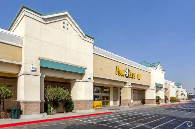
Property Record
2751 Highland Ave, Selma, CA 93662


Property Detail
2751 Highland Ave
385-260-24S
6.45 AC SUR RT PAR A P/M 97-95 BK 58 PGS 96-97
Supermarket
Fresno
C3P
California
B and X Area of moderate flood hazard, usually the area between the limits of the 100-year and 500-year floods.
6.46 AC
2025
Fowler/Selma
2025
Fresno
007101
Fresno, CA
58,560 SF
NEARBY LISTINGS FOR SALE OR LEASE
DEMOGRAPHICS near 2751 Highland Ave
1 mile
3 mile
5 mile
2025 Total Population
8,788
28,114
39,518
2030 Population
8,876
28,370
39,944
Pop Growth 2025-2030
+ 1.00%
+ 0.91%
+ 1.08%
Average Age
35
36
36
2025 Total Households
2,385
8,004
11,310
HH Growth 2025-2030
+ 0.96%
+ 0.84%
+ 1.03%
Median Household Inc
$53,481
$55,949
$57,832
Avg Household Size
3.60
3.50
3.50
2025 Avg HH Vehicles
2.00
2.00
2.00
Median Home Value
$328,906
$336,337
$352,505
Median Year Built
1980
1978
1980
Nearby Places
Map Layers
Map Styles
 Street
 Aerial
Layers
 Traffic
 Biking
Places
Listings with unknown addresses are not visible on the map
- Restaurants
- Banks
- Shops
- Fitness
- Groceries
PUBLIC TRANSPORTATION
AIRPORT
Fresno Yosemite International
Drive
Walk
Distance
Fresno Yosemite International
26 min
16.9 mi
SALE & LEASE HISTORY
LISTING DATE
SALE/LEASE

Sep 25, 2016
For Lease
Nearby Properties
Address
Land Use
TOTAL SIZE
Lot Size
Zoning
Address
Land Use
TOTAL SIZE
Lot Size
Zoning
272,338 SF
25.80 AC
M2
Address
Land Use
TOTAL SIZE
Lot Size
Zoning
14,024 SF
4.56 AC
M2
Address
Land Use
TOTAL SIZE
Lot Size
Zoning
104,516 SF
11.30 AC
C3*TWR
Address
Land Use
TOTAL SIZE
Lot Size
Zoning
106,112 SF
12.78 AC
AE20
Address
Land Use
TOTAL SIZE
Lot Size
Zoning
166,390 SF
32.58 AC
M3
Address
Land Use
TOTAL SIZE
Lot Size
Zoning
52,725 SF
2.04 AC
CR
Address
Land Use
TOTAL SIZE
Lot Size
Zoning
48,639 SF
6.50 AC
CR
Address
Land Use
TOTAL SIZE
Lot Size
Zoning
37,081 SF
4.40 AC
C2
Address
Land Use
TOTAL SIZE
Lot Size
Zoning
140,609 SF
84.02 AC
M2
Address
Land Use
TOTAL SIZE
Lot Size
Zoning
195,223 SF
10.66 AC
M3
Address
Land Use
TOTAL SIZE
Lot Size
Zoning
86,314 SF
5.62 AC
R3
Address
Land Use
TOTAL SIZE
Lot Size
Zoning
58,473 SF
0.77 AC
C3
Address
Land Use
TOTAL SIZE
Lot Size
Zoning
60,138 SF
8.46 AC
PMD
Address
Land Use
TOTAL SIZE
Lot Size
Zoning
127,130 SF
9.78 AC
AE20
Address
Land Use
TOTAL SIZE
Lot Size
Zoning
246,464 SF
39.73 AC
M3
Address
Land Use
TOTAL SIZE
Lot Size
Zoning
10,800 SF
1.52 AC
CZP
Address
Land Use
TOTAL SIZE
Lot Size
Zoning
62,534 SF
12.45 AC
C3
Address
Land Use
TOTAL SIZE
Lot Size
Zoning
21,510 SF
2.92 AC
C2
Address
Land Use
TOTAL SIZE
Lot Size
Zoning
100,772 SF
6.09 AC
R4
Address
Land Use
TOTAL SIZE
Lot Size
Zoning
48,660 SF
4 AC
R3
Address
Land Use
TOTAL SIZE
Lot Size
Zoning
51,886 SF
3.35 AC
C2
Address
Land Use
TOTAL SIZE
Lot Size
Zoning
14,550 SF
1.68 AC
C3
Address
Land Use
TOTAL SIZE
Lot Size
Zoning
27,426 SF
1.88 AC
R1
Address
Land Use
TOTAL SIZE
Lot Size
Zoning
17,780 SF
1.25 AC
C3
Address
Land Use
TOTAL SIZE
Lot Size
Zoning
17,500 SF
3.86 AC
C3
Address
Land Use
TOTAL SIZE
Lot Size
Zoning
2,131 SF
148.88 AC
AE20
Address
Land Use
TOTAL SIZE
Lot Size
Zoning
77,298 SF
5.04 AC
R4
Address
Land Use
TOTAL SIZE
Lot Size
Zoning
35,504 SF
3.77 AC
C3
The World's #1 Commercial Real Estate Marketplace
Connect with us
© 2026 CoStar Group
The information above has been obtained from sources believed reliable. While we do not doubt its accuracy we have not verified it and make no guarantee, warranty or representation about it. It is your responsibility to independently confirm its accuracy and completeness. Any projections, opinions, assumptions, or estimates used are for example only and do not represent the current or future performance of the property. The value of this transaction to you depends on tax and other factors which should be evaluated by your tax, financial, and legal advisors. You and your advisors should conduct a careful, independent investigation of the property to determine to your satisfaction the suitability of the property for your needs.